
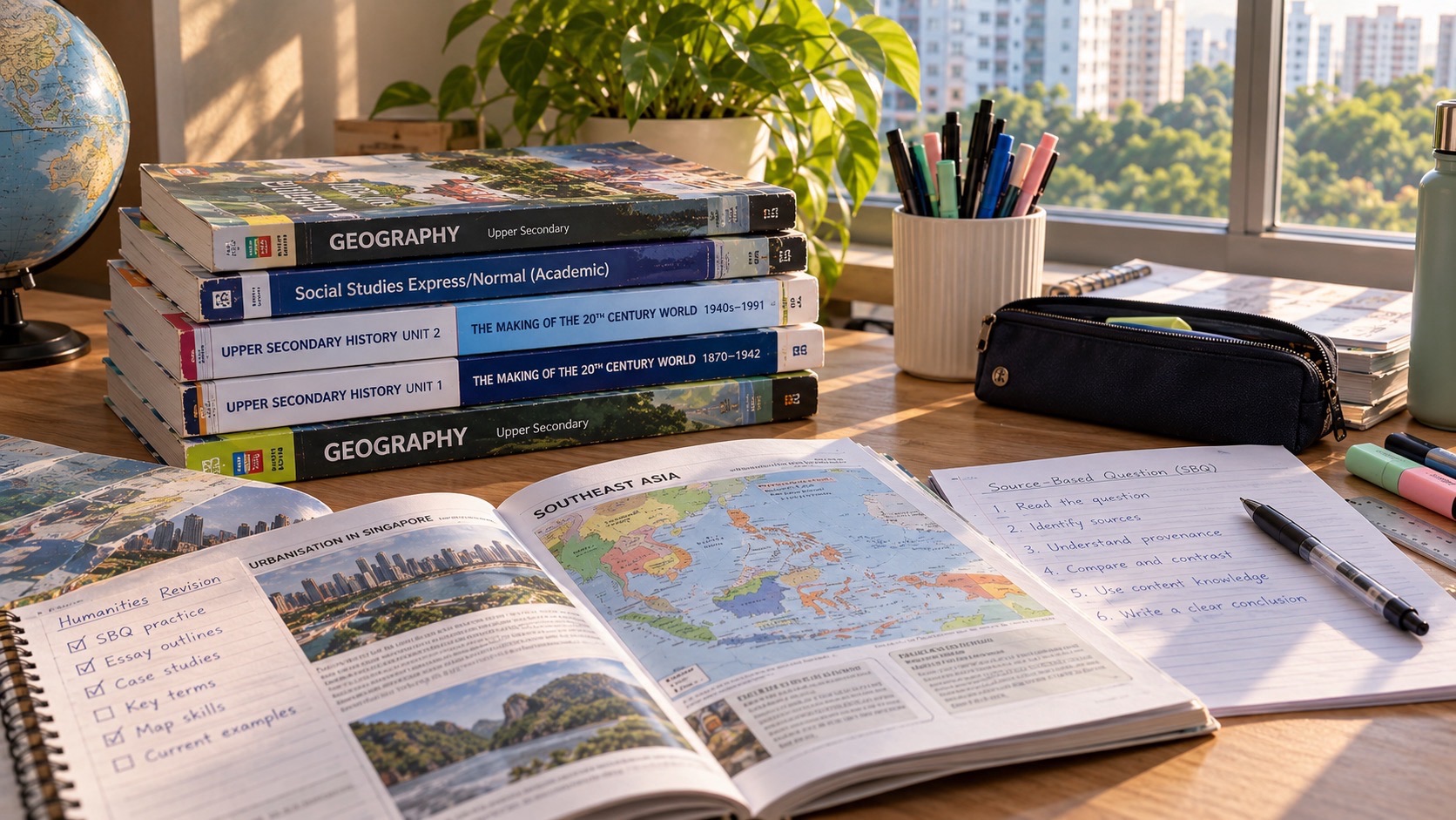
G3 Geography in Singapore’s 2027 Singapore–Cambridge Secondary Education Certificate (SEC) is subject K329, previously O-Level Geography 2279. It is a standalone subject, not the Geography half of G3 Humanities K335. Candidates sit two compulsory papers, each lasting 1 hour 45 minutes with 50 marks and 50% of the grade. Paper 1 tests fieldwork (20 marks), Tourism (15) and Climate (15). Paper 2 tests Everyday Geography (15), Tectonics (15) and Singapore (20). All three questions in each paper are compulsory. An approved calculator may be used in both.
The syllabus also calls for extended fieldwork over ten weeks as part of the learning programme. This does not mean there is an additional standalone 10-week coursework examination paper; the national assessment integrates fieldwork in its written Paper 1. For Punggol families, the essential task is learning how to ask geographic questions, collect defensible evidence and make decisions in context. A student may know a volcanic hazard fact and still lose marks when their risk evaluation ignores vulnerability, or calculate a visitor percentage without checking the sample. This guide explains the exam pattern and gives practical ways to improve those skills. 2028 candidates must consult the official 2028 specification.
- 2027 SEC standalone G3 Geography: K329, former O-Level 2279.
- Two written papers, each 1h45, 50 marks and 50% of the subject.
- Paper 1 Q1 Geographical Methods and Fieldwork: 20 marks; Q2 Tourism: 15; Q3 Climate: 15.
- Paper 2 Q1 Geography in Everyday Life: 15 marks; Q2 Tectonics: 15; Q3 Singapore: 20.
- All questions in both papers are compulsory: there is no Climate-versus-Tectonics examination choice in K329.
- Each paper contains one 9-mark judgement-and-decision-making question, in either its second or third question.
- An approved calculator is permitted in both papers.
- Five syllabus clusters: Everyday Geography, Tourism, Climate, Tectonics, Singapore.
- Extended fieldwork of ten weeks is a learning requirement, not a third SEC paper.
- Standalone K329 is different from combined Humanities Geography K335.
- Verify school subject access and the examination year before buying assessment books.
Quick answers first
- K329 is standalone G3 Geography with two written papers.
- Paper 1 is Fieldwork 20, Tourism 15, Climate 15.
- Paper 2 is Everyday Geography 15, Tectonics 15, Singapore 20.
- All six questions across both papers are compulsory.
- Ten weeks of school fieldwork build skills assessed in Paper 1.
- Approved calculators are permitted in both papers.
Why K329 is not the same as K335 Humanities Geography
Standalone G3 Geography includes five clusters across two Geography papers. In contrast, K335 pairs Social Studies with a shorter Geography paper and gives a Climate-versus-Tectonics choice. Confusing the two can make a pupil buy the wrong practice materials, overlook Singapore geography or spend time preparing for optional question rules that do not exist in the standalone examination.
Ask the school for the registered code, the examination year and the current subject-combination booklet. A student in Secondary 3 during 2027 will usually sit SEC in 2028, and the relevant 2028 documents should control final preparation.
Why five clusters belong to one coherent way of thinking
The clusters are Geography in Everyday Life, Tourism, Climate, Tectonics and Singapore. The first supplies concepts and methods for understanding place and sustainable development. Tourism explores human movements and economies. Climate and Tectonics explain important environmental processes and risks. Singapore applies geographical understanding to a small island city-state.
A map can connect several clusters. A tourist area may need transport links, climate adaptation and sustainable management. A question about Singapore’s urban environment can use spatial data, environmental constraints and the interests of different groups. Thinking in connections is useful, but candidates must still respect the specific question and prescribed concepts.
Paper 1: three compulsory structured questions
Paper 1 has a 20-mark fieldwork question, 15 marks for Tourism and 15 for Climate. The fieldwork context can relate to different clusters, not necessarily to an identical local investigation that the pupil performed at school. There is also one 9-mark judgement question in either the Tourism or Climate question. Each paper question has no more than nine subparts in the 2027 scheme.
A student who focuses only on memorising climate terms will be exposed if they cannot interpret sampling results or assess a method. The paper expects knowledge, analysis and judgement. Keep separate revision notebooks for subject content and methodological errors, then deliberately connect them in practice.
Paper 2: Singapore becomes compulsory
Paper 2 contains Everyday Geography for 15 marks, Tectonics for 15 and Singapore for 20. There is one 9-mark judgement question in either the Tectonics or Singapore question. All parts are compulsory. This is a key difference from K335, where Singapore is not a fifth separate cluster in the examination pattern.
The Singapore question invites thinking about a small island city-state’s opportunities, constraints and resilience. Pupils need precise concepts and evidence rather than generic praise or criticism of their home country. Good answers ask what challenge is being addressed, who is affected and what trade-offs a particular response involves.
The ten-week fieldwork programme is a learning experience
The 2027 standalone Geography syllabus includes extended fieldwork lasting ten weeks. The purpose is to help students conduct an in-depth investigation through classroom and field methods. National Paper 1 then assesses knowledge and analysis of fieldwork using a written question; the formal scheme lists two written papers, not a separate school-submitted fieldwork paper.
Parents can support the process by asking which question the pupil is investigating and why the chosen method will answer it. Fieldwork should not become an exercise in collecting decorative photographs. Schools supervise arrangements and safety, and families should not attempt unsupervised public surveys or intrusive recording of strangers.
The research question governs the evidence
A good geographical enquiry defines an answerable question before collecting data. ‘Is the park nice?’ is vague; ‘How does observed use vary across three defined areas at specified times?’ can lead to a measurable comparison. Even then, the study must consider its own limits and whether the selected observation periods are representative.
If a pupil only visits one rainy afternoon, a conclusion about typical weekend activity may be unjustified. Repeated observations and consistent methods help. Ask what the evidence actually shows rather than what the learner hoped the project would prove.
Fieldwork ethics and practical safety matter
Geographical studies can involve public spaces, people and environmental observations. Students must follow school guidelines, avoid inappropriate collection of personal data, and consider the safety of outdoor routes and weather conditions. A high-quality investigation does not need to expose identifiable individuals or require students to approach strangers without suitable supervision.
An observational count that uses anonymous totals can sometimes answer a question without recording faces or names. If the method requires surveys, schools should guide consent and age-appropriate practice. Ethical methods strengthen validity and trust rather than being an optional inconvenience.
How to plan revision across both compulsory papers
Begin with a grid showing all six examined question areas, not merely the topics that feel familiar. Give every area a weekly slot and record whether the learner can define concepts, interpret an unfamiliar resource and explain a judgement. A candidate who excels in Tourism but neglects Singapore cannot simply avoid the latter on examination day. Use a short diagnostic question from each area before allocating extra practice. If a topic is weak, distinguish missing knowledge from a failure to read the question accurately. The first problem needs concept repair; the second needs resource interpretation practice. Build revision around the examination year actually being taken, because a Secondary 3 learner may not sit the same year’s paper as a Secondary 4 learner. Revisit the grid fortnightly rather than guessing progress from the number of pages read.
The command words that change the answer
Describe, explain, compare, assess and evaluate ask for different intellectual work. A description identifies a pattern or characteristic. An explanation makes a reasoned link between cause and effect. A comparison addresses similarities and differences using the same basis. An evaluation considers evidence, limitations and trade-offs before reaching a supported judgement. Students often lose clarity by answering every question with a memorised paragraph. Before writing, underline the command word, circle the geographic focus and identify any specific group, place or timeframe. Then check the mark allocation and resources supplied. A useful self-check asks whether every sentence advances the requested task. A detailed description of a tourist attraction may be irrelevant if the question asks for the sustainability of visitor management. Precision is more useful than decorative length.
Read maps before drawing conclusions
Maps contain choices about scale, symbols, projection and boundaries. A student should identify the legend, orientation, scale and date before using a map to make a claim. Two coloured areas may look different because of a classification scheme rather than a large difference in actual conditions. A map of a coastal district also cannot prove why a pattern exists without supporting evidence. In a Punggol-themed exercise, students might compare an official transport map with a land-use diagram and ask what each can and cannot establish. Avoid inventing measurements from an unscaled illustration. If a question supplies a map, cite a visible pattern and then explain a plausible geographical relationship. Good answers distinguish observation from inference and do not treat a map as a photograph of every local detail.
How to interpret a line graph
Start by identifying the variables, units, time interval and scale. State whether the graph shows a level, a rate, a percentage or an index. A rising line does not necessarily mean a constant rate of increase; the slope can change. When a graph shows a short period, do not assume it predicts the next decade. Students should describe the overall trend, important peaks or troughs and exceptions before suggesting causes. If two lines rise together, correlation alone does not establish that one caused the other. For examination practice, write a two-sentence description using a numerical example from the graph, then a separate explanation using relevant geographical concepts. Keeping these functions separate prevents a common error: presenting an unsupported explanation as though it were directly visible in the data.
Sampling choices and their consequences
A survey of people encountered beside one popular entrance is convenient, but it may not represent everyone using a park or neighbourhood. A quota sample deliberately seeks specified categories; a simple random sample requires a genuine random selection procedure from an appropriate sampling frame. Students should explain how each method affects representativeness, cost and practical feasibility. For a hypothetical Punggol investigation, a pupil could compare a weekday morning count with a weekend afternoon count and ask whether the timing biases the findings. Never imply that two brief visits establish a year-round pattern. Strong fieldwork evaluation names the likely bias and suggests a feasible improvement. More respondents do not automatically fix a badly selected sample. Quality depends on whom the method reaches and whether the observations match the research question.
Design questions that do not lead respondents
A question such as ‘Don’t you agree that this park is too crowded?’ encourages a particular answer. A more neutral version asks how crowded the respondent perceived the location to be, using clearly defined response categories. Students should avoid combining two questions into one, such as asking whether a route is safe and convenient, because a person may agree with only one part. A questionnaire also needs an appropriate sampling plan and privacy safeguards. If the exercise is purely classroom-based, use invented responses and label them clearly. Where actual human participants are involved, follow school supervision and consent procedures. An ethically collected small dataset is preferable to a larger dataset obtained through intrusive or misleading questioning. In examination answers, the ability to identify leading wording is often as important as proposing a replacement.
Counts, rates and denominators
A statement that an area had 60 visitors is incomplete without a defined observation period and location. Sixty visitors in ten minutes differs from sixty over two hours. A percentage also needs a denominator. If 18 of 30 fictional respondents prefer walking, the share is 60 percent; if 18 of 60 prefer walking, it is 30 percent. A learner who remembers only the numerator may draw the wrong conclusion. For comparison, keep observation periods and methods consistent or explicitly discuss the limitation. In a graph-based question, label units and show enough working for the calculation to be checked. Never substitute a local anecdote for measured evidence. A clear denominator is a small detail that often determines whether a geographical claim is credible.
Distinguish mean, median and range
Consider fictional counts of 4, 5, 5, 6 and 30. The mean is 10, while the median is 5 and the range is 26. The unusually large final value raises the mean well above most observations. A student should not describe 10 as a typical count without noticing the distribution. The median may better represent the middle observation in this skewed example, but the choice depends on the question. A range describes spread, not the cause of variation. Geography uses these summaries to interpret fieldwork, tourism and environmental data, yet calculations alone are not a conclusion. Explain what the statistic reveals, what it conceals and what further observations might be necessary. The numbers here are synthetic and are not measurements from Punggol.
Tourism: distinguish benefits from distribution
Tourism can generate employment, support businesses and encourage investment, but those benefits may be unevenly distributed. A place may attract visitors while residents experience crowding, rising costs or pressure on shared infrastructure. Students should identify which stakeholder gains, which bears a cost and over what period. A small business owner, visitor, worker and nearby resident can reasonably assess the same development differently. A strong answer does not assume that every tourist dollar remains locally or that every visitor produces an identical impact. Use evidence from the question before adding a general principle. When judging management strategies, consider affordability, implementation, enforcement and unintended consequences. Tourism evaluation is stronger when it explains trade-offs rather than producing a list of unconnected positives and negatives.
Tourism: seasonality and carrying capacity
Visitor numbers can change by season, day and time. A busy public holiday does not necessarily represent an ordinary weekday, and a quiet observation period does not prove that a destination has no crowding problem. Carrying capacity is a useful discussion concept, but it should not be treated as a single universal number that applies regardless of behaviour or management. Different dimensions may include environmental stress, infrastructure limits and visitor or resident experience. A hypothetical destination may tolerate a certain visitor volume if routes are maintained and waste is managed, but not if sensitive areas are damaged. Students should specify the evidence needed before claiming a capacity has been exceeded. In a judgement question, distinguish a proposed limit from a measured threshold and consider who would monitor compliance.
Climate: weather is not climate
Weather describes atmospheric conditions over shorter periods, while climate concerns patterns and statistics over longer periods. One hot day, severe thunderstorm or cool week does not by itself establish a long-term climate trend. Students should use the time scale in the question and avoid treating an isolated photograph as proof of climate change. When interpreting a long-term temperature series, ask about baseline, units, averaging, variability and uncertainty. A graph may show warming even while individual years fluctuate. For Singapore examples, official meteorological and climate sources are preferable to unsupported local claims. A clear explanation can connect greenhouse gases to energy balance while recognising that short-term weather variability continues. The most common error is to confuse an event with a trend and then draw a conclusion stronger than the evidence permits.
Climate: mitigation and adaptation are different
Mitigation seeks to reduce the drivers of climate change, such as greenhouse-gas emissions or their net accumulation. Adaptation seeks to manage the impacts of a changing climate. Improving energy efficiency can be discussed as mitigation; designing protection for flood-prone coastal areas is an adaptation example. Some strategies have overlapping benefits, but students should identify the primary mechanism instead of memorising labels without reasoning. In a Singapore-focused answer, consider land constraints, cost, maintenance, uncertainty and the time required for implementation. A strategy that works in one location may not be equally suitable elsewhere. A high-quality judgement weighs effectiveness against feasibility and equity, then explains which conditions could change the recommendation. Avoid suggesting that planting trees alone can solve every climate-related problem.
Tectonics: distinguish hazard and disaster
An earthquake or volcanic eruption is a physical hazard, but its human consequences depend on exposure, vulnerability, preparedness and response capacity. Two places experiencing similar physical events may have very different outcomes. Students should not explain disaster severity only by the size of an earthquake. Building design, population distribution, warning systems, emergency access and governance can matter. In an evaluation, distinguish immediate effects from longer-term social and economic consequences. If a case study is used, verify its location, date and relevant evidence rather than memorising a dramatic but inaccurate figure. A good answer makes the causal chain explicit: the physical process creates a hazard, the hazard affects exposed people and assets, and vulnerability influences the resulting damage. This structure is more transferable than an isolated list of facts.
Tectonics: why preparedness has limits
Hazard maps, drills, building standards and evacuation planning can reduce risk, but no measure removes uncertainty or guarantees safety. Students should examine the particular hazard, the population affected and whether a strategy can be implemented and maintained. An early-warning system may provide useful time for some hazards yet be less effective for others. Relocation may reduce physical exposure while creating financial and social difficulties. A student who simply writes ‘build stronger houses’ misses the issues of cost, enforcement and existing buildings. A balanced judgement considers which combination of measures is appropriate for a given context. The strongest answers use evidence from a supplied resource and make their assumptions visible rather than claiming that one policy works equally well in every country.
Singapore: small island constraints and choices
Singapore’s geography creates particular planning challenges involving land, transport, housing, water, coastal areas and competing uses of space. Students should not describe these challenges as though every policy has a cost-free solution. A transport project can improve accessibility while requiring land, funding and construction management. A coastal protection strategy may reduce risk while affecting ecosystems and public space. Geography asks who benefits, who faces trade-offs and how decisions are made under constraints. A Punggol example can help a student visualise the questions, but an examination answer must follow the actual source and case study requirements. Avoid assuming that a local project has achieved every promised outcome simply because it is described as innovative. Distinguish a plan, an implementation milestone and a measured result.
Singapore: urban liveability needs evidence
Liveability includes more than attractive buildings or a single transport line. Accessibility, safety, public space, services, environmental conditions and affordability can matter differently to different residents. Students can examine how a new facility might change travel options for a family with children, a wheelchair user or an older person. However, they should not infer universal satisfaction from a promotional photograph. If a question provides survey results, check sample size, wording and representation. If it provides a map, examine distances and connections rather than simply naming landmarks. An evaluative answer can acknowledge improvements while identifying remaining gaps or groups who may not benefit equally. This balanced approach is a geographical method, not a requirement to praise or criticise a place.
Judgement questions: build a defensible conclusion
A judgement answer should state the decision criterion before selecting a position. If asked whether a strategy is effective, define effectiveness in relation to the problem and stakeholders. Use two or three distinct lines of evidence rather than repeating the same benefit with different words. Acknowledge a significant limitation and explain whether it changes the overall decision. A conclusion such as ‘the policy is good because it helps people’ is too vague. A stronger conclusion might say that a measure is likely to reduce one clearly defined risk in the short term, but that long-term success depends on maintenance, funding and complementary measures. The exact judgement must fit the resource and question. Students should practise making conditional conclusions instead of treating evaluation as a contest to sound certain.
A 9-mark response needs more than a template
A response template can remind students to consider claims, evidence, counterarguments and judgement, but it cannot replace content knowledge or careful reading. Before writing, list the two most relevant criteria and the evidence supplied. Draft a paragraph explaining the first criterion, another assessing a different consideration and a final judgement that weighs them. The answer should not force equal space for every possible perspective if the question’s evidence supports one side more strongly. Avoid inventing case-study numbers to make a paragraph appear authoritative. The aim is to show the examiner a reasoned decision, not simply a long answer. After practice, compare the response with the official assessment expectations and identify whether lost marks arose from missing evidence, weak explanation or an unsupported conclusion.
Revision mistakes to repair first
One common mistake is using notes prepared for a different examination code. Another is memorising generic examples while neglecting the compulsory fieldwork and Singapore components. A third is describing a graph without referring to its units or time period. Students may also write lengthy explanations when asked for a comparison or confuse mitigation with adaptation. Repair these errors individually. Create an error log with the question, the mistaken reasoning, the corrected reasoning and a short retest question. Review the log after several days rather than immediately repeating the same answer. Parents can help by asking students to explain what the question actually demanded. The most useful revision session often targets a precise weakness instead of adding another full practice paper.
A six-week revision sequence
In week one, map the examination components and test baseline skills. Week two focuses on fieldwork methods, graphs and sampling. Week three covers Tourism and Climate, with one judgement response from each. Week four covers Everyday Geography and Tectonics. Week five gives Singapore a dedicated review and practises resource interpretation across clusters. Week six alternates timed Paper 1 and Paper 2 sections, followed by error correction. This is an example schedule, not an official school programme. Adjust it to the student’s actual timetable, health and examination date. If a major concept remains weak, allocate more time to it rather than following the schedule mechanically. Each week should end with a short retrieval exercise completed without notes and a written explanation of one corrected error.
A family conversation that helps without micromanaging
Ask the student which cluster is hardest to explain, which command word causes errors and whether their notes match the registered subject code. Offer a short discussion rather than a daily interrogation about marks. A parent can use a simple fictional data table to ask what it shows and what it cannot show. That builds the habit of evidence-based explanation without requiring the parent to become a Geography specialist. If the student feels overwhelmed, prioritise sleep, realistic scheduling and communication with teachers. A learner who is anxious about a full paper may benefit from a ten-minute resource interpretation exercise before returning to longer timed practice. The goal is increasing independence and accuracy, not generating more worksheets for their own sake.
Where to verify the latest requirements
The Singapore Examinations and Assessment Board is the controlling source for the syllabus and examination requirements. Use the syllabus document for the exact examination year and registered code, then compare the school’s subject information and examination instructions. Do not assume that a 2027 paper structure automatically governs every later year. If a tuition article or revision book disagrees with the official specification, follow the current official document. The 2027 K329 guide can help families understand the intended structure, but it is not a replacement for school notices, examination entry information or later syllabus amendments. Keep a dated copy of the relevant source and recheck it before purchasing resources or planning final revision. Clear source discipline prevents avoidable confusion.
Frequently asked questions
Is standalone G3 Geography the same as Humanities Geography? No. Confirm the exact subject code and syllabus before using practice materials. Is fieldwork a separate third SEC paper? The described K329 scheme assesses fieldwork through the written Paper 1, while the extended inquiry forms part of learning. Can a student omit Singapore Geography? Not under the compulsory question structure described for K329. Does a good case-study memory guarantee high marks? No; students must interpret resources and answer the command word. Can Punggol serve as a fieldwork context? It can inspire supervised inquiry, but the national question may use another setting. Should a Secondary 3 student rely only on 2027 requirements? No; verify the year in which the student will actually sit the examination. Where can parents confirm updates? Check the official SEAB syllabus and school communications.


