
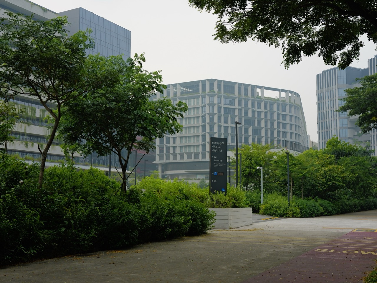
Why does Punggol Digital District put much of its vehicle servicing, parking and essential infrastructure underground instead of allowing loading bays and car parks to dominate the streets? The answer is that a dense district must accommodate goods, people, energy systems and building operations at the same time. JTC’s published design deliberately places heavy-vehicle servicing, car parks, pneumatic waste facilities and major technical services within a subterranean network, helping reserve much of the ground-level public environment for walking and community activity.
The decision belongs to the district’s car-lite planning, not to a ban on all vehicles. Punggol Digital District combines business-park developments with the Singapore Institute of Technology, public transport, retail and public spaces. Some activities need vehicles, deliveries and technical equipment; others need routes that feel safe and pleasant for pedestrians. Organising these functions vertically gives planners more choices than placing every service entrance beside every public plaza. JTC describes the arrangement as part of a three-dimensional district design, developed with the architecture and engineering teams working on PDD.
- Site: Punggol Digital District, including JTC business parks and the SIT Punggol campus.
- Design choice: move substantial parking, heavy servicing and technical infrastructure below the principal pedestrian public realm.
- Why: reduce competition between people-oriented streets and service traffic while using scarce urban land more effectively.
- What remains below: service access, parking and selected infrastructure including district cooling and electrical facilities under the planned scheme.
- Above: connected walking routes, greenery, community spaces and links to public transport.
- Important limit: car-lite does not mean all freight, emergency vehicles or vehicles vanish, or that every basement is publicly accessible.
- Distinct focus: the physical separation of service and pedestrian activity, not the digital platform or the district cooling process.
Why a dense district needs loading and servicing
Workplaces, retail spaces and campus facilities require deliveries. They also need waste collection, maintenance access and occasional movement of heavy equipment. These activities do not disappear when planners want a walkable district.
A traditional arrangement may place many loading bays and service lanes at ground level. That creates competition with pedestrians for space and can make a district feel more like a collection of back-of-house roads than a connected public place.
Punggol Digital District explores a different spatial organisation. The useful goal is not to pretend goods can arrive without vehicles. It is to provide suitable routes and facilities for the required services while reducing their presence in the main pedestrian environment.
Why car-lite is different from car-free
A car-lite area encourages reduced dependence on private vehicles by providing strong public transport and routes for walking or cycling. It can still include parking, authorised service vehicles and essential access.
JTC and Beca describe Punggol Digital District as car-lite, with roads and parking organised below key community and active-mobility spaces. That arrangement should not be translated into an absolute claim that no driver or delivery vehicle ever enters the district.
The distinction is important for residents and visitors: a planning preference for pedestrian priority changes the arrangement of transport, but the operational needs of a working mixed-use district remain.
Why a public walkway and a loading dock have different needs
A walkway should be understandable to people of varying ages and abilities. A loading dock is designed to receive vehicles and transfer goods safely, sometimes involving reversing movements, equipment or restricted access.
Putting these uses in the same narrow space can create conflicts. Different speeds, sightlines, noise and access requirements make coexistence more complicated.
Separating them vertically or through managed routes can reduce some of those conflicts. The correct design still needs safe links between the delivery area and the receiving building. Moving a loading dock underground changes the problem; it does not eliminate it.
Why underground service space is not just an empty basement
An engineered subterranean network must accommodate vehicles, building services, ventilation, drainage, emergency access and the support structure above. These are not interchangeable functions.
JTC’s description identifies a coordinated network rather than isolated basements added after construction. Heavy servicing, parking and utility installations are planned in relation to the broader district.
This is an infrastructure decision with long-term effects. The routes and plant rooms may be hidden from ordinary visitors, but they influence whether the activities above can function comfortably and safely.
Why land scarcity creates a vertical design problem
Singapore has limited land, while a business district needs large amounts of floor area, access and amenities. Placing every function next to every other function on one ground plane creates competition.
A three-dimensional approach can allocate uses to different levels. Parking or service areas occupy suitable lower spaces, while the public realm can concentrate on walking and social activity. Rooftops may support other uses.
The key is not that underground space is free. Excavation and supporting infrastructure can be expensive and technically demanding. The planning opportunity is to balance those costs against the space and public benefits created above.
Why the ground level is valuable to people
Ground-level spaces connect buildings with the surrounding neighbourhood. People experience them during commutes, lunch breaks, errands and visits.
If those spaces are dominated by vehicle lanes and loading activity, pedestrians may face more detours or less comfortable gathering areas. Reserving important routes for people can support a different street environment.

JTC identifies pedestrian connectivity as a central PDD design objective. The physical arrangement makes it possible to consider public life as a priority rather than treating it as a narrow strip left after all vehicle needs have been assigned.
Why Campus Boulevard fits the car-lite approach
Punggol Digital District’s Campus Boulevard is part of the planned network of pedestrian-oriented spaces linking SIT and business-park developments.
The boulevard illustrates the street-level ambition: a connected public route that works with surrounding educational, commercial and community destinations.
That does not mean every link is fully sheltered or free from temporary construction works. A visitor should follow current signs and access rules. The design principle is to create an environment where walking can be a practical way to travel between nearby buildings, not merely a recreational activity.
Why public transport is the other half of the equation
A car-lite district becomes more workable when people have reliable alternatives for arriving from outside it. Punggol Coast MRT and connecting bus services form part of that access strategy.
A person can use regional rail, change modes where appropriate and complete the final portion on foot rather than assuming a private car must reach every building entrance.
But the actual best route depends on origin, destination and accessibility. Public transport and walking work together when transfer locations and pedestrian routes are properly connected. A beautiful plaza alone cannot make up for an impractical regional journey.
Why SIT’s timetable creates demand for walking routes
A university produces daily movements between lecture buildings, laboratories, study areas, food outlets and transport nodes. Those journeys are often short and repeated throughout a day.
A connected pedestrian network supports movement between activities without requiring motor vehicles for every short segment.
The planning logic also applies to offices and retail: people may leave one building for a meeting, meal or service nearby. Actual patterns vary, so their size should not be invented from the development’s total floor area.
Why servicing cannot be designed as an afterthought
A building may look complete in an architectural rendering but still need deliveries, repairs, waste collection and equipment replacement.
If those operations lack suitable access, they can interfere with public routes or create practical difficulties for tenants. Planning servicing early allows the design to coordinate vehicle approach, goods movement and the placement of plant rooms.
PDD’s underground strategy shows that hidden operations are part of the masterplan, not an optional problem for somebody to solve once tenants arrive. The invisible design can be as important as the public-facing appearance.
Why separating vehicles does not eliminate danger
Underground ramps and service roads still involve moving vehicles. They require professional traffic design, speed controls, lighting and suitable separation where people must be present.
A visitor should never interpret the words “car-lite” as permission to wander into a service tunnel or ignore a vehicle crossing at a permitted entrance.
The important safety lesson is that moving one source of conflict away from the main pedestrian space creates a different controlled environment that still needs its own rules and maintenance.
Why underground car parks need ventilation
Vehicles may produce emissions, and enclosed or partially enclosed spaces require appropriate air-quality management. Electrical equipment and other services may generate heat.
The underground setting therefore introduces engineering requirements for ventilation and monitoring, according to the actual design and applicable standards.
It would be misleading to claim that underground parking is automatically environmentally superior because cars cannot be seen. A full assessment also considers air movement, energy, construction and operations. Good planning requires the underground space to function safely rather than merely conceal vehicles.
Why underground parking still requires access and payment rules
Drivers using an authorised parking facility need to identify appropriate entrances, parking areas and payment arrangements. A basement’s existence does not give everyone unrestricted access.
PDD’s parking operators may have site-specific procedures for visitors, tenants and authorised vehicles. Those details can change over time.
For a real journey, use the current official parking information rather than assume every basement is accessible from the same street. This article describes why parking is placed below the public realm, not a live price comparison or guaranteed bay availability.
Why the delivery route and public route must connect carefully
Goods arriving underground ultimately need to reach shops, classrooms, offices or other destinations. Suitable lifts, service corridors and authorised access points may be required.
The challenge is to move supplies without confusing the route used by delivery workers with the one intended for ordinary visitors.
A useful design allows the back-of-house system to serve the public-facing buildings while preserving different security and safety requirements. Separation should improve movement rather than create an isolated logistics network with no practical connection to its customers.
Why a campus may need loading even when most people walk
Laboratories, offices, teaching spaces and food services use materials and equipment that cannot all be carried by individual commuters.
A university’s car-lite character therefore does not remove its need for deliveries and occasional heavy servicing. It changes how these operations are arranged within the campus and business district.
The correct question is not whether freight should exist. It is how freight can be accommodated without unnecessarily dominating the walking and learning environment.
Why the underground substation is a different function
JTC’s description includes a substation among the technical infrastructure lowered into the subterranean network. An electrical substation serves electricity distribution requirements, not vehicle storage.
Its placement must satisfy the relevant safety, maintenance and electrical requirements. A district needs it even if visitors never see its equipment.
The example demonstrates how the underground level accommodates multiple specialised functions. It should not be presented as one large public basement where every service can be accessed through the same door.
Why district cooling also occupies technical space
Punggol Digital District uses a shared district cooling system supplying chilled water through suitable infrastructure to connected facilities. JTC includes its central plant within the subterranean arrangement.
That design allows major cooling machinery to be organised as part of shared district infrastructure rather than occupying equivalent space in every individual building.
The physical plant and pipes perform the cooling function. The underground road and logistics design perform circulation and servicing functions. They are related spatially, but they are not one technology. The shared district cooling guide explains the separate thermal mechanism.
Why pneumatic waste facilities belong in the system
JTC’s account also identifies pneumatic waste bins and waste infrastructure below the main public realm. These installations manage particular waste-collection tasks through specialised systems.
They can help keep some waste-handling activity away from public-facing routes, subject to the actual technology and operating arrangements.
Do not assume every Punggol household is connected to the same waste system as PDD. The HDB Northshore pneumatic waste system is a separate local project. Both demonstrate that different developments can use engineered waste management, but they do not automatically share one physical network.
Why the underground utilities do not make the district self-sufficient
A substation, cooling plant and service roads help operate the district, but they do not mean it can function independently of Singapore’s wider energy, water and transport systems.
The electricity grid, external supply chains and city infrastructure remain important. Local networks are parts of larger systems.
This is a helpful lesson about the word integrated. A district can coordinate its internal services without becoming a sealed, self-contained island where every resource is created on site.
Why pedestrian priority does not guarantee every street is vehicle-free
A car-lite masterplan may prioritise walking on important public routes while still including authorised access for servicing, emergencies and other appropriate uses.
The exact location and legal status of every street depend on the approved design and current operating conditions. A marketing label should not replace real signs.
Residents and visitors should therefore distinguish a public-space intention from an assertion that any particular route is permanently closed to every vehicle. That precision makes the transport story both more useful and safer.
Why the term ‘subterranean network’ needs explanation
Subterranean means beneath the ground surface. A network means that several parts are planned in relationship to one another rather than operating as entirely isolated facilities.
In PDD, this can include vehicle routes, parking, servicing and plant facilities arranged below people-oriented areas above.
But the word network does not prove that every underground corridor is a public through-route or that all technical rooms are physically interconnected. The actual approved layout determines those facts.
Why underground work is not automatically greener
Excavation, retaining structures, waterproofing and mechanical systems consume materials and energy. Some below-ground facilities need lighting and ventilation throughout operation.
A genuine sustainability assessment therefore compares the whole design, including construction and operating impacts, with realistic alternatives.
The visible benefit of calmer pedestrian streets can be meaningful without proving that every environmental indicator improves automatically. JTC’s broader sustainability programme includes complementary strategies such as passive design and energy management, which should be evaluated by their own evidence.
Why a basement cannot be built without studying soil and water
Underground development interacts with the ground beneath the site, including soil, rock, groundwater and neighbouring structures. Engineering investigations and construction controls are essential.
A reader should not assume the Digital District’s basement was excavated with the same machinery as the future Cross Island Line tunnel at Riviera. They are different projects with potentially different methods.
The general lesson is that underground space has real engineering costs and risks. A decision to move operations below ground must be supported by competent design, not merely an attractive street-level plan.
Why the district remains a three-dimensional planning problem
A two-dimensional map can show roads, plazas and buildings, but it may conceal the levels at which different activities occur.
PDD’s public realm, rooftops and underground services form a vertical arrangement. JTC explicitly describes treating the district as a three-dimensional ecosystem rather than a conventional flat masterplan.
A student who draws a sectional diagram can reveal relationships that disappear from a top-down view. The underground service roads explain why the space above can have a different character.
Why a building’s entrance and service entrance are different
A visitor entrance is designed for people arriving to use a facility. A service entrance may handle deliveries, technical equipment or authorised operational work.
They may be separated to reduce conflicts and manage access. A person going to a university classroom should not assume a loading entrance is a shortcut.
This simple distinction illustrates why maps and signs matter. Two doors on the same building can serve very different functions. Their existence should not be interpreted as permission for everybody to use both.
Why the design can support walking between businesses
A business district needs people to move between workplaces, meeting rooms, food services and public facilities.
More continuous pedestrian links can make these short movements more practical. The car-lite design reduces some competition for ground-level space between service vehicles and pedestrians.
But a walking network only succeeds if the routes are legible and accessible to the intended users. A broad pavement with no useful destination or unsafe crossing is less valuable than a connected path forming part of a real daily journey.
Why the district still needs parking for some users
Not every visitor can arrive by train or bicycle. Some people may have accessibility needs, carry equipment or use a vehicle for a legitimate operational purpose.
PDD’s underground parking recognises that such demand must be accommodated even as the district gives greater priority to public transport and walking at street level.
The purpose is not to make driving impossible or to promise unlimited spaces. It is to manage necessary vehicle use without allowing it to determine the character of the main public realm.
Why delivery timing matters
A retail or catering operation may receive goods at particular times, while public pedestrian routes become busy at different times.
An underground service arrangement creates opportunities for managed deliveries with less interference at selected ground-level spaces. However, trucks still need appropriate scheduling and access at their actual entry points.
A responsible article should not invent a universal delivery timetable for every tenant. The planning principle is that service activity and public circulation have different operating patterns that can be coordinated.
Why noise is more complicated than hiding trucks
Moving vehicle activity away from the main public level may reduce some direct exposure to servicing noise in particular places.
But underground roads require ramps and equipment, and sounds may still reach surrounding areas. The effect depends on geometry and operating conditions.
A strong claim about noise reduction needs actual measurements. The defensible design intention is to separate noisy or disruptive functions from places where people gather, not to guarantee that the district becomes silent.
Why fire and emergency access remain non-negotiable
A car-lite plan cannot make the needs of emergency response disappear. Approved building and road arrangements must accommodate the relevant safety requirements.
Service routes and public plazas may have specialised access provisions that are not obvious to casual visitors. These should be respected rather than treated as unused pedestrian space.
For students, the lesson is that a design objective operates within safety constraints. Pedestrian priority is valuable because it is carefully engineered with the district’s other responsibilities, not because all exceptions are ignored.
Why public access changes as construction proceeds
Punggol Digital District has opened progressively since the first facilities became operational. Some areas may remain under development or have temporary routes and restricted entrances.
The existence of a planned plaza or underground network does not prove that every route is currently available to the public.
Visitors should use present-day JTC, SIT and transport information. A construction rendering can describe intended relationships but cannot replace the current signs on a particular day.
Why the project is linked to the ‘inverted skyline’
JTC’s design account connects the underground network with the broader inverted skyline developed by WOHA Architects. Service functions are organised below, pedestrian routes and green space across the public levels, and useful roof areas above.
The two concepts are related but answer different questions. This article is about what happens when servicing and vehicles are placed lower. A separate roof-design article can explain why buildings create broad upper surfaces for solar and greenery.
Keeping those mechanisms distinct helps the reader understand the district as a set of interacting design decisions rather than one vague “smart city” invention.
Why software cannot replace the underground road
Punggol Digital District’s Open Digital Platform connects selected estate systems and operational information. It can support management decisions and monitoring.
But software cannot carry a delivery truck, replace structural support or physically move a cooling pump through a service corridor. The digital layer and underground physical network perform different tasks.
A reader should not assume that “smart logistics” means goods vanish into the internet. Physical deliveries still require suitable space and machines. The Open Digital Platform explanation covers the information-integration side.
A fictional comparison: one-level district versus three-level district
Draw a fictional block with offices, shops, a plaza and a loading area all at street level. Mark where vehicles and pedestrians may compete for access.
Now redraw it with selected servicing and parking below, the public plaza above and suitable building connections. Identify which conflicts might be reduced and which new needs appear, such as ventilation, ramps and freight lifts.
The exercise is conceptual and does not reproduce PDD’s engineering plans. Its purpose is to reveal the trade-off rather than prove that underground construction is universally better.
A fictional delivery route
A supplier delivers boxes to an imaginary business in a car-lite district. The truck enters an authorised underground service area; a worker checks the delivery and moves goods through the approved back-of-house route.
A customer meanwhile enters through the public plaza. Their paths can be better organised, but the supplier still needs secure access, a suitable lift and loading facilities.
The example shows how separating activities changes their interaction without removing either. It should not be presented as a verified step-by-step description of one tenant’s actual PDD delivery arrangements.
A fictional area calculation
Imagine a ground-level site of 20,000 square metres. A hypothetical conventional layout reserves 4,000 square metres for selected service roads and loading functions.
If an alternative design relocates part of that space below ground, more of the surface may be available for other functions, subject to entrances, structures and safety requirements.
The numbers are invented. They illustrate opportunity cost, not a calculation of the actual PDD land saved. Real projects require detailed land-use drawings and cost comparisons.
A fictional safety scenario
A visitor sees an open-looking service ramp and assumes it offers a quicker path to the mall. The route is not signed for pedestrian use.
The correct response is to use the designated public walkway instead. The basement’s existence does not turn it into a convenient walking tunnel.
The lesson is that shared urban space works only when people can distinguish their permitted routes from those reserved for vehicles and essential operations.
A fictional freight-versus-person lift question
A student proposes using every available lift to move goods because the district is meant to be efficient.
The teacher asks whether access rules, capacity and design purpose have been considered. A lift intended for particular people or goods may have restrictions that cannot be ignored.
Efficiency is not equivalent to using every machine for every task. Appropriate equipment and authorised processes matter more than a superficial reduction in walking distance.
A student Geography investigation
Start with JTC’s site-planning explanation and a diagram showing ground and underground functions. Label transport, public space, energy infrastructure and servicing separately.
Then examine an authorised photograph of the Digital District exterior. Ask which underground functions cannot be verified from that photograph alone.
This teaches an evidence distinction: a picture of an open plaza is compatible with the district’s design, but it does not establish the dimensions or route of the hidden services. Official design sources are needed for those claims.
Teaching Guide: why put the back-of-house below the street
Learning goal: explain why a mixed-use district separates heavy servicing from the main pedestrian public realm while retaining operational requirements.
Activity one: draw an imaginary site with pedestrians, deliveries and public activities competing for ground-level space. Activity two: add a lower service level and mark the vehicle, freight and technical components.
Activity three: trace a delivery from outside the district to a shop, identifying every required authorised connection. Activity four: add a person with a stroller using the public route and compare possible conflicts.
Activity five: place a substation and district-cooling plant below ground, then identify how those functions differ from vehicle storage. Activity six: ask what engineering problems underground construction creates.
Activity seven: compare a digital operating platform with physical service infrastructure. Transfer test: consider a campus or hospital with service traffic and public walkways, recognising that the actual design requirements depend on the site.
Frequently asked questions
Is Punggol Digital District entirely car-free? No. It is planned as car-lite with substantial vehicle and servicing functions placed below important pedestrian spaces.
What is underground? JTC identifies heavy vehicle servicing, car parks, pneumatic waste infrastructure, a substation and district cooling among the functions organised in the subterranean system.
Why move them below the public level? To reduce competition for surface land and create a more pedestrian-oriented public realm.
Does underground mean anybody may walk through the basement? No. Use authorised public routes; some areas are restricted for vehicles, maintenance or technical services.
Does the system make deliveries unnecessary? No. Physical goods still need access and movement to the appropriate buildings.
Why are parking lots still provided? Some legitimate users and services still require vehicles even in a car-lite development.
Are roads and parking the same as the Open Digital Platform? No. One is physical infrastructure, the other integrates selected information and control systems.
Are all Punggol HDB homes part of this underground network? No such claim follows. PDD is a defined mixed-use district with its own scheme.
Does placing service roads below save energy automatically? No. A complete analysis must also account for excavation, ventilation and operations.
Where are current public entrances? Use JTC, SIT and current signs for the actual facility.
Your next step
If you are visiting PDD, choose the actual destination—an SIT block, JTC business-park tenant or mall—and find its authorised pedestrian route. Do not use an unsigned service entrance as a shortcut.
To study the planning decision, start with JTC’s sustainable mixed-use district blueprint, URA’s PDD urban design guidance and Beca’s July 2026 engineering explanation.
For related but distinct topics, the PDD district cooling explanation covers the chilled-water utility, and the PDD Open Digital Platform explanation covers data integration. The key lesson here is why physical servicing goes below people-oriented streets to help a dense urban district function on several levels.


