
A Punggol student admitted through Posting Group 2 (PG2) can improve G2 Geography by understanding where Singapore obtains water, how precipitation affects supply, why water pollution threatens ecosystems and people, and how different strategies contribute to water security. PG2 is a secondary-school admission group, not automatically the level of every subject; G2 Geography or Humanities is determined by the student’s actual Full Subject-Based Banding offer. A good answer should explain the relationship between water availability, human use and management, not simply list the names of reservoirs.
MOE’s lower-secondary Geography syllabus covers natural resources, water supply, floods, droughts, water pollution and sustainable use. Singapore’s national water agency PUB identifies Four National Taps: water from local catchment, imported water, NEWater and desalinated water. Punggol’s waterways and nearby reservoirs can make these ideas easier to visualise, but a canal photograph cannot establish water quality or prove the exact drinking-water treatment route. This guide helps families at Edgefield, Greendale, Punggol Secondary and Yusof Ishak Secondary teach the correct distinctions through official maps, careful graph reading, hypothetical comparisons and practical water-conservation reasoning.
- PG2 versus G2: admission grouping and individual subject level are different.
- Water as resource: freshwater availability depends on precipitation, storage, quality, demand and management.
- Flood and drought: too much rainfall over a short period and prolonged rainfall deficits create different challenges.
- Local catchment: rainwater flows through appropriate catchment networks towards reservoirs and requires treatment.
- Imported water: one of Singapore’s Four National Taps, obtained under applicable agreements and arrangements.
- NEWater: high-grade reclaimed water treated through advanced processes.
- Desalination: seawater is treated to remove salts, with energy and other resource implications.
- Water pollution: reduces quality and can harm people and aquatic ecosystems.
- Next step: make a sourced diagram of the four taps and explain one trade-off without inventing measured claims.
Definition lock: PG2, Geography and a water resource are different concepts
Posting Group 2 is part of the Secondary 1 admission arrangement. G2 refers to an individual subject level under Full Subject-Based Banding, and a student may have different levels in different disciplines. Geography considers how physical environments, people and resources interact. Water resources are part of that field, not an academic stream. Families should confirm whether the child is currently studying water in lower-secondary Geography, Science or a combined Humanities arrangement before selecting the task.
Different questions require different answers. A Science question about filtration examines physical properties and purification mechanisms. A Geography question about water security examines supply, spatial conditions, social demand and management. The topics are related but not interchangeable. A good tutor identifies the specific command word and teaching goal rather than reproduce the same account of water in every subject.

Why water is an essential natural resource
Freshwater supports drinking, food preparation, sanitation, industry, agriculture, recreation and ecological processes. Its importance goes beyond the water coming from a household tap. Rivers and wetlands may support organisms and human activities even when their raw water is not immediately safe to drink. Students should avoid classifying all water bodies solely as drinking sources or assuming seawater can replace freshwater directly for every purpose.
Ask the teenager to name the use in a particular question. A domestic-use example concerns households, an industrial-use example may involve cooling or manufacturing, while an ecological example concerns habitats. The availability, quality and infrastructure requirements can differ across these uses. A water resource is valuable in relation to a specific need, not merely because water appears on a map.
Water availability is not the same as water quality
A country may have substantial rainfall but face supply challenges because of limited storage, pollution, uneven distribution or growing demand. Conversely, a dry region may secure some water through infrastructure and management, albeit with constraints and costs. Availability concerns the quantity that can be supplied, while quality concerns suitability for particular uses. Both matter for water security.
Ask the child to separate the two in a written example. A reservoir containing water does not mean the untreated water is safe to drink. A river with high flow could still be polluted. A reliable Geography answer identifies which challenge is described and explains the management response suited to it. Treating all water problems as simply ‘not enough rain’ misses several mechanisms.
Precipitation provides an important input
Precipitation includes forms of water falling from the atmosphere, with rainfall being especially important in Singapore’s tropical context. Variations in precipitation influence catchment inflows and can contribute to changing reservoir conditions. But a single heavy shower does not establish that storage is secure for months, and one dry day does not prove a drought. Time scale and the relevant catchment area matter.
A climate or rainfall graph should identify its period, units and location. Students can compare monthly totals in an appropriately sourced dataset or a clearly fictional classroom example. Avoid using a photograph of dark clouds as quantitative evidence. The right explanation connects rainfall to collection, runoff and storage under the given conditions.
Drought is more than a hot afternoon
A drought generally involves a prolonged deficit in precipitation or water availability relative to relevant conditions, potentially affecting ecosystems, reservoirs and users. A hot school day is weather, not proof of drought. The length and severity of a drought depend on appropriate climatic and hydrological definitions. Geography students should avoid turning an uncomfortable afternoon into a conclusion about long-term water security.
Ask the child what evidence would be needed: rainfall records over time, reservoir levels, official declarations or indicators appropriate to the question. A hypothetical multi-month rainfall deficit can help explain the concept without claiming a current drought in Punggol. Scientific restraint is as important as awareness of possible risks.
Flooding represents a different water challenge
Intense rainfall can exceed the capacity of drainage or ground absorption in certain settings, contributing to local flooding. This does not mean that all rainfall is harmful or that a flood necessarily reflects insufficient drinking-water supply. Flood risk depends on land, intensity, drainage, tides and other conditions. Students should distinguish stormwater management from long-term water supply management even though both involve the same water cycle.
Ask what spatial and temporal factors a flood question provides. Is there a low-lying area, a storm event or an infrastructure constraint? Do not diagnose a particular Punggol road as flood-prone without official evidence. A strong response identifies the pathway by which intense rainfall may produce a hazard and the limits of what the given data can establish.
The water cycle links environment and people
Evaporation, condensation and precipitation are major processes in the water cycle, while runoff, infiltration and storage affect the movement of water on and below land. Human development changes some pathways through roofs, roads, drains and reservoirs. A water-cycle diagram is a simplified model: it helps show connections but may omit important local conditions.
Ask the learner to trace how precipitation might move through an urban catchment and eventually enter a managed supply system. The pupil should explain where treatment is needed and where water may flow to the sea. Do not draw one universal arrow suggesting every raindrop becomes drinking water. Geography studies pathways and constraints as well as the broad cycle.
Catchments are defined drainage areas
A catchment or drainage basin is an area whose water drains towards an outlet or collection network under specified conditions. The boundaries may follow topography and engineered drainage arrangements. Students sometimes assume that a reservoir collects every drop of rain across the whole island. Actual catchment areas are defined and managed, and not all surfaces drain into the same reservoir.
Read an official catchment map when the school requires spatial detail. Ask which area contributes water to which system and why land use within the catchment matters for raw-water quality. A map’s date and categories are essential. The idea of a catchment becomes clearer when the child recognises that water moves through a particular connected landscape, not everywhere at once.
Singapore has Four National Taps
PUB identifies the Four National Taps as local catchment water, imported water, NEWater and desalinated water. The strategy diversifies sources and strengthens resilience because the taps have different characteristics and dependencies. It would be wrong to call four taps four identical reservoirs or to assume every tap collects rainwater in the same way.
A learner should name each tap and then explain the source or process behind it. One is collected rainfall, another imported water, another reclaimed used water and another desalinated seawater. The value of the framework is the complementary roles of the sources. Listing the names is the starting point; explaining what each contributes demonstrates geographical understanding.
Local catchment water begins with rainfall
PUB describes the local catchment tap as rainwater collected through waterways, drains and reservoirs. Singapore has developed an extensive water-catchment system and manages the quality of raw water for treatment. The process should not be confused with pouring rain directly from a drain into a household cup. Raw water requires appropriate treatment and quality assurance before distribution as drinking water.
Ask the teenager to draw a broad flow from rain to catchment to reservoir and then to the relevant treatment and distribution system. The diagram is schematic and should not be presented as an exact route for a particular Punggol puddle. The child should understand why storage and treatment are both necessary.
Imported water is a distinct source
Imported water is one of Singapore’s Four National Taps and is currently associated with supply from Johor, Malaysia, under the relevant agreements and infrastructure arrangements. It is not a claim that every litre used in Singapore is imported, nor does the existence of an agreement make the resource free of all geopolitical or environmental considerations. Geography studies supply relationships as well as the physical resource.
A student should avoid inventing current contractual quantities or deadlines when the question does not provide them. Use PUB’s up-to-date official information for factual figures and legal context. The broad syllabus concept is diversification: imported water supplies one route among several for meeting demand. The different pathways help explain why a country with limited land invests in multiple water sources.
NEWater recycles treated used water
NEWater is Singapore’s high-grade reclaimed water produced by treating used water through advanced purification processes. PUB explains that used water is collected and treated before further processing to produce NEWater. The source is distinct from rainwater entering a reservoir and from seawater desalination. Students should not describe NEWater simply as unfiltered wastewater flowing directly to homes.
Ask the learner to identify the stages at a conceptual level: collection, preliminary or conventional treatment, advanced purification and appropriate use. The specific technology and allocation belong to PUB’s official descriptions. The important geographical principle is that reclaiming used water creates an additional managed resource, potentially reducing reliance on rainfall-dependent supplies.
Used water and stormwater are managed differently
Singapore has systems for collecting used water from households and premises and for managing rainfall runoff. These systems serve different purposes even when both involve channels or pipes. A learner who draws household sewage directly entering the public drinking-water reservoir without treatment is confusing infrastructure networks. Similarly, not every rain drain leads to the same place.
Ask what type of water the question concerns and which process is meant to handle it. PUB’s integrated water-management materials provide the appropriate context. A correct school diagram does not need to reproduce the entire engineering network, but it should maintain the key separation between sources, collection and treatment. Good Geography connects urban planning with environmental protection.
Advanced purification is more than ordinary filtration
PUB describes advanced treatment for NEWater, including membrane technologies and disinfection in its current public information. Ordinary filter paper can remove some suspended solids but cannot replicate the full industrial water-reclamation system. Students should not claim that an elementary filtration demonstration makes previously used water safe to drink. Water quality depends on appropriate treatment and rigorous monitoring.
A useful comparison asks what contaminants different processes are designed to manage, without requiring laboratory detail beyond the syllabus. The child can understand the principle that several complementary steps are used to obtain high-grade water. Do not encourage attempts to reclaim household wastewater or taste an experimental sample. A conceptual diagram and reliable official sources are sufficient.
Desalination treats seawater
Desalination removes dissolved salts and other unsuitable components from seawater through appropriate engineering processes. PUB states that Singapore currently uses reverse osmosis for desalination. The process contributes a source that is not directly dependent on local rainfall, although it uses energy and specialised infrastructure. A teenager should not describe ordinary kitchen sieving as an equivalent way to remove dissolved salt.
A school answer might compare the source and requirements of desalination with local catchment water. Seawater is abundant around an island, but transforming it into suitable freshwater takes investment, treatment and energy. The benefit must be considered alongside these costs. This is a genuine Geography trade-off, not a promise of unlimited cost-free drinking water.
Reverse osmosis has a cost and a purpose
Reverse osmosis uses specialised membranes and applied pressure to separate water from dissolved salts and other materials under controlled conditions. It differs from a student passing saltwater through ordinary filter paper. PUB’s public desalination page discusses the energy intensity of desalination, reinforcing that technological supply has resource requirements. The exact figure may change with technology and operating conditions, so use current official values for numerical claims.
Ask the pupil why a country might still use desalination despite energy demands. Resilience and rainfall independence can be important benefits. A complete evaluation can acknowledge cost and environmental effects without rejecting the tap categorically. The underlying lesson is that water security involves trade-offs, not a single perfect technology.
Four different sources reduce a single dependency
A diversified supply can improve resilience because a change affecting one source may be offset to some extent by others. A drought could reduce local catchment availability while rainfall-independent sources remain relevant, although all supplies depend on infrastructure, resources and operational constraints. It would be too strong to claim that diversification guarantees no future water shortage under any conditions.
A good Geography answer explains the mechanism. Different taps have different vulnerabilities, so managing several sources can support reliable planning. Ask which sources are affected by prolonged dry weather and which use more energy or imported infrastructure. An honest evaluation discusses the trade-offs and conditions rather than merely repeating that four is better than one.
Water security depends on demand too
Water supply is only one side of the balance. Households, industries, commercial premises and other users create demand, which can change with population, economic activity and technology. Increasing supply without managing demand can raise costs and environmental pressures. PUB promotes water conservation as part of Singapore’s sustainability strategy.
Ask the student to identify whether a question describes an increase in demand, a decrease in supply or a decline in quality. These situations may need different responses. For example, efficient industrial processes and appropriate household use can reduce unnecessary consumption. A well-supported recommendation identifies the source of demand rather than blaming all water users equally.
Water conservation means preventing unnecessary waste
Practical conservation can involve fixing leaks through proper maintenance, using water-efficient devices, avoiding unnecessary flow and following established public guidance. A school task may invite students to suggest actions, but the response should explain how the behaviour affects consumption. A slogan such as ‘save water every day’ gives little mechanism on its own.
Ask the teenager to choose one realistic action and explain which wasted use it reduces. Do not instruct a child to alter plumbing or operate potentially hazardous installations. Households with genuine leaks should use appropriate maintenance channels. Responsible conservation is an ongoing habit supported by suitable equipment and management, not a contest to use unsafe amounts of water.
Pollution can reduce usable water resources
Water may be physically present yet unsuitable for certain uses because of contamination. Human activities can introduce chemicals, litter, nutrients or microorganisms into water systems under different conditions. Pollution can harm aquatic ecosystems and make treatment more difficult or expensive. Students should avoid assuming that all pollutants behave alike or that one photograph can identify chemical concentrations.
A school response should name the relevant source of pollution, explain its pathway and describe a plausible effect on water quality or living organisms. If a question supplies a specific contaminant, use that information rather than writing a general sentence about dirty water. Accurate cause-and-effect reasoning makes conservation proposals more credible.
Human activities can affect river ecosystems
River habitats depend on water flow, quality, temperature, dissolved conditions and their biological communities. Altering one factor can affect organisms in different ways. A student should not assume that every fish dies whenever any pollution is present, or that one healthy-looking plant proves the water is clean. Ecosystem effects require a suitable source and evidence.
A conceptual question might ask how excessive nutrients can affect aquatic conditions under a defined model. The learner should use the science and geography provided rather than invent population counts. Connecting water quality to ecological function is valuable, but the magnitude of a real local effect must be measured. Careful explanation avoids turning concern for nature into unsupported alarm.
Punggol Waterway is a useful visual reference
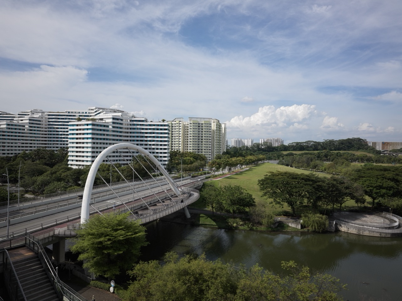
Punggol Waterway and the neighbouring reservoirs offer a familiar landscape in which students can discuss urban water management, storage and public recreation. However, the visible waterway is not evidence that its water can be drunk untreated or that its quality is identical across locations and dates. A photograph is a record of appearance at one moment; it is not a laboratory analysis.
Ask what the image genuinely supports. It may show canal banks, bridges, buildings and planted areas. A claim about flow rates, treatment efficiency, chemical pollutants or microbial quality needs different evidence. This is especially important in local publishing, where familiar surroundings can encourage confident but unsupported statements. The waterway should inspire inquiry, not replace it.
Punggol and Serangoon reservoirs are managed water bodies
Singapore’s Punggol and Serangoon reservoirs form part of the country’s managed water landscape, with associated catchments and public recreation arrangements under PUB’s relevant guidance. A student should not confuse the waterway’s recreational design with the complete water-treatment system. Raw reservoir water undergoes managed processes before use as potable supply; being in a reservoir does not make the water ready to drink.
A Geography project can use official maps and descriptions to locate the reservoirs and explain their broad function. But specific recreational access or current restrictions should be checked with PUB rather than guessed from a school poster. Resource management and visitor rules are related but different questions.
Waterway scenery does not prove environmental performance
A photograph of a landscaped canal may look clean and attractive while revealing very little about water chemistry, ecological health or long-term engineering performance. A student could describe the visible landscaping accurately but should not declare that flood risk has been eliminated or biodiversity has doubled without appropriate evidence. Those outcomes require proper measurements and comparisons.
Ask the learner to make an observation–interpretation table. Place visible features in one column and potential questions for further research in the other. This practice teaches epistemic discipline: knowing what a source cannot establish is part of geographical competence. A precise modest claim is stronger than a dramatic unsupported environmental conclusion.
Climate change introduces additional uncertainty
Changes in climate can alter rainfall patterns, sea levels and related water-management challenges. The implications depend on geography, infrastructure and the time horizon considered. PUB’s sustainability framework discusses water security, coastal resilience and adaptation. Students should not describe one hot day in Punggol as proof of a long-term shift in national rainfall or assert a precise future water shortage from a simple diagram.
A strong response explains plausible risk pathways and identifies suitable evidence such as long-term observations or official projections. It can discuss the importance of diverse taps and demand management while acknowledging uncertainty. Geography helps students reason about future challenges without pretending every outcome is already known.
Flood management and water supply are connected but different
PUB’s work includes water supply, used-water reclamation and flood or coastal management. A drain or canal may influence stormwater movement, while water reclamation and treatment address other parts of the system. Students should distinguish which infrastructure and process the question is about. A structure serving stormwater functions is not automatically a potable-water treatment plant.
A city can seek to capture rainwater while also managing intense runoff to reduce flood risk. These aims can interact and require planning, but the mechanisms differ. Ask the teenager what moves through each part of the system and under what conditions. A well-labelled schematic is more informative than drawing every pipeline as one undifferentiated blue arrow.
Water footprint is broader than a glass of drinking water
Water is used indirectly when producing food, manufacturing goods and supplying services. A household may see water from a tap yet not see the water involved in creating products it buys. Students should understand this general relationship without inventing a precise product footprint. Valid numerical footprints require carefully defined scope and sources because production conditions vary.
Ask whether a conservation proposal targets direct household use or a broader supply chain. The response should avoid overconfident comparisons between unrelated products without matching methodology. The useful lesson is that human water demand includes many sectors. Geographic literacy involves knowing how direct and indirect demands relate to resources.
Industrial water demand can involve special quality requirements
Some industries require water with particular quality characteristics for processes such as cleaning or manufacturing. PUB identifies the role of high-grade NEWater for certain industrial uses. A student should not assume all industry needs household drinking-water quality, nor that any reclaimed water is suitable for every industrial process without further treatment and standards.
Ask why quality requirements may differ and how specialised treatment supports a particular use. A credible answer references official descriptions and avoids invented allocations of national supply. The geographical point is that demand depends on the nature of activity and that technology can expand usable sources under controlled conditions.
A fictional four-tap comparison activity
Imagine a worksheet listing four invented scenarios: a dry period reducing rainfall, a disruption to one imported source, a rise in industrial demand and an increase in energy cost. The student must explain which National Taps may be affected and why, using the actual definitions but without claiming that these events have happened. A weak answer says one tap will solve every scenario.
A stronger response considers different dependencies and limitations. Catchment supply depends on rainfall, imported supply on external arrangements, and reclaimed or desalinated supplies on advanced infrastructure and resources. The purpose is reasoning about resilience, not predicting current national operations. Fictional scenarios should remain clearly labelled rather than published as alerts.
A second fictional exercise about water pollution
Imagine a made-up river ecosystem receiving excessive litter and untreated discharge. The teaching prompt asks what consequences might follow for aquatic organisms and human use. A student should distinguish visible litter from chemical or biological pollution that cannot be judged by appearance alone. The answer can identify possible risks while noting that exact effects need details of the substances and concentrations.
This fictional river is not Punggol Waterway, and the scenario does not assert an actual local incident. It demonstrates how Geography links human activity, environmental quality and resource availability. A useful response explains a plausible pathway rather than listing every imaginable disaster. Parents should encourage scientific restraint alongside environmental concern.
How to read a rainfall chart
A rainfall graph should identify its location, measurement period and unit, commonly millimetres. The student should read the horizontal time axis and compare quantities based on the numerical scale rather than the visual height alone. A sharp rise over one month does not automatically imply a year-long flood, and a low month does not by itself establish drought.
A school-approved or explicitly fictional chart can be used to describe patterns and calculate simple changes. Ask what the chart directly shows and what additional information would be needed for broader climate claims. This prevents overinterpretation while developing Geography and Mathematics skills together.
The four-tap table should describe mechanisms
A useful table has columns for source, how it is obtained, one advantage, one challenge and the evidence supporting the description. Local catchment uses collected rainfall; imported water involves external supply; NEWater uses reclaimed treated used water; desalination removes salts from seawater. Each has different infrastructure and resource requirements. No method should be labelled universally perfect.
Ask the pupil to explain why one source complements another. A name-only answer is incomplete for an evaluative question. Students should also distinguish a characteristic from an unsupported prediction. For example, seawater desalination is rainfall-independent in the direct sense but energy-intensive; that is a reasoned trade-off, not an unlimited supply guarantee.
Water conservation questions need specific recommendations
A student may propose turning off an unnecessary flowing tap, repairing an identified leak through authorised channels or choosing suitable water-efficient fittings. The answer should state which waste is reduced and why the action is practical. An idea that requires families to drink unsafe water or ignore hygiene would be inappropriate, even if it superficially reduces water use.
Ask for one relevant action with a mechanism, possible obstacle and realistic implementation. Avoid a long generic list. Strong Geography evaluations consider human needs alongside resource sustainability. The goal is responsible management, not the smallest possible personal water consumption regardless of safety.
One student’s fictional explanation improves
Imagine a fictional PG2-entry learner, Farah, who writes that Singapore’s Four National Taps are four reservoirs. Her teacher asks her to name the source of each tap rather than locate four bodies of water. Farah recognises that NEWater and desalinated water are manufactured through advanced treatment, while imported water and local catchment have different supply pathways. She revises her answer using a clear table.
On a new question about dry weather, Farah explains why diversification could support resilience without claiming shortages can never occur. This is an invented educational example, not a report about a real child. The correction improves conceptual classification and causal reasoning, not merely the spelling of four names.
A ten-day study sequence for water Geography
Begin by distinguishing water availability and quality, then learn water-cycle and catchment terms. Next, examine precipitation variability and the difference between flooding and drought. Introduce the Four National Taps with their source mechanisms and trade-offs. Later, study pollution and ecosystem effects, then evaluate one conservation proposal using PUB information. End with a new hypothetical scenario requiring a reasoned response.
This is an optional home plan, not the current school timetable. If the class is studying transport or housing instead, follow the actual syllabus first. A child who can explain one tap accurately should extend to comparative reasoning only after the distinctions are secure. Short independent explanations are more useful than memorising the same four labels repeatedly.
A responsible tutor makes every claim traceable
When a pupil says that desalination uses no energy or that all filtered canal water is potable, the tutor should identify the incorrect assumption and use suitable authoritative evidence to correct it. If a student cannot read a rainfall chart, work on the axes and units. If they list the taps correctly but cannot compare them, practise one advantage–limitation explanation. Different weaknesses require different remedies.
Parents can ask the learner where each factual statement came from and whether the evidence is current. A fresh question solved independently is stronger proof of understanding than copying a well-written national water story. The objective is a student who can reason about unfamiliar resource problems without inventing data.
Source links and Your Next Step
MOE’s Lower Secondary Geography syllabus covers natural resources, water availability, flood and drought, pollution and sustainable responses. PUB’s official Singapore Water Story identifies the Four National Taps, while PUB’s sustainability framework explains conservation, supply diversification and climate-related challenges. The relevant current Punggol school timetable and teacher instructions determine which Geography topics are assessed.
For general maps, urban waterway observations and safe inquiry, read the earlier PG2 Geography inquiry guide. For the physical Science behind separating salt from water, see the separate Science Separation guide. Your next step is to ask the child to draw four boxes for the National Taps, describe their sources correctly and explain one advantage and limitation of any two.
Frequently asked questions about PG2 G2 Geography Water Resources
Does PG2 automatically mean the child studies G2 Geography?
No. PG2 is admission grouping and individual Humanities offers follow Full SBB arrangements.
What are the Four National Taps?
Local catchment water, imported water, NEWater and desalinated water.
Is all water seen in Punggol Waterway ready to drink?
No. Water appearance does not prove potable quality; water supplies require appropriate treatment and quality assurance.
Does NEWater come directly from rain?
No. NEWater is high-grade reclaimed water produced through advanced treatment of used water.
How is desalination different from ordinary filtration?
Desalination removes dissolved salts using specialised technologies such as reverse osmosis, unlike standard filter paper.
Why might Singapore need four sources?
Different sources reduce dependence on one set of environmental or supply conditions, although each has limitations.
Are flood and drought the same water problem?
No. They involve different precipitation and hydrological conditions, time scales and hazards.
Can a photograph reveal a reservoir’s chemical water quality?
No. Reliable measurements or official results are needed.
What is one realistic water-conservation action?
Reduce a specific unnecessary use, following safe hygiene practices and appropriate maintenance.
What should a Geography water-resources answer include?
A defined problem, a credible source or data point, the relevant process and a realistic, evidence-based explanation or trade-off.
Editorial note: Prepared 1 November 2026. Official water-source descriptions use PUB and MOE references. Fictional drought, pollution and student scenarios are teaching examples, not live advisories or local water-quality measurements. Follow current school and official guidance.


