
A Punggol student admitted through Posting Group 2 (PG2) can learn G2 Geography housing by asking how homes meet human needs, why housing is located where it is, how development affects people and the environment, and what makes a city liveable for different residents. PG2 is an admission category; G2 is the level of an individual subject under Full Subject-Based Banding. A strong Geography answer does not simply say that Punggol has beautiful new flats. It connects actual housing features with land-use decisions, access to amenities, environmental impacts, affordability and the needs of people living in the city.
MOE’s lower-secondary Geography syllabus includes a Housing topic and sustainable-city questions about safe housing, resource demand, environmental pressures, mobility and quality of life. HDB’s official Punggol town account documents its development as a waterfront town, Punggol 21, the waterway and eco-town strategies; URA describes ongoing plans for inclusive housing and amenities. Families at Edgefield, Greendale, Punggol Secondary and Yusof Ishak Secondary should use the assigned teacher’s current Geography scope and consult these sources rather than assume every planned building is already open. This guide teaches students to compare types of housing, reason about land-use trade-offs, read plans carefully and evaluate liveability without inventing resident survey results.
- PG2 versus G2: an admission grouping and an individual Geography subject level are different.
- Housing: provides shelter and relates to security, sanitation, amenities and everyday opportunity.
- Types: the lower-secondary syllabus contrasts formal and informal housing using proper context.
- Location: land prices, planning, developers, transport, employment and environmental conditions can matter.
- Liveability: evaluate practical access, safety, inclusive design and quality of life for different groups.
- Environmental effects: consider land, resources, waste, pollution and climate-related risks.
- Punggol: HDB documents its waterfront and eco-town planning; distinguish completed and proposed features.
- Evidence: use maps, dated official sources and appropriately scoped data rather than assumptions from one photograph.
- Next step: compare two fictional neighbourhood plans on specific, justified liveability criteria.
Definition lock: PG2 does not define the student’s housing curriculum
Posting Group 2 assists with Secondary 1 admission under Full Subject-Based Banding. G2 identifies a particular level of an individual subject, which may differ from the pupil’s entry grouping when eligibility and school arrangements allow. Housing is a topic in lower-secondary Geography, not an alternative posting pathway or a description of the child’s household. The family should consult the school’s current syllabus and assessment criteria before selecting practice material.
A student can be fluent in naming transport stations but still struggle to explain why housing develops in particular locations. Another can describe a new building without evaluating whether residents can reach necessary services. These are specific geographical reasoning gaps. A good tutor identifies the first weak step, clarifies the concept and asks the learner to apply it to a different place. The goal is geographical understanding rather than memorising a Punggol marketing description.

What housing provides beyond a roof
Housing helps meet the basic need for shelter, but the quality of housing also relates to sanitation, safety, available space, reliable services, affordability and access to education, work and healthcare. A building can be architecturally striking without meeting all those needs equally for every resident. Conversely, simple housing may fulfil important functions without looking luxurious in a photograph.
Ask the teenager which aspect of living conditions the question is about. A description of structural materials answers a different question from one about access to a clinic. A complete Geography response uses the relevant criterion and available evidence. It does not assume all residents of one neighbourhood share the same experience, financial position or travel needs.
Formal and informal housing are syllabus categories
MOE’s lower-secondary Housing topic distinguishes formal housing, which is planned and developed under recognised legal arrangements, from informal housing associated with inadequate tenure security or services in some cities. Students must understand the definitions within their geographical and social contexts. Informal settlements are not simply places whose residents lack effort or responsibility, and the same conditions should not be presumed in every country.
A good comparison identifies tenure, housing materials, access to basic services and location factors using the actual sources provided. Avoid presenting a single photograph of one settlement as proof of every person’s legal status. The task is understanding urban housing structures and constraints, not stereotyping communities. Respectful, evidence-based language improves geographical accuracy.
Why people need secure tenure
Secure legal occupancy can influence a resident’s ability to plan, invest in improvements and access services, depending on the local system. Informal settlements may have complex histories of land ownership, affordability constraints and public provision. A student who writes that all informal residents deliberately ignore rules has missed the wider structural question. Geography examines how institutions, resources and opportunities shape where people live.
Ask what evidence the map or article supplies about tenure. Does it identify a legal status, an official planning category or merely a building’s appearance? These are different kinds of information. If tenure is not documented, do not invent it. A responsible comparison can explain general patterns while acknowledging variation among actual communities.
Housing availability and affordability are different
A city can have many housing units yet still have affordability pressures for certain households. Price, household income, financing eligibility and location influence who can access a particular home. A student should not equate new construction automatically with affordable homes for everyone. Similarly, describing a dwelling as expensive without relevant comparison data is an unsupported claim.
An appropriate learning exercise compares hypothetical housing options under clearly supplied income and cost conditions, without collecting private family financial details. Ask which cost the question measures: purchase price, rental payment, transport, maintenance or overall household burden. The answer changes with the measure. A good urban Geography evaluation identifies whom affordability is being assessed for.
Land is a limited resource in a city
Housing competes with employment sites, roads, parks, schools, utilities and other land uses. Singapore’s limited land area makes trade-offs especially visible in planning. A new residential development may help provide homes while requiring infrastructure and environmental management. Students should avoid saying that every vacant plot must become housing or that every additional building automatically harms nature.
Ask what alternative uses the land might support, what public need is being addressed and which constraints apply. A map or official plan can reveal designated uses, but a proposed zone is not proof that construction has finished. Reasoned judgement compares needs and consequences using the available evidence. Geography teaches how several objectives must coexist within limited space.
Government and private developers have different roles
Cities can involve public and private actors in financing, building, maintaining and regulating housing. In Singapore, HDB is a major public housing institution, while private developers participate in other housing forms. The specific arrangements differ by jurisdiction and planning framework. Students should not assume that a city with formal housing uses one universal model or that private construction alone determines every household’s ability to afford accommodation.
A useful comparison asks who plans the land use, who develops the building, who sets the relevant rules and who occupies the homes. Sources must support each answer. These roles can interact, and the outcome cannot be reduced to a simple ‘government good’ or ‘private good’ claim. Housing Geography studies systems and constraints rather than slogans.
Punggol has an official development history
HDB’s Punggol town profile explains that the Punggol 21 vision was unveiled in 1996, that new plans under Remaking Our Heartland followed in 2007 and that Punggol was selected as Singapore’s first Eco-Town in 2010. It describes the subsequent waterway-oriented housing vision and later smart-technology trials in Punggol Northshore. These are official planning milestones, not invented dates from a school worksheet.
Ask the learner to place the milestones in order and explain what each introduced. The history can illuminate how urban plans develop across time. However, a policy announcement is not the same as a completed feature, and the date of a district strategy does not mean every dwelling was built that year. Accurate chronology is part of Geography when explaining land-use change.
Waterway planning changes the residential landscape
HDB describes a man-made waterway connecting the dammed Sungei Punggol and Sungei Serangoon reservoirs, opening opportunities for waterfront living. Its town profile identifies housing developments including Waterway Terraces I and II and Waterway Ridges. These examples illustrate how a prominent water feature can be integrated with urban residential planning and recreational space.
A student should distinguish a planned amenity’s intended purpose from measured outcomes. A scenic photograph can show water, buildings and pathways, but it does not quantify residents’ health, house values or commuting time. If the question concerns quality of life, select appropriate evidence for the specific benefit claimed. An attractive setting may support liveability, but its contribution requires a defined criterion and careful interpretation.
What ‘liveability’ asks us to evaluate
Liveability concerns how well an environment supports people’s everyday life, considering factors such as safety, comfort, access, opportunity and social or environmental conditions. A place that is convenient for one family may pose difficulties for a person with limited mobility or different work hours. The concept should therefore be evaluated with more than a general statement that a city is modern.
Ask the learner to name a particular resident need and a practical indicator. For example, proximity to essential services may matter to some households, while accessible routes and reliable transport matter to others. A responsible answer does not pretend a simple index captures every experience. Geography examines the relationship between urban design and the people who use it.
Quality of life has more than one dimension
Quality of life can include physical conditions, social participation, environmental comfort and the ability to access services. A large shopping centre may provide convenience but not automatically solve school access, noise or housing affordability concerns. Similarly, a park may offer recreation while requiring safe access routes and maintenance to be useful for different groups.
A classroom exercise can rank fictional neighbourhood plans on several criteria, explaining why no option dominates every dimension. The student’s priority should be to justify each rating from the stated features. Without a genuine survey, do not claim that ninety percent of Punggol residents prefer one design. The goal is sound evaluation, not fabricated consensus.
Schools and healthcare are important amenities
Housing locations interact with school access, clinics, community facilities, markets and other everyday services. A family may value a short and safe route to school more than a scenic viewpoint, while another may prioritise access to medical care or work. The correct conclusion depends on the circumstances and evidence. A map showing a school symbol does not establish how long a particular child takes to travel.
Ask which amenity the question is about and whether the map uses a straight-line or route-based measure. If walking access is the issue, crossings and path networks matter, not just distance on a picture. The focus of this article is housing and liveability; transport-network calculation is covered separately in the existing PG2 Geography inquiry guide.
Accessibility is not identical to proximity
Two buildings may stand at similar distances from a facility but offer different practical access because of stairs, crossings, slopes or the availability of step-free routes. A student who measures only a straight line may ignore a barrier relevant to a wheelchair user, an older resident or a parent with a stroller. Inclusive design therefore belongs in a discussion of quality of life.
Ask which resident is being considered and what the environment actually provides. Avoid assuming a person with a disability has one fixed need; real accessibility is diverse. If a particular building’s facilities are unknown, state the uncertainty instead of promising features. A well-reasoned response uses grounded information and acknowledges whose experience it can and cannot describe.
URA explicitly discusses inclusive towns
URA’s long-term planning material explains an intention to mix public and private housing more closely and encourage everyday interaction among residents. It also identifies Punggol Waterway as a shared recreational attraction. These are useful official planning principles for a Geography discussion about inclusion, but they do not establish that every resident has equal access or experiences the same benefits.
A student should ask how a planning strategy might work and what evidence would be needed to evaluate its results. Mixed housing can create opportunities for interaction, while actual social relationships depend on many factors. The plan is a hypothesis about improving urban life; observed social outcomes require appropriate research. Careful distinction between intention and outcome is a sign of mature geographical judgement.
Green space contributes to urban experience
Parks, planted corridors and waterway paths can provide recreation, visual relief and opportunities for residents to spend time outdoors. HDB and URA describe green and recreational planning as elements of Punggol’s development. Yet greenery alone does not establish that a site is ecologically healthy or that every resident enjoys equal access. Maintenance, weather, safety and mobility constraints also matter.
Ask which benefit is actually supported by the source. A photograph showing a walkway proves that the walkway was visible when the image was taken; it does not prove daily usage levels. A statement about biodiversity needs ecological records rather than one scenic image. This careful source use connects urban liveability with environmental literacy.
Higher density can create both benefits and challenges
Concentrating homes can support public transport, shared infrastructure and nearby amenities. It may also increase demand for facilities, open space and services if planning does not keep pace. Students should avoid declaring high-rise development inherently good or bad. Density is a quantitative and spatial concept whose effects depend on design, management and surrounding infrastructure.
A hypothetical exercise might compare two urban layouts, one spread out and one compact. The pupil can discuss potential service efficiency alongside crowding or accessibility concerns, but should not invent population-per-hectare figures. A strong answer explains mechanisms and trade-offs under the conditions given. Density is not a substitute for understanding daily living conditions.
Housing has an environmental footprint
Building and maintaining homes requires materials, energy, water and land. Construction can generate waste and other local impacts, while residents’ long-term use involves electricity, cooling and maintenance. Sustainable-city planning attempts to manage these demands. A student should not conclude that a new block is environmentally successful merely because its facade includes plants or a green label.
Ask which environmental variable is being evaluated: energy consumption, resource use, waste handling, water, habitat impact or heat. Each requires different evidence. An official planned performance target is not the same as measured achievement. Good Geography can recognise innovative design while maintaining honest standards for evaluating its actual effects.
Punggol’s eco-town programme is documented
HDB explains that Punggol was selected as an eco-town in 2010 and that the area has served as a living laboratory for sustainable housing ideas. Its profile names Treelodge@Punggol among early eco-friendly projects and describes Northshore smart-technology trials involving common-area lighting, parking monitoring and waste management. Those details can be cited as documented planning and development examples.
The student should not overstate them as universal features in every block. A trial in one district does not prove all residents use that system, nor that all promised savings were achieved. Ask what the technology is intended to improve, what the reported implementation covers and which measured evidence would establish success. Sustainability becomes meaningful when tied to specific functions and outcomes.
Smart housing technologies still need evaluation
Sensors, adaptive lighting and digital resource systems can potentially support better urban management. But technology is not a guarantee of efficiency or inclusion. Maintenance, cost, reliability and privacy protections all matter. A student should not assume that a smart device’s existence proves it reduced energy use or that it automatically helps every resident.
A useful classroom evaluation asks how a technology works, who benefits, what data it uses and what happens if it fails. The response should distinguish the claimed purpose from a verified measured outcome. Human needs remain central. A system that is technically clever but inaccessible to some residents may not fully deliver its intended liveability benefit.
The difference between an announced project and an open facility
Urban plans often move through proposal, approval, construction, opening and subsequent modification. A map showing an intended amenity may use colours or symbols that differ from existing buildings. Students who treat every planned feature as completed risk writing inaccurate accounts of their neighbourhood. This is especially important in Punggol, where development has progressed over multiple decades.
Ask the learner to check the document’s date and legend. Does the source describe a vision, a planned facility or a completed development? When publication dates differ, use the appropriate source for the claim being made. A project can be relevant to future urban design even before it exists, but the tense and degree of certainty must remain accurate.
Punggol Digital District is part of a wider planning strategy
URA describes Punggol Digital District as a 50-hectare mixed-use hub in Punggol North, announced in 2018 as part of decentralising jobs and amenities. Its stated aim includes bringing employment, education and innovation opportunities closer to residential areas. A lower-secondary student can use it to explore how housing and work locations may interact, without assuming that all positions or amenities are already available.
A good geographical explanation identifies the planning goal and plausible mechanism: if opportunities are closer to homes and reachable by suitable transport, some journeys may become more convenient. The actual effect on residents needs evidence. Avoid announcing precise commute savings from a master-plan illustration. The planning document describes an intention and a developing district, not a universal measured result.
Employment access can affect housing demand
People may choose residential locations partly because of access to jobs, schools, family networks and transport. These motivations interact with affordability and housing availability. A district that gains employment opportunities could become more attractive to some households, but it does not follow that every resident works there or that housing prices must change by a particular percentage.
Ask what data would be needed to support an outcome claim: employment distribution, travel patterns or a suitable housing study. If those figures are not provided, write an appropriately conditional explanation. Geography values plausible mechanisms while recognising that mechanisms alone do not establish the size of real effects. This distinction prevents a student from turning a planning idea into an unsupported economic prediction.
Land-use zoning helps manage conflicts
Planning authorities can allocate land for different uses to balance housing, industry, recreation, transport and environmental protection. Appropriate separation or management of incompatible uses can reduce some hazards and conflicts. But zoning is not a guarantee that a particular neighbourhood is free from noise, pollution or other difficulties. The outcome depends on enforcement, infrastructure and actual activities.
An exercise may ask why some formal housing is located away from certain undesirable land uses. The pupil should explain the environmental and quality-of-life considerations, not merely say that one location is nicer. Maps can demonstrate intended spatial relationships, while specific pollution claims need actual measurements. Good housing geography connects location with consequences using relevant evidence.
Informal housing requires contextual understanding
The MOE Housing topic includes informal settlements in some growing cities. Such housing may arise from shortages, affordability constraints, insecure tenure or other structural factors. Students should not frame people living in informal settlements as personally inferior to residents in planned estates. A respectful explanation can describe differences in infrastructure, legal status and risks without blaming communities.
Ask which factors the study material identifies and how those factors influence location. Does the settlement occupy land with limited services? What constraints do residents face? What public or community interventions have been documented? Avoid importing a Singapore housing solution as though it could automatically fit every different urban context. Geographical comparison considers institutions and circumstances.
Safe housing is a multidimensional objective
Safe housing may involve structural standards, appropriate water and sanitation, fire safety, ventilation and access to essential services. A photograph cannot establish every one of those conditions. Students should not diagnose a building as unsafe from facade colour alone or assume that a newly built tower has no risks. The relevant evidence includes building standards, maintenance information and context-specific measures.
A school question may provide indicators of housing quality. The child should compare them carefully rather than substituting subjective appearance. If the task asks for one challenge, choose the one actually supported by the material. A good answer is grounded in a criterion and avoids speculation about particular residents or buildings.
Housing and transport are connected but not identical topics
A residential development may be close to a station on a map yet involve a long or difficult actual route. Transport access is one factor in housing liveability, alongside amenities, security, environmental comfort and cost. Students should not reduce a housing decision to the number of station symbols nearby. Nor does every household travel in the same direction at the same hour.
Ask what kind of journey is relevant and whose needs it serves. The school may require comparing accessible routes or broader network connectivity. Use the appropriate transport information without inventing real-time journey lengths. The separate PG2 Geography maps-and-waterways guide covers map scale and travel evidence; this article keeps attention on how access affects housing experience.
The needs of elderly residents and children differ
A family with young children may prioritise safe play areas and schools, while an older resident may need convenient healthcare, resting places and step-free access. These are illustrative tendencies, not fixed descriptions of all people within an age group. Inclusive planning should consider varied needs without stereotyping. Some needs overlap, such as well-lit paths and clear signage.
A classroom exercise could present two fictional neighbourhood plans and ask how each accommodates a resident using a mobility aid and a family with small children. The student should refer to the supplied features, not invent people’s disabilities or preferences. A strong judgement recognises that one design may suit different users differently and seeks improvements based on evidence.
Community spaces can create opportunities for interaction
Shared courtyards, open spaces, libraries, recreational amenities and community facilities can bring residents together. Whether they actually strengthen relationships depends on accessibility, usage patterns and other social factors. URA’s inclusive-town plans discuss encouraging interactions among residents. The intention is a legitimate policy objective, but the success of a particular space cannot be proven simply by its existence on a plan.
Ask the learner what would count as evidence: responsible usage data, suitable community feedback or observations conducted under approved research methods. A single photograph with several people is not a scientifically representative survey. Geography teaches students to make claims proportionate to the information available. The desire for social connection should not become a reason to invent attendance figures.
Noise, air quality and urban heat are real planning considerations
Residential environments can be affected by traffic, construction, weather and other sources of noise or environmental stress. But it is not responsible to declare a particular Punggol block polluted or hazardous without relevant measurements. MOE’s cities topic includes managing environmental pollution and improving quality of life, which can be explored through general mechanisms and carefully selected examples.
Ask what pollutant or condition is involved, how exposure may occur and what evidence would establish a real effect. A planning measure might aim to reduce traffic conflicts or create more shade. Its actual success requires suitable data. Students should learn to separate environmental concern from unsupported local accusation.
Punggol Waterway and recreation need balanced interpretation
HDB calls Punggol Waterway a recognisable town landmark and describes opportunities for leisure along its landscaped spaces. URA also identifies shared green and waterfront amenities in regional plans. Those are useful examples of integrating recreation with housing. But one attractive path may be unsuitable for a specific activity or user during certain weather or maintenance conditions.
A student should evaluate what the space offers and what limits might remain. Accessibility, safety, weather and maintenance are reasonable criteria, but their current conditions need verification. The fact that recreation is planned or available does not imply it satisfies every need at all times. A nuanced response explains benefits while recognising practical context.
Maps need a date, purpose and legend
A land-use map is not the same as an up-to-date walking map, and a transport schematic is not a precise measure of housing affordability. Each map has a purpose, symbols and a date. If the source identifies planned residential zoning, students should not describe those flats as occupied without a later confirmation. Aerial images can also become outdated as districts develop.
Ask the child to identify the publisher, map date and meaning of its categories before reading a pattern. An accurate description might say a plan reserves an area for future housing, rather than claims that a named project has opened. The distinction makes the answer more reliable and encourages responsible interpretation of future urban plans.
A photograph can show buildings but not resident satisfaction
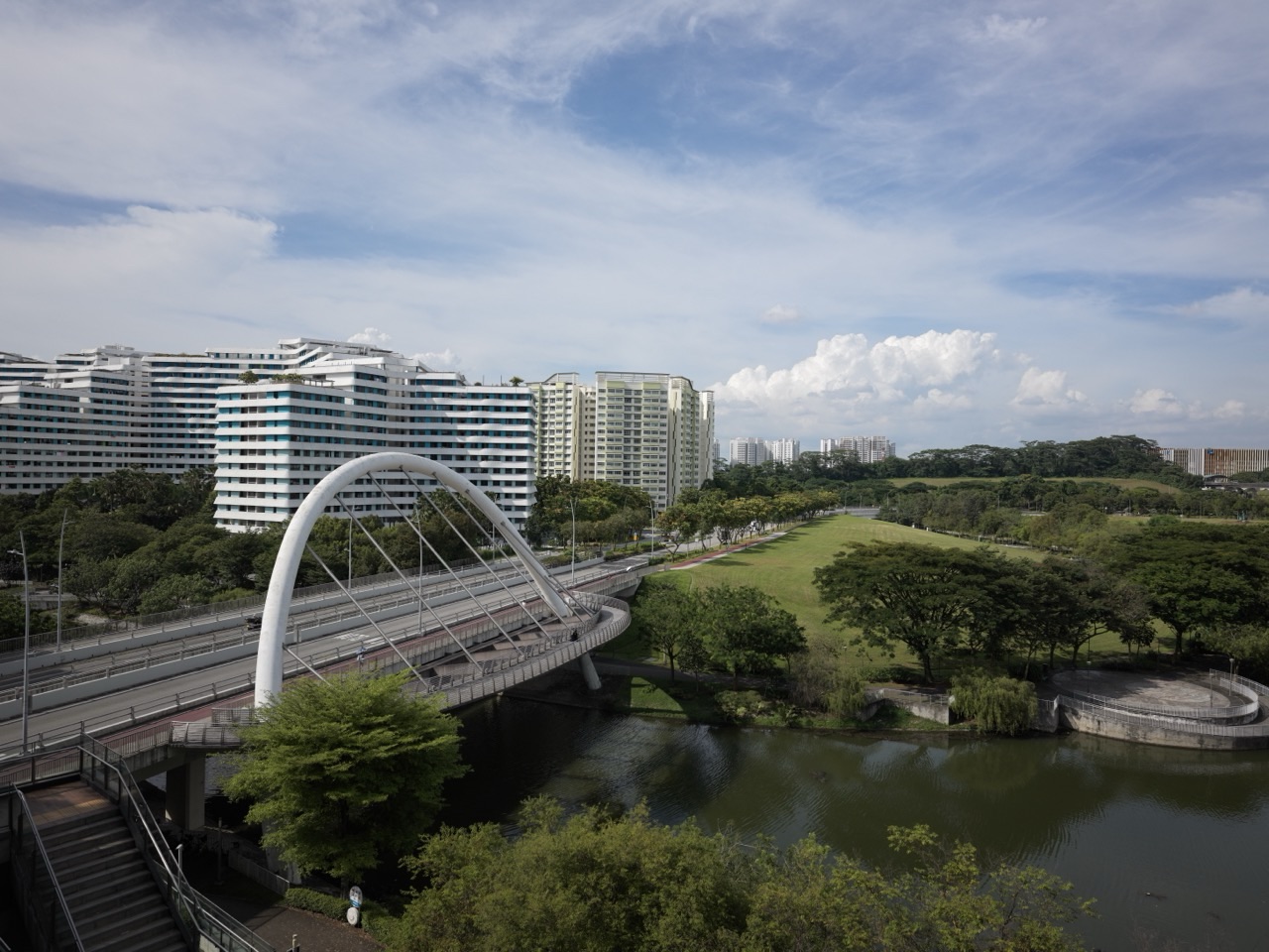
An image of Punggol’s waterfront flats may establish that particular buildings and landscaping were visible when the photograph was taken. It cannot by itself quantify affordability, resident happiness, construction emissions, disability access or property value. A beautiful scene is useful as illustrative context, but the visual is not a comprehensive dataset. Parents should discourage students from treating a caption as proof of everything the photograph cannot reveal.
Ask the learner to make two columns: observed features and claims requiring other sources. For example, ‘a bridge is visible’ belongs in the first; ‘all residents find the route convenient’ belongs in the second. This simple exercise improves evidential discipline across Geography, Science and media literacy.
A fictional town-planning comparison
Imagine two fictional housing layouts with the same number of homes. Plan A places a shared library at one edge of the estate, while Plan B places it centrally but reduces another open-space area. The question asks which layout improves access for specified hypothetical households. Students should identify the chosen criterion, read the schematic accurately and consider the trade-off rather than declare one plan universally superior.
This exercise is invented and is not an evaluation of any actual Punggol HDB development. A pupil may calculate simplified straight-line distances if a valid scale is given, but should acknowledge that a real route needs additional path data. The strongest answer explains what each layout makes easier and what it potentially sacrifices. That is applied geographical judgement.
Another fictional problem about housing supply
Imagine a classroom source stating that a hypothetical city has experienced population growth while the available housing units remained fixed for several years. A student might reasonably infer that demand pressure could increase, depending on household size and other conditions. The pupil should not announce a precise rise in rent without further information. The task is to understand the relationship between housing demand and availability, not to manufacture an economic forecast.
Ask what additional data would help: household formation, actual occupancy, prices and building completion. The student should distinguish a possible mechanism from an observed outcome. This is a responsible way to connect human Geography with quantitative thinking while staying within the information supplied.
Formal housing is not synonymous with luxury
Formal housing concerns recognised legal development and the provision of appropriate structures and services; it does not mean every resident is wealthy or every home is high-end. Students may see a modern high-rise and assume luxury because of its exterior, or see simple housing and assume informality. Both are weak inferences based on appearance alone.
Ask which evidence supports the classification: tenure, planning, services and legal framework. A suitable Geography response uses definitions rather than social stereotypes. Housing discussion should remain respectful of people with different incomes and living circumstances. The learner develops stronger civic understanding by examining constraints instead of judging residents from a photograph.
Sustainable housing involves trade-offs
Measures intended to reduce energy use, manage rainwater, improve mobility or preserve greenery can serve sustainability goals, but they may have costs or require ongoing maintenance. A student should not assume every innovation works equally well or has no environmental footprint. Sustainable urban design involves balancing social, economic and environmental objectives across time.
Ask what the specific measure is intended to accomplish and which evidence would show success. For example, sensor-controlled lighting may aim to reduce unnecessary electricity usage, while suitable maintenance is still required. A project can have meaningful benefits without being perfect. Good evaluation acknowledges both purpose and performance, avoiding unqualified claims of a complete solution.
Long-term change makes urban facts time-sensitive
Punggol’s neighbourhoods and regional amenities have developed over decades, and additional plans continue to be discussed. A statement that a particular facility is ‘upcoming’ can become outdated after opening, while a planned feature can be delayed. Students should record the source date and use appropriate current official information when writing factual reports or public-facing articles.
In a school essay, the question may intentionally refer to a historical planning stage. In that case, do not replace the supplied date with an assumption about the present. The ability to distinguish past, present and proposed conditions is central to geographical reasoning. It also helps avoid inaccurate local SEO articles that treat old renderings as live facts.
How to build a balanced evaluation paragraph
An effective Geography paragraph can state a claim, describe the relevant feature, explain its mechanism and assess one important limitation. For instance, locating shared amenities close to housing could reduce travel burdens for some residents if routes are usable and facilities meet their needs. The paragraph should not leap to a universal conclusion that every resident’s life improves by a fixed percentage.
Ask the child to identify which part comes directly from the source and which is inference. If the data are limited, qualify the claim. A concise, transparent explanation is stronger than a long paragraph filled with positive adjectives. The same approach can be applied to housing affordability, recreation access and environmental management.
A two-week study sequence for housing Geography
During the first days, define formal housing, informal housing, tenure, amenities and affordability. Next, practise reading land-use maps and describing locations. Then investigate factors that influence housing distribution and consider environmental effects. In the second week, evaluate safe housing, inclusive design and quality-of-life strategies using official Punggol examples alongside a fresh fictional comparison exercise.
This is optional home practice rather than the school’s compulsory schedule. The teacher may teach another part of the Geography syllabus first. If the student cannot distinguish an observed feature from an inferred benefit, spend more time on source interpretation before producing a long evaluation. Progress is visible when the child can assess an unfamiliar city plan independently.
Why the tutor should correct the first reasoning mistake
A student may correctly identify a housing location but confuse proximity with accessibility. Another may describe a green space and assume measured ecological success. A third may classify a dwelling from visual appearance rather than tenure or services. Those are distinct misconceptions. A useful tutor asks exactly what evidence the pupil has used and explains why the next claim does or does not follow.
After feedback, the learner should face a new city diagram, source or comparison. The teaching has worked when the child can state a justified claim without adult hints. Repeating the same Punggol brochure does not prove transfer. Accurate, independent geographical evaluation is more valuable than memorising a promotional paragraph about waterfront living.
Official sources and Your Next Step
MOE’s Lower Secondary Geography syllabus covers Housing and sustainable cities, including types, location factors, environmental impacts and safe housing. HDB’s Punggol town profile documents the waterfront and eco-town programme. URA’s inclusive-town planning material and Punggol Digital District planning page describe current policy intentions. These are more reliable starting points than undated sales material.
For transport mapping and wider geographical inquiry, read the separate PG2 Maps and Waterways article. This article is specifically about housing and liveability. Your next step is to choose two documented housing-design features or one teacher-provided fictional plan, identify whose needs each serves and write one balanced evaluation with an evidence-supported limitation.
Frequently asked questions about PG2 G2 Housing and Sustainable Cities
Does PG2 automatically determine a G2 Geography class?
No. PG2 is the admission grouping; confirm the student’s actual subject-level offer.
What is the lower-secondary Geography Housing topic about?
Housing types, location, basic needs, environmental impacts, affordability and sustainable planning.
Is formal housing the same as expensive housing?
No. Formal describes recognised legal development and services, not a resident’s wealth.
Why is affordability different from housing availability?
Housing units may exist without being affordable or suitable for all households.
Can Punggol waterfront scenery prove that residents are satisfied?
No. A photograph cannot measure resident satisfaction, affordability or equal access.
What is the difference between proximity and accessibility?
Proximity concerns spatial closeness; accessibility includes practical paths and barriers affecting different users.
What does HDB say about Punggol as an eco-town?
HDB identifies the 2010 eco-town selection and local housing technologies and environmental planning projects.
Are all features on an URA planning map completed?
No. Check the date, legend and whether an item is proposed, under development or completed.
Why are different resident needs important?
An older adult, a child and a person with mobility difficulties may experience the same design differently.
What makes a strong housing Geography answer?
A clear criterion, grounded evidence, causal explanation and a realistic limitation or trade-off.
Editorial note: Published 1 November 2026. Town planning facts are based on HDB, URA and MOE sources. Fictional neighbourhood comparisons are teaching illustrations, not surveys of Punggol residents. Plans and facility statuses can change; consult current official sources.


