
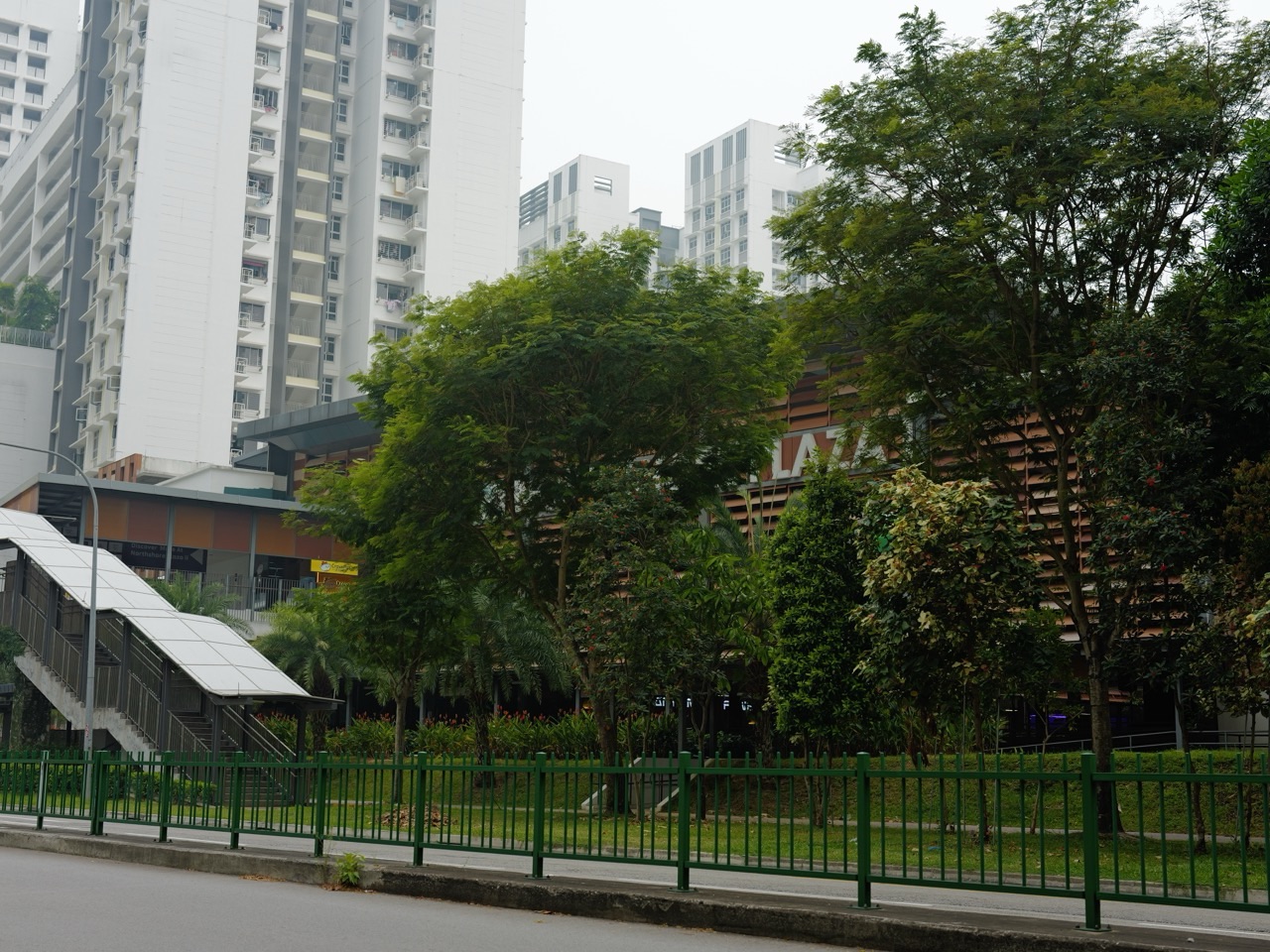
Why would a housing developer spend time studying how the wind flows between buildings before deciding exactly where those buildings should stand? Most residents notice the size of a flat, its floor plan and the distance to the nearest station. The spaces between blocks may seem secondary. Yet those spaces can shape how comfortable the estate feels every single day.
Punggol Northshore offers an especially useful example. HDB describes it as the first Punggol district to adopt its Biophilic Town Framework, beginning in 2015. In planning the estate, HDB used environmental simulations of wind and sunlight to influence block orientation, building heights, shade and public-space design. It also incorporated planting and habitats such as bird-friendly areas, butterfly gardens and dragonfly ponds.
Those decisions show why an estate is more than a collection of separate flats. A building affects the wind experienced by neighbours. A high wall of towers can create shadows and sheltered pockets, while the positioning of open spaces can influence movement and comfort. Greenery may provide ecological functions as well as visual appeal.
This article explains why Northshore’s buildings and landscapes were designed as one connected system. It focuses on the reasons for airflow, sunlight and biophilic planning, rather than repeating housing prices, a shopping-centre directory or another general list of green innovations in Punggol.
The answer in 50 seconds
HDB’s Punggol Northshore planning used environmental modelling to study wind flow, sunlight, shade and outdoor comfort. The arrangement of buildings—including different heights and orientation—was influenced by those studies. HDB says the waterfront position helped planners orient blocks to give more residents sea views, while vegetation and landforms were used to improve the outdoor environment.
The estate was also a test case for HDB’s Biophilic Town Framework, which considers soil, water, flora and fauna, outdoor comfort and people together. Biodiversity features and stormwater-management landscapes are part of that wider approach.
The main lesson is simple: the arrangement of buildings can change what happens outside them. A good housing design should consider the shared spaces between flats, not only the rooms inside each home.
Why the empty space between buildings is not really empty
Look at two neighbouring housing blocks. The land between them may contain paths, plants, seats, playgrounds or a courtyard. On a planning drawing, this appears as the gap between buildings. In real life, it is part of the place where residents spend time.
Air moves through it. Sunlight falls into it. Noise travels across it. Rainwater must go somewhere after reaching the surfaces. People use it to walk to the bus stop, meet neighbours and let children play.
If a planner considers each tower separately, the effect of the group may be missed. A block that works well in isolation can influence the daylight, wind and views experienced in another part of the estate. That does not mean any single arrangement is automatically correct; it means the relationships must be studied.
Northshore’s planning is a local example of considering the ensemble rather than treating the individual block as the entire design problem.
Why Singapore’s climate changes housing design
Singapore is hot and humid, with frequent rain and strong periods of sunlight. Outdoor comfort depends on several interacting factors, including air temperature, humidity, direct solar radiation, surface conditions and airflow.
A corridor receiving strong afternoon sun may feel different from a shaded route at the same reported air temperature. An open place may be exposed to sun even when it catches a breeze. A sheltered courtyard may avoid direct solar radiation while having less air movement.
There is no universal simple rule such as “more wind always means cooler” or “more shade always means comfortable.” The outcome depends on conditions and intended use.
For housing planners, the question is how to create usable outdoor spaces across many ordinary days. Northshore’s environmental simulations were intended to help make those design choices using evidence about the site rather than relying only on visual intuition.
What environmental simulation means
A simulation is a model used to estimate how a system may behave under specified assumptions. In estate planning, software may help evaluate wind movement, the amount of sunlight reaching surfaces, shadow patterns and related environmental conditions.
The model is not an exact recording of every future day. It uses inputs, assumptions and approximations. The usefulness of its results depends on the quality of those inputs and the decisions made from them.
HDB reports that environmental modelling influenced Punggol Northshore’s layout and the placement of greenery and amenities. Its Annual Report discusses smart initiatives and the use of modelling to improve outdoor comfort.
A student can think of simulation as a structured way of comparing possibilities before construction. Instead of building every possible arrangement, planners can model alternatives and then apply engineering judgement and other requirements.
This is not proof that the chosen layout produces identical comfort for every resident at every hour. Actual experience can be checked through observations and appropriate measurements after construction.
Why building orientation can influence wind
Imagine wind moving across an open area towards a row of buildings. The buildings can redirect the flow, create sheltered regions or accelerate it through particular gaps. Changing the orientation and spacing can change these patterns.
That does not mean a resident should expect a constant pleasant sea breeze at a particular block. Wind direction and speed vary with weather and time, and different floors or spaces experience different conditions.
HDB explicitly says its Northshore planning used simulations to maximise wind flow and improve thermal comfort. This is an established planning intention supported by HDB’s documentation.
For the family, the lesson is to distinguish a design strategy from a guaranteed personal experience. The buildings were planned with airflow in mind, but only real conditions at a specific time describe what a resident currently feels.
Why varying building heights can matter
When buildings have different heights, their shapes influence where wind moves and where shadows fall. A consistent wall of equal-height blocks can behave differently from a staggered skyline in a simulated wind environment.
HDB’s 2022 awards description says engineering studies influenced the staggered-height façades and block layouts at Waterfront I & II @ Northshore to optimise natural ventilation. This is a concrete example of using analysis to shape architecture.
The key is not that staggered heights are universally superior. They are one design tool whose effect depends on geometry and site conditions. The same arrangement may perform differently if the prevailing winds, nearby buildings or terrain change.
A student should avoid reducing the lesson to “uneven buildings are always cooler.” A stronger explanation is that varying building forms can be evaluated as part of a site-specific environmental strategy.
Why the sea view is only one design objective
Northshore faces the Straits of Johor. HDB says its blocks were oriented to allow more residents views towards the sea. That is a meaningful amenity in a waterfront district.
But maximising views is not the only planning goal. A block also needs structural stability, appropriate privacy, fire safety, circulation, service access and environmental performance. A good view alone does not justify ignoring other considerations.
There may be trade-offs. Orientation that improves views for some flats can affect sunlight or airflow in other areas. Buildings cannot all occupy the most desirable position simultaneously.
The important lesson is that urban design is a balancing exercise. HDB’s description of Northshore acknowledges the combination of waterfront experience, outdoor comfort and sustainability instead of presenting one goal as the whole design.
Why sun and wind should be studied together
It is tempting to ask whether wind or shade matters more. In practice, they interact. A route can be breezy and exposed. Another can be shaded and still. The combined experience depends on the weather and the activity.
HDB says it used shading analysis to locate social facilities in well-shaded areas and solar irradiation studies to identify suitable areas for solar panels and greenery. Those decisions illustrate that different uses require different environmental conditions.
A playground benefits from avoiding excessive direct sun during common periods of use, subject to its design. Solar panels need suitable solar exposure. The same sunlight can be a benefit for energy generation and a discomfort for some outdoor activities.
That is why planners do not simply try to maximise or minimise sunlight everywhere. They match conditions to the function of each space.
Why a child’s playground is a microclimate decision
A playground is not just a set of swings and climbing structures. The surface, planting, surrounding blocks and direction of sunlight can influence whether families find it comfortable to use.
HDB’s Northshore design reports describe locating outdoor amenities such as playgrounds in shaded positions based on modelling. The aim is to make public spaces more pleasant for residents, within the practical constraints of the development.
This does not mean any shade makes a playground safe during extreme heat or lightning. Parents must still respond to current conditions and supervise children appropriately. Nor does the description prove every play area in Northshore has identical exposure.
For a child, the lesson is that a playground’s location can matter as much as its equipment. A shaded space that is difficult to reach or poorly maintained still needs attention to other aspects of usability.
Why the ground level matters as much as the flat
Many residents spend most of their time indoors, but daily life requires a journey through the estate: leaving home, using a lift, crossing a courtyard and reaching transport or amenities.
The experience of that journey depends partly on the building arrangement, planting, shelter and pedestrian connections. A housing design that ignores these common areas can create friction even if the individual flat is well planned.
Northshore’s broader planning included connected paths, precinct spaces and nearby services. HDB’s early district material described a two-level community spine linking precincts and commercial uses.
These connections support the idea that public housing is a system of living spaces rather than only individual apartment units.
Why HDB calls the approach biophilic
The term *biophilia* refers to a human connection with the natural world. HDB’s Biophilic Town Framework organises its approach around five dimensions: soil, water, flora and fauna, outdoor comfort, and people.
That list is important because it shows that green design is not simply counting trees. Soil affects what can grow. Water affects drainage and habitat. Plants and animals respond to different conditions. Outdoor comfort influences how residents use the landscape. People determine whether the spaces serve everyday life.
The framework was first applied to the Punggol Northshore district in 2015 and later adapted to other HDB projects. It is therefore an example of a planning approach developed and tested at district scale.
It would be wrong to claim that an attractive green façade alone makes a building fully biophilic. The framework considers a broader set of relationships.
Why biodiversity needs a connected landscape
HDB says Northshore’s planning included field studies to understand existing fauna, followed by features such as bird sanctuaries, butterfly gardens and dragonfly ponds.
Why create several kinds of habitat instead of planting one uniform lawn? Different organisms need different resources. A butterfly may depend on particular flowering or host plants. A dragonfly’s lifecycle relates to aquatic environments. Birds use a variety of food and shelter resources.
One attractive pond does not guarantee a thriving dragonfly population, and a garden does not automatically bring every species into the estate. Habitat function depends on actual conditions, management and connectivity.
The planning intention is to weave biodiversity opportunities into the residential landscape. The scientifically responsible follow-up is to evaluate what species actually use the spaces rather than treating every intended benefit as a proven outcome.
Why dragonfly ponds belong near homes
A pond associated with dragonfly habitat may look like decoration to a passer-by. Ecologically, a suitable water-associated environment can support part of an insect’s lifecycle.
HDB identifies a dragonfly pond near Northshore Plaza as one of the biophilic features in the district. That example shows how an ordinary residential landscape can incorporate habitat concepts.
The distinction between an engineered habitat and a neglected puddle matters. Ponds need suitable design and management. Residents should not add animals, chemicals or plants on their own, and they should follow the responsible operator’s water-safety rules.
A child can learn that a habitat is defined by the living requirements it supports, not by the presence of a decorative sign.
Why butterfly gardens are more complex than colourful flowers
Butterflies may visit flowers for nectar, but many species also depend on particular plants during earlier stages of life. A garden designed for butterflies therefore has to consider more than visual colour.
HDB’s Northshore case study includes butterfly gardens in its wider landscape approach. Their intended value is biodiversity support and opportunities for residents to encounter nature.
However, the exact species present cannot be predicted from a general development description. There may be seasonal variation, habitat changes and other ecological factors.
The educational principle is to look for relationships between plants and insects rather than collecting or disturbing them. A responsible nature observation uses public paths and documents uncertainty.
Why water management appears in housing design
Buildings and paved areas influence how rainwater moves. HDB’s biophilic Northshore design includes rain gardens and bioswales intended to help slow and cleanse stormwater runoff.
A rain garden is not an ornamental planting area chosen solely for appearance. The engineering of suitable media, water entry and discharge matters. A bioswale can play a role in conveying and treating runoff depending on its design.
This water-management role connects with the wider urban environment. A household may never notice a stormwater feature on a dry day, yet its function becomes relevant when rain falls across the estate.
As with all drainage infrastructure, the features have limitations and require maintenance. They do not guarantee that every extreme rainfall event will cause no difficulty.
Why shade and stormwater can share a landscape
A planted area may help with shade or habitat while also being designed to receive some runoff. That can make a landscape multifunctional.
Yet not every tree bed is a detention basin, and not every rain garden provides useful shade. The functions depend on the actual engineering and planting. A responsible reader should avoid inferring technical systems from their appearance alone.
HDB’s Northshore approach is interesting because it deliberately considers multiple environmental dimensions together. A planting scheme may contribute to comfort and ecology while stormwater infrastructure performs another function nearby.
The aim is not to give every feature every imaginable job. It is to coordinate compatible roles so the overall estate works well.
Why underground parking can make room above ground
HDB’s original Northshore planning material described basement car parks as a way to free more surface land for greenery and common spaces. That is a land-use choice.
Parking facilities consume space and require ramps, circulation and services. Placing some parking below ground can change how much ground-level area is available for paths, planting and public amenities.
However, underground construction has costs, engineering challenges and its own environmental impacts. It would be misleading to describe it as a universally better solution for all housing projects.
The Northshore case helps students see that making room for greenery can involve decisions about infrastructure that is not visible from the street.
Why a neighbourhood needs more than a nice view
Waterfront views can be desirable, but residents still need ordinary facilities: shops, paths, community areas, transport connections and places to rest.
HDB’s early Northshore description included a connected community spine and a seafront commercial centre. Northshore Plaza subsequently became part of the area’s local amenities.
The purpose is to combine the waterfront setting with daily convenience. A family cannot live on sea views alone, and a resident who rarely looks towards the water may still benefit from well-connected ground-level spaces.
This is an important way to evaluate planning. The district should be judged by how it supports repeated everyday activities, not only by how attractive it looks in publicity images.
Why ‘smart’ and ‘green’ are different but related
HDB describes Punggol Northshore as an early smart and sustainable district. The smart aspects include technologies such as motion-sensing lighting and estate-management innovations. The biophilic aspects include environmental modelling, habitat features and nature-integrated design.
These are not identical concepts. A sensor that adjusts lighting may reduce unnecessary energy use under suitable operation. A planted habitat supports a different environmental purpose. Both can contribute to a better estate, but each requires its own evidence and maintenance.
A common marketing mistake is to call every new gadget a sustainability achievement without showing what it improves. Another is to call every green area “smart” even when it has no technological function.
Students should ask two questions: what problem is being solved, and how would we know whether the solution works?
Why smart common-area lighting can be useful
HDB’s Annual Report explains that common-area lighting in Northshore can use motion sensing and analytics to adjust illumination according to human traffic patterns. The idea is to avoid unnecessary energy use while maintaining appropriate lighting.
This sounds simple, but good design must account for safety, reliability and the needs of users. A light should not become dangerously dim simply because a sensor fails to detect someone. The actual system must have suitable operational safeguards.
It is not appropriate to invent a measured energy-saving percentage for a particular block without verified performance data. The defensible explanation is the mechanism: adjust lighting to real use rather than keep every area at the same output regardless of conditions.
For a child, this introduces the idea of a feedback loop—sensing a condition and adjusting a response within controlled limits.
Why sea-facing design does not make the estate climate-proof
A coastal location offers views and potentially distinctive airflow. It also means the town must consider long-term environmental realities, including heat, severe weather and coastal changes.
HDB’s biophilic planning helps address particular aspects of daily comfort and landscape resilience. It should not be presented as a guarantee against all climate risks, flooding or future sea-level changes.
Coastal protection at national or district scale is a separate planning and engineering responsibility. Individual housing features cannot substitute for that wider work.
The educational point is to distinguish day-to-day microclimate design from long-term climate adaptation. They are related but require different evidence, scales and interventions.
Why the framework includes people
The fifth element of HDB’s Biophilic Town Framework is people. That may appear obvious, but it prevents the landscape from becoming a purely technical demonstration.
A well-placed plant bed is useful only if it is appropriate for the space. A shaded seat is more meaningful when a resident can reach it. A habitat should be protected from unnecessary disturbance while allowing people appropriate ways to observe it.
Residents also have different preferences. A young child, working parent, older resident and person using a mobility aid may experience the same space differently.
A people-centred approach asks how the environment supports real activities while respecting safety, accessibility and ecological needs. A photograph of dense planting cannot answer those questions on its own.
Why modelled comfort must eventually meet real experience
Before construction, a simulation helps compare possible layouts. After construction, the actual environment exists, and people can experience its strengths and limitations.
The ideal evaluation would compare relevant observations with design expectations, while recognising changes in weather, surrounding developments and occupancy. One resident’s hot afternoon is not enough to prove an entire modelling approach was wrong, but repeated specific feedback can reveal problems worth investigating.
HDB’s account establishes why the Northshore layout was chosen. It does not mean a blog can certify exact temperatures or wind speeds at every courtyard.
For residents, this suggests constructive feedback: describe the precise place, time, type of discomfort and affected users. Such information can be more useful than a general claim that an estate is either perfectly designed or poorly designed.
Why a small change can affect several things
Imagine moving a hypothetical residential block a short distance. It might change the shadow across a playground, alter a walking route, affect views and influence wind movement. These outcomes could be beneficial or harmful depending on the wider plan.
Now imagine adding tall trees. They may improve shade over time and contribute ecological value, but placement must consider growth, visibility, maintenance and nearby infrastructure.
This is why master planning requires coordination between architecture, landscape design, engineering and estate management. Individual decisions have consequences beyond their immediate location.
Northshore’s use of environmental studies is a practical expression of that complexity.
Three scenarios for Punggol families
Scenario one: choosing a walking route at midday
A family compares two routes from home to a nearby amenity. One is shorter but more exposed; the other is shaded by buildings and planting. They consider the child’s needs, current weather, crossing safety and the total route.
They do not assume the shaded route is completely safe in high heat or thunderstorms. They check actual conditions and may choose to delay the trip.
The lesson is that the building layout affects real choices in the open spaces between flats.
Scenario two: a child sees a dragonfly pond
A child notices a water feature near a residential area and asks why it exists. The adult explains that HDB’s Northshore plan includes habitat features, including dragonfly ponds, as part of a biophilic approach.
They observe from a designated public space and do not approach the water unsafely or try to catch insects. The child records what was actually visible, such as water, plants or insects, without claiming a whole population has been measured.
The lesson is to connect landscape design with habitat needs and careful evidence.
Scenario three: comparing two block layouts
A student draws a fictional row of equal-height towers and another arrangement with different heights and gaps. They hypothesise that wind and shadows may behave differently.
The teacher explains that the drawing is not a reliable simulation. To predict actual effects, one would need site geometry, weather data and an appropriate model. The student can still identify which questions an environmental simulation might answer.
The lesson is that visual intuition begins an engineering investigation but does not finish it.
A simple mathematical model of environmental planning
Give a Secondary 1 student a fictional table with three courtyard designs. Each has a hypothetical shaded area, pathway length and available community space. Ask the learner to compare the designs.
The student might calculate that Design A has 400 square metres of shaded area while Design B has 500. But those numbers alone do not tell us which design is best. Shade quality, time of day, accessibility and the intended use of the space matter.
Add a second constraint: all designs must preserve a safe emergency-access route. A design that cannot meet that constraint is not acceptable even if it appears to offer the most shade.
This demonstrates how real engineering works. Mathematics helps evaluate options, but requirements and evidence define what counts as a valid solution.
Why HDB’s early planning documents must be read carefully
HDB’s early Northshore promotional material contains master-plan intentions and artist impressions. These are useful evidence about what planners intended at the time.
But a design concept is not a guarantee that every illustrated detail was built exactly as shown. Construction, approvals and changes can alter outcomes. The current estate should be described using current site evidence rather than treating an artist’s impression as a photograph.
HDB’s later reporting and award descriptions confirm particular realised initiatives such as environmental modelling and Northshore’s smart estate features. Reading both early intentions and later accounts gives a more reliable picture.
This is a useful media-literacy lesson for anyone following development in Punggol.
What students should learn about evidence
A statement such as “HDB used wind modelling at Northshore” is supported by HDB’s published planning accounts. A statement such as “this exact courtyard is always two degrees cooler than another one” would require local measurements.
A statement that Northshore includes planned butterfly and dragonfly habitats is also supported by HDB’s description. A statement that every target species is thriving would need biodiversity monitoring evidence.
This distinction is the core of scientific reasoning. The existence of an intervention is not proof of every outcome attributed to it.
Students should develop the habit of asking whether a source documents a plan, an installed feature, a measurement or an independent evaluation. Each supports different claims.
Why maintenance affects the environmental vision
Trees grow and require care. Water features need appropriate management. Sensors can fail. Paths and public spaces are exposed to weather and heavy use.
An estate’s initial design cannot replace ongoing maintenance. The long-term living environment depends on the responsible managers keeping the systems functioning and responding to legitimate issues.
Residents have a role in using shared spaces responsibly and reporting faults through the appropriate channels. They should not alter landscaping, drainage features or smart systems themselves.
The lesson is that sustainability is not an event completed at the opening ceremony. It is a continuing relationship between design, operation and community behaviour.
Why density and greenery need not be opposites
High-density housing concentrates many people on limited land. This creates genuine challenges around space, comfort and shared facilities. It also creates an opportunity to coordinate landscaping, infrastructure and amenities at district scale.
HDB’s Northshore example shows one approach to integrating greenery and habitat features within a residential setting. That does not prove density is harmless or that every high-rise estate can achieve identical outcomes.
The more useful conclusion is that density requires careful design. The arrangement of buildings and common spaces can help determine whether residents experience the neighbourhood as connected, comfortable and liveable.
A child can learn that urban planning is not a choice between “many homes” and “nature everywhere” with no middle ground. Thoughtful trade-offs can support more than one objective.
Why Northshore is useful beyond Punggol
HDB states that its Biophilic Town Framework began in Punggol Northshore and was refined for subsequent developments. That makes the district a useful historical case of a planning method being tested and extended.
A method can be adapted to other sites while recognising that the same design cannot simply be copied. Different districts have different wind conditions, terrain, layouts and ecological contexts.
The transferable lesson is the process: understand the environment, model possibilities, design for people and nature, and evaluate real outcomes.
That principle is useful to students even if they never work in architecture. It shows how evidence can improve decisions before they become permanent features of the built environment.
Common misunderstandings
Do not say that Northshore was designed only to provide sea views. Views are one objective among many. Do not say that staggered towers guarantee continuous breezes. Wind patterns vary.
Do not assume that every planted area is a rain garden. Do not call every sensor a sustainability solution without examining its function. Do not say that the existence of biodiversity features proves all intended species are present.
Do not mistake early artist impressions for exact built conditions. Do not attribute specific measured temperature reductions to Northshore without verified data.
Finally, do not confuse biophilic landscape design with climate-proofing the entire coast. Local comfort and long-term coastal adaptation are different responsibilities.
Frequently asked questions
What is Punggol Northshore?
It is a seafront housing district in Punggol that HDB describes as an early smart and sustainable district and the first application of its Biophilic Town Framework.
When did HDB begin the biophilic approach there?
HDB says the framework was first applied to Punggol Northshore in 2015.
Why were block heights and orientation studied?
To help optimise wind flow, sunlight, outdoor comfort and the waterfront living environment within the wider development requirements.
Does the layout guarantee a breeze every day?
No. Weather and the specific position affect actual conditions. The HDB documentation establishes design intent and methods, not a universal guarantee.
Why are some community facilities shaded?
HDB says it used shading analysis to locate outdoor amenities in more comfortable positions, including playgrounds.
What does biophilic mean?
It refers to connecting people with nature. HDB’s framework includes soil, water, flora and fauna, outdoor comfort and people.
What biodiversity features are there?
HDB identifies bird-friendly habitats, butterfly gardens and dragonfly ponds within its Northshore landscape approach.
Do the planted areas also manage rain?
HDB describes rain gardens and bioswales that contribute to stormwater management, depending on their actual design.
Are smart systems the same as green systems?
No. Smart sensors and environmental landscapes have different functions, though both may support estate performance.
Can other towns copy Northshore exactly?
The planning principles can inform other projects, but different sites need their own analysis of climate, geography and residents’ needs.
A Northshore environment checklist
- Distinguish what HDB planned from what has actually been built.
- Notice how buildings create shade, gaps and walking routes.
- Avoid assuming the wind feels the same at every hour or floor.
- Check actual conditions before choosing outdoor activities.
- Treat ponds and planting as managed habitats, not unrestricted play areas.
- Distinguish biodiversity design from evidence of actual species abundance.
- Respect maintenance and access boundaries.
- Ask how the surrounding routes connect homes to daily amenities.
- Use HDB’s authoritative explanations for claims about engineering decisions.
- Describe specific observed issues rather than guessing at model failures.
Teaching Guide: plan a town around people and nature
Learning goal. Students should explain why a housing estate’s buildings, greenery, paths and water-management features must be planned together, not independently.
Activity one: design the blocks. Draw four towers around a courtyard. Add a path, playground and open space. Ask what changes if a tower is moved or rotated. The child should identify possible effects on shade, views and movement, without pretending to calculate them exactly.
Activity two: introduce wind. Draw arrows showing a hypothetical prevailing breeze. Ask how gaps between buildings might affect its path. Explain that real predictions require environmental modelling.
Activity three: introduce sun. Draw afternoon sunlight from one direction. Ask where the playground might receive less direct exposure. Explain that actual shadows depend on time, season and building dimensions.
Activity four: introduce biodiversity. Add a bird-friendly tree area, suitable butterfly planting and a managed pond. Ask why different organisms need different resources rather than a uniform lawn.
Activity five: introduce runoff. Draw rain falling on roofs and pavements. Ask what a suitable rain garden might contribute and why it would still need engineered outlets and maintenance.
Activity six: introduce people. Give the learner three residents: a child, an older adult and a person using a mobility aid. Ask whether the planned paths and rest spaces work for each.
Transfer test. Present another imaginary housing estate without a seafront. Ask which Northshore planning principles still apply and which must be adapted to a different site.
Parent checkpoint. A good explanation is: “The buildings affect the wind and shade around them, so HDB studied the layout and planted landscape together. A good estate works for people, water and wildlife, not just for individual flats.”
How this differs from existing eduKatePunggol articles
The Northshore biophilic planning history explains when the framework was introduced and its historical significance. The Tropical Design and Outdoor Comfort article covers broader tropical-design ideas. The Why Punggol guide to shaded walking routes focuses on choosing an individual walking journey.
This article owns a different question: why did planners arrange Northshore’s buildings and spaces using wind, sunlight and biodiversity studies in the first place? It explains the district-scale design decision rather than repeating an address guide or a generic sustainability list.
Official sources and further reading
- HDB: Biophilic Towns, including Punggol Northshore
- HDB: 2022 Awards and the Northshore environmental modelling
- HDB: Annual Report 2020/2021, Smart Initiatives in Northshore
- HDB: Punggol Northshore virtual experience
- eduKatePunggol: Northshore biophilic planning history
- eduKatePunggol: Why shade changes the best walking route
The one idea to remember
Northshore’s most interesting design feature may not be a single building or garden. It is the decision to plan buildings, wind, sunlight, water, plants and people as a connected system. The shape of the estate affects daily life between the flats, and thoughtful planning begins long before the first resident moves in.


