
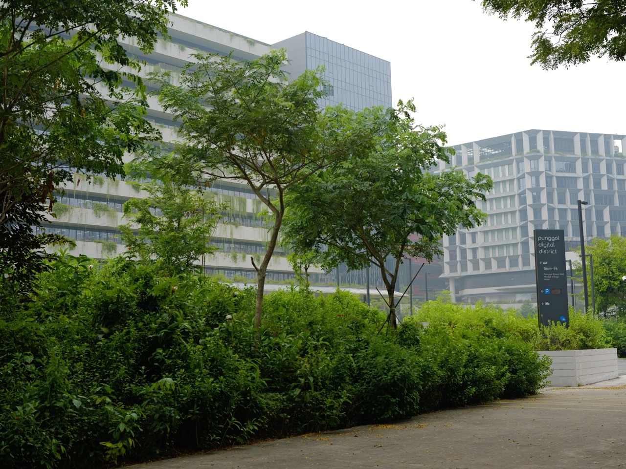
The top 10 things to do in Punggol for Architecture students are to study programme stacking at One Punggol, compare Oasis Terraces’ public functions with its form, analyse Northshore Plaza’s community spine, explore passive shading at Punggol Digital District, research the conservation of Matilda House, sketch Waterway Park bridge forms, design an inclusive transport-to-library route, practise scale plans and sections, study the opened Punggol Heritage Trail and build a three-drawing architecture portfolio with an explicit revision.
Best first design exercise: use the People’s Association’s verified description of One Punggol to draw a simplified building section showing the relationship between library, hawker centre and public circulation. Label what the official source states and what your sketch imagines. For outdoor form observation, use a safe public Punggol Waterway Park viewpoint. A student diagram is not a surveyed construction drawing or permission to enter a technical building space.
This October 2026 guide is deliberately different from a sightseeing list for architecture lovers or an urban-planning essay. Its reader job is developing architectural representation and decision-making: plans, elevations, sections, massing, environmental response, conservation constraints, accessibility and evidence of design improvements. All hypothetical dimensions are clearly identified; building facts and current access come from the responsible authorities.
Choose an architectural learning problem
- Beginner sketching: represent one public building’s visible form without inventing measurements.
- Spatial planning: draw functions, circulation and adjacencies in a real documented hub.
- Environmental design: compare shading, daylight and air movement through a safe small model.
- Heritage: learn which changes to a conserved building require authority oversight.
- Inclusive design: study the entire journey to a public facility, not just the presence of a lift.
- Technical representation: practise scale plans and sections with consistent units.
- Portfolio: show a proposal, feedback and one improvement with verified site assumptions.
An architect learns to distinguish four kinds of drawing
A plan shows horizontal relationships and possible movement at a defined level. A section cuts through a building to show vertical relationships, light, enclosure and circulation in height. An elevation records an exterior or interior face. A perspective suggests how a place might be experienced from a viewpoint. Students often use a perspective when a plan would answer the design question more efficiently, or copy an attractive facade without understanding how its entrances function.
Before drawing, ask what the intended reader needs to learn. If the problem is finding a library from a station, a route or plan is useful. If the problem is daylight entering a room through an overhang, a section and orientation study are needed. If the problem is a conservation feature on Matilda House, a sourced elevation and URA’s actual constraints are relevant. The representation is a tool for reasoning, not decoration.
A further distinction protects local accuracy: official building descriptions, observed public features, student conceptual drawings and approved construction plans are not interchangeable. A scaled model can correctly calculate an invented courtyard area while telling us nothing quantitative about the real plaza. An energy-efficient design intention can be documented without allowing a student to claim measured electricity savings. Honest labelling is part of architectural competence.
Ten architecture learning experiences in Punggol
Draw a programme-stacking diagram of One Punggol
Where: One Punggol at 1 Punggol Drive; study publicly open spaces and PA’s facility description.
Architectural question
One Punggol combines a community club, regional library, hawker centre, government-service contact point and other community services. The People’s Association identifies Punggol Regional Library between Levels 1 and 5 and the hawker centre at Level 2. For architecture students this is a case of stacking different activities within one building while coordinating circulation, wayfinding and shared areas. It is distinct from asking whether people enjoy the hub: an architectural diagram asks how functions are arranged and connected.
Drawing or model method
Read PA’s current building information and select three publicly identified programmes. Sketch a simplified vertical section with generic rectangular levels and label each verified function. Separate the official stated location from any areas you could not inspect. Add arrows for an imagined visitor’s movement from public entrance to library to dining, then identify where lifts and circulation information would need to be confirmed. The drawing should be labelled educational and not presented as a measured construction section or approved floorplan.
Original worked example
An invented four-floor schematic places a public foyer at the bottom, a dining level above and learning spaces on other floors. A pupil initially labels every level a private library because the library spans Levels 1–5 in PA’s description. The corrected diagram distinguishes the overall vertical extent from the presence of other co-located services, notes the need to consult the actual public directory, and avoids assuming exclusive floor occupation. Architectural accuracy starts by resisting an over-literal diagram.
What to test next
Ask whether a single vertical circulation core would serve everyone equally well. Consider visitors with prams, wheelchairs, deliveries, staff and children. Create two alternative conceptual layouts showing separate noisy and quiet zones, then test how each affects the route between library and hawker centre. Use BCA’s inclusive design principles for questions, not to declare compliance from a sketch.
Evidence, access and safety
The hub contains childcare, health and other sensitive facilities with their own access controls. Do not enter them as a tourist, photograph service users or place measuring devices in crowded corridors. The building’s directory is not public permission to survey technical or private spaces.
Official reference: Draw a programme-stacking diagram of One Punggol. Confirm public access and the current source before any site visit.
Compare the architecture of Oasis Terraces with its public functions
Where: Oasis Terraces at Punggol Drive near Oasis LRT, using HDB’s official centre information.
Architectural question
HDB identifies Oasis Terraces as the first new-generation Neighbourhood Centre, introduced in 2019, with public plazas, play areas and integrated healthcare and childcare functions. It provides a distinct architectural challenge from a town-centre mall: a neighbourhood centre must support daily errands while making space for informal public life. A student should understand the relationship between building form and planned use rather than awarding points for how photogenic a terrace looks.
Drawing or model method
Use HDB’s page to identify the centre’s verified facilities and intended community spaces. From a safe publicly open position, make a rough massing sketch showing stepped or open parts you can actually see. Do not estimate structural dimensions by eye and call them facts. In your notebook label shade, public circulation, entrances and possible gathering areas as observations or questions. Then build a cardboard model with your own chosen dimensions to test whether a central plaza is easy to find from two hypothetical approach paths.
Original worked example
A learner sketches a centre that shows a courtyard but no route to it. A peer cannot explain how a person arriving from LRT would reach the imagined public space. The student adds a legible entrance and circulation path, then rechecks the diagram. The improved model communicates access, rather than claiming the real Oasis Terraces has the exact pathway shown. A good design drawing must distinguish actual building study from the student’s proposed layout.
What to test next
Compare two alternatives for a shared community plaza: one directly visible from an entrance, the other hidden behind retail units. Ask how visibility might affect wayfinding and use, while acknowledging that actual visitor behaviour needs more evidence. Consider trade-offs among retail frontage, public shelter, daylight and accessibility. The task is design reasoning, not a commercial ranking.
Evidence, access and safety
HDB’s description of a water play or community area does not guarantee it is open on a particular visit. Clinics, childcare spaces and back-of-house facilities are not open architecture studios. Follow management rules and avoid blocking residents or patients.
Official reference: Compare the architecture of Oasis Terraces with its public functions. Confirm public access and the current source before any site visit.
Analyse Northshore Plaza’s community spine as a building-to-city connection
Where: Northshore Plaza I and II near Samudera LRT and Punggol Promenade.
Architectural question
HDB describes Northshore Plaza as the first seafront New Generation Neighbourhood Centre in an HDB estate, with a community spine linking the two retail parts, residential blocks, Samudera LRT and the promenade. It notes a naturally ventilated corridor toward the waterfront. This is an excellent study of an architectural threshold between indoor retail and a larger public network. The design concept is more specific than simply calling the building ‘green’.
Drawing or model method
Start with HDB’s publicly available descriptions and location information. On a small schematic plan, label transit approach, retail frontage, residential interface, community-spine connection and waterfront direction. Take observations only from public routes that are genuinely open. Note which links are visible and which remain inferred from the official page. Design a hypothetical shaded passage with a clear width and entrance sequence, using fictional dimensions for all model calculations.
Original worked example
A student draws an attractive waterfront route but makes the corridor a dead end. When a hypothetical user wants to travel from Samudera LRT to the promenade, the drawing fails. The learner redraws it as a connected spine with entry and exit. The exercise reflects HDB’s described circulation concept without asserting the real site has the student’s imagined dimensions or exact walking time.
What to test next
Make two section sketches: one for an enclosed air-conditioned corridor and another for a naturally ventilated path. Discuss possible differences in enclosure, airflow, rainfall protection and acoustic character. Actual comfort depends on many environmental variables; a paper section alone cannot quantify energy consumption. Identify where post-occupancy measurement would be necessary.
Evidence, access and safety
The public community spine does not make neighbouring flats or childcare areas freely accessible. Retail opening hours and maintenance diversions can change, so current management and site signs override a drawing.
Official reference: Analyse Northshore Plaza’s community spine as a building-to-city connection. Confirm public access and the current source before any site visit.
Study shaded facade design at Punggol Digital District
Where: Public Punggol Digital District streets reached from Punggol Coast MRT, and JTC sustainability information.
Architectural question
JTC documents passive design features shaped through simulations to improve natural light, reduce solar heat and support airflow. An architecture student can examine facade orientation, overhangs and the contrast between public and private zones without claiming a particular energy saving from a photograph. The district’s smart grid is an operational infrastructure concept that cannot be inferred from facade appearance alone. Architecture integrates physical form, environmental performance and the evidence needed to evaluate it.
Drawing or model method
Read JTC’s sustainability page and choose one publicly observable facade or shaded walkway. Make an original line sketch from an authorised viewpoint, recording the time and whether it was cloudy. Draw a second abstract elevation highlighting openings and shading devices. At home, use a small cardboard facade and a safe cool light to test two awning depths while keeping light angle stable. Record the geometric difference and label the experiment as a model rather than a measurement of the actual district.
Original worked example
A hypothetical facade has a one-metre-deep overhang and a two-metre-tall window in a diagram. A learner confidently asserts that the overhang cuts real Punggol Digital District cooling energy use by twenty per cent. The diagram supplies no such evidence. They revise the conclusion to describe how the overhang may cast shade under specified sun angles, and list the environmental modelling or metered data needed for an actual performance claim.
What to test next
Consider trade-offs: a deeper awning can increase shade yet reduce daylight or views at some times. Plan and section studies can show the design geometry; calibrated simulation and later performance data are needed to estimate actual effects. Add sun-path and wind considerations at a conceptual level, making clear when precise orientation or wind data remain unknown.
Evidence, access and safety
Do not enter private offices, SIT teaching areas, rooftops, electrical rooms or construction zones. Solar and battery systems are not public attractions or beginner test equipment. JTC’s published energy figures are expected or documented values with a specific status, not a visitor’s live reading.
Official reference: Study shaded facade design at Punggol Digital District. Confirm public access and the current source before any site visit.
Learn conservation constraints through Matilda House’s historical architecture
Where: Matilda House, 78 Punggol Walk, studied from URA’s official conservation entry and legal public viewpoints only.
Architectural question
URA identifies Matilda House as the only remaining historical bungalow in Punggol, built in 1902 and gazetted for conservation on 21 February 2000. It documents its original association with Alexander Cashin and the role of specific restoration guidelines. This gives architecture students a case in which a building’s inherited character and legal conservation constraints affect what changes can be made. Studying an old facade is not permission to enter private property or propose unrestricted alteration.
Drawing or model method
Read the current URA conservation record and distinguish what is documented about construction, ownership and conserved status. Draw a simplified front elevation from official imagery or a lawful exterior viewpoint, identifying broad elements such as roof, windows and entrance without inventing exact measured dimensions. Create a paper hypothetical brief asking how a new use could be accommodated while conserving original heritage features. Label it an educational proposal, not an application or professional conservation plan.
Original worked example
A student imagines replacing the entire front elevation with a glass wall because it would create more natural light. The URA record identifies conservation guidelines and specific restoration obligations for elements such as residential fronts. The student changes the brief: any proposed intervention must start from authorised conservation requirements, and alternatives require qualified design review and permissions. The valuable lesson is recognizing a legal and historical design constraint.
What to test next
Compare conservation with reconstruction and adaptive reuse. Ask which parts of a building’s cultural meaning come from authentic fabric, context, setting and public interpretation. Do not assume a modern-looking addition is always forbidden or always permitted; the answer depends on the actual URA guidelines and approvals for the site.
Evidence, access and safety
Do not enter, trespass, claim interior tours or stage a student event at Matilda House. Conservation permission is required for relevant alteration work, and architectural proposals need the appropriate qualified professionals and authorities. Avoid unverified ghost stories in a design history report.
Official reference: Learn conservation constraints through Matilda House’s historical architecture. Confirm public access and the current source before any site visit.
Sketch a bridge form and learn the difference between silhouette and structure
Where: NParks Punggol Waterway Park bridges, especially Jewel and Kelong Bridge.
Architectural question
NParks describes Jewel Bridge’s dome-like structure and Kelong Bridge’s resemblance to an offshore fishing platform. These provide visible formal references for architectural sketches and relationships to place identity. A student’s drawing, however, cannot demonstrate actual foundation design, loading capacity or material specification. Visual language and structural engineering overlap but require different evidence. The architecture exercise should communicate form and user experience without pretending to certify bridge safety.
Drawing or model method
Use NParks’ official description and, if conditions permit, an unobstructive public viewpoint. Draw a line elevation and a rough perspective of one bridge, noting where the shape changes with the viewer’s position. Later use clean paper to build a small non-load-bearing model that explores repeating ribs or an arched silhouette. Record which features were directly visible and which were simplified for model construction. A title should cite the correct bridge rather than guessing from a photograph.
Original worked example
A learner draws a curved Jewel Bridge-inspired arch and labels it a mathematically perfect circle. The visible shape might not support that claim, and perspective further changes the apparent geometry. They relabel it as a curved dome-like silhouette inspired by the bridge and avoid assigning exact radius or material data. The model communicates the form without converting impression into a precise survey result.
What to test next
Make a conceptual section through the model showing where an imagined pedestrian route passes through or beside the structure. Explore how a railing, shade or canopy may affect experience. Then identify structural and accessibility matters a qualified professional would need to assess before a real design. This keeps architectural form-making distinct from casual bridge-engineering assertions.
Evidence, access and safety
Do not attach materials, weights or measurement devices to public bridge structures. Avoid blocking cycle paths, climbing rails or entering water. Use lawfully obtained or original photographs rather than reprinting copyrighted materials without permission.
Official reference: Sketch a bridge form and learn the difference between silhouette and structure. Confirm public access and the current source before any site visit.
Design an inclusive route from Punggol MRT to the regional library
Where: Official public routes from Punggol MRT to One Punggol and BCA’s Universal Design principles.
Architectural question
A destination can have lifts yet still confuse a visitor arriving from public transport. Architecture students should consider the full route: entrance recognition, weather shelter, crossings, level changes, circulation space and destination signage. BCA’s Universal Design guidance includes equitable use, simple and intuitive design, perceptible information and suitable approach space. These principles offer a useful design lens, but an amateur route sketch cannot certify compliance with the 2025 Code on Accessibility.
Drawing or model method
Use the current public transport information and PA’s directory to identify an actual public starting and ending point. Draw a route storyboard with three main decision nodes, each showing the information a newcomer needs. Label lift or step-free details only when verifiable from the managing authority or actual lawful observation. Design a hypothetical alternate sign for a point of confusion, using clear text and an icon. Test the map with a consenting family member who has not seen it before.
Original worked example
The first map says ‘turn left at the sign’ without naming which sign or defining the direction from the traveller’s viewpoint. A tester approaching from a different entrance cannot follow it. The student changes the instruction to include a verified destination name and a visible landmark, then indicates where the user should check current lift status. The result is more useful because it addresses a specific user decision.
What to test next
Compare the route for a person carrying a stroller and for someone with limited stamina. Do not simulate impairment by forcing another person to use equipment. Ask about resting points, clearer wayfinding and manageable distances. A useful architecture brief includes uncertainty and a proposal, not a false legal compliance score.
Evidence, access and safety
BCA’s Code on Accessibility 2025 applies according to project type and effective date; compliance is a professional regulatory matter. Do not block walkways, install unofficial signs, film commuters or publish identifiable accessibility needs without consent.
Official reference: Design an inclusive route from Punggol MRT to the regional library. Confirm public access and the current source before any site visit.
Make a scale drawing without presenting invented Punggol dimensions as fact
Where: Home, school design studio or authorised library workspace.
Architectural question
Architectural drawings use scale to explain relationships, but early learners often apply a length factor directly to area or confuse a sketch with a survey. A Punggol-inspired plaza or sheltered corridor can be used as a clearly hypothetical practice site. An accurately labelled invented plan is useful; a precise-looking invented measured drawing of One Punggol would mislead readers about the actual building. The underlying Mathematics should be checked before additional presentation polish.
Drawing or model method
Select a straightforward hypothetical rectangular courtyard and choose a drawing scale such as 1:200, meaning one unit on paper represents 200 of the same units in the modelled space. Draw its boundary, add two access points and a tree or seating zone. Label the proposed dimensions fictional and calculate the represented area using consistent units. Include a north arrow only if its direction is deliberately defined rather than guessed from a photograph.
Original worked example
An invented corridor is 6cm long on a 1:200 paper plan, representing 12m in the model. If it is 2cm wide on the drawing, the represented width is 4m and the area is 48m². A learner who multiplies the paper rectangle’s 12 square centimetres by 200 gets a wrong area; the area factor is the square of the linear factor. The resulting 48m² belongs only to this model, not to a real Punggol corridor.
What to test next
Compare a plan with a section. A plan can show adjacency and circulation; a section can show height relationships and natural ventilation paths. Ask which representation answers a given question and what information is still missing. Introduce annotation, graphic scale and revision dates so another reviewer can distinguish the current model version.
Evidence, access and safety
Do not use tape measures in restricted building areas or publish an invented plan as a professional architectural survey. Any real construction or alteration requires competent design and the appropriate authority and owner permissions.
Official reference: Make a scale drawing without presenting invented Punggol dimensions as fact. Confirm public access and the current source before any site visit.
Examine the first 400 metres of Punggol Heritage Trail as landscape architecture
Where: JTC-confirmed opened public trail section from Punggol North Avenue to Campus Boulevard.
Architectural question
JTC states that the first 400 metres of the planned 1.3km Punggol Heritage Trail are now open, with features of Old Punggol Road retained. The trail uses existing vegetation and topography as part of the newer digital district’s setting. For landscape architecture students, the question is how circulation, memory, planting and public interpretation can coexist. It differs from a history-only exercise because the focus is the present physical sequence and its relationship to development.
Drawing or model method
Read JTC’s current community page and the NParks opening information. If a short lawful visit suits the group, remain on the clearly open section and sketch an interpretive feature or public pathway from an authorised viewpoint. Record the transition between planted areas and built infrastructure without making unsupported species or structural claims. Draw a sequence diagram showing entrance, one point of interest and a planned return route. Do not extend the survey beyond current signs because a future masterplan shows a longer connection.
Original worked example
An architectural student designs a study walk along all 1.3km based on the planned alignment and ignores JTC’s ‘first 400m open’ information. Their revised itinerary covers a confirmed public section and labels the rest as planned or requiring verification. The design diagram becomes a truthful explanation of staged delivery rather than an attractive but unusable full-route promise.
What to test next
Ask what a project can preserve besides a building: terrain, mature trees, road alignment or atmosphere. Compare an authentic retained feature with an interpretive recreation, making the distinction explicit. An advanced student can draft a concept for a new rest point as a speculative proposal, listing habitat and accessibility questions that would require expert review.
Evidence, access and safety
Never enter closed phases, remove plants or assume all announced future trail features are operating. Changes to heritage landscapes and land are subject to relevant site management and authority requirements.
Official reference: Examine the first 400 metres of Punggol Heritage Trail as landscape architecture. Confirm public access and the current source before any site visit.
Assemble a three-drawing architecture portfolio with an honest critique
Where: A home or authorised design studio using independently researched Punggol cases.
Architectural question
An architecture portfolio should show choices, iteration and understanding of constraints, not just attractive exterior sketches. Punggol offers different typologies—an integrated community hub, a new-generation neighbourhood centre, a conserved bungalow and an emerging business district. A learner can study these through authorised public material and original drawings without accessing private construction documentation. A thoughtful critique names the user’s task and what evidence supports the analysis.
Drawing or model method
Choose one verified building context and prepare three original drawings: a simplified plan, an elevation or massing diagram, and a section showing an important relationship. Include a small project brief stating the intended user, site constraint and one environmental or circulation question. Critique the first version with a partner who has not seen it before. Preserve one revision that improves legibility or access. Cite all publicly sourced site facts, and mark all invented dimensions clearly.
Original worked example
A Punggol-inspired mini library scheme initially has a single access route that crosses a noisy multipurpose area. A peer says the quiet study zone feels difficult to reach. The learner revises the circulation and creates a clearer quiet-to-active gradient. Their portfolio compares versions and acknowledges that the proposed layout is an educational exercise, not a plan to alter the actual Punggol Regional Library.
What to test next
Add a source and limitations sheet: Which real building ideas inspired the work, what could be verified, what was assumed and which proposals would require a professional technical check? Discuss structural integrity, fire safety, accessibility, climate performance and conservation as genuine constraints, not decorative labels. This gives the student a pathway from sketching toward responsible design thinking.
Evidence, access and safety
Do not reproduce copyrighted architects’ drawings without lawful permission, misrepresent a student sketch as approved construction work or propose unauthorised modification of a conserved structure. Portfolio images of real residents or private facilities need suitable rights and privacy care.
Official reference: Assemble a three-drawing architecture portfolio with an honest critique. Confirm public access and the current source before any site visit.
Three architecture learning itineraries
A ninety-minute programme-and-circulation study
Start at a safe public approach to One Punggol and consult the building directory. Identify the listed library, community facilities and Level 2 hawker centre, without entering any sensitive service room. Take brief lawful notes about how a visitor would move between the public destinations. At home draw a simplified section and public route, distinguishing documented floor functions from hypothesised connections. Ask a first-time reader to explain the wayfinding and revise the one ambiguous step.
A neighbourhood-centre comparison
Read HDB’s Oasis Terraces and Northshore Plaza information. On separate visits if convenient, observe only the currently open public circulation and general form. Record each centre’s stated purpose and transport connection. Draw two small massing diagrams focusing on the relationship between retail and community paths. Avoid assigning a preference score based on appearance; instead compare how each scheme addresses its own stated design priorities.
An indoor heritage-and-climate portfolio
Research URA’s Matilda House record and JTC’s Punggol Digital District sustainability guide. Create an elevation sketch of the historic bungalow from an authorised source, then a separate conceptual shading section for a fictional modern building. Compare what conservation means for alterations with what environmental simulation means for new designs. Neither exercise requires entry to Matilda House or technical infrastructure. Finish by writing the difference between an authoritative fact and a design hypothesis.
The five checks every architectural sketch needs
- Purpose: state which spatial or environmental question the drawing answers.
- Source: identify the official reference for the real site.
- Representation: name the plan, elevation, section, model or perspective correctly.
- Scale: keep length and area units consistent, and label invented dimensions.
- Users: identify who must enter, move, rest or use the space.
- Conditions: state any heritage, accessibility, weather and operational constraints.
- Uncertainty: distinguish visible details from assumed internal layouts.
- Revision: keep the first version and write why one design change improved it.
Three common analytical errors and their repairs
First: a diagram without a route. A proposed plaza can be beautifully drawn and still fail if a visitor cannot locate its entrance. Repair this with an approach path, clearly marked decision points and a test with someone who did not create the drawing. Do not invent operating exits in a real building merely to make the sketch convenient.
Second: energy claims from greenery alone. A facade may include plants or an overhang, but a photograph cannot establish a particular cooling or electricity-saving percentage. Repair the statement by naming the observed feature and attributing documented performance expectations to the original agency. A real measured claim requires relevant data and a sound comparison.
Third: treating conservation as nostalgia rather than rules. Matilda House’s value includes historical context, but URA also specifies an actual conservation status and alteration requirements. Repair a proposal by identifying which elements need preservation and which modifications would require authority review. A hypothetical adaptive-reuse idea cannot bypass those conditions.
Frequently asked questions
What are useful Architecture activities in Punggol?
Study One Punggol circulation, Oasis Terraces, Northshore Plaza, Punggol Digital District, Matilda House, Waterway Park bridges and the opened Heritage Trail.
What is the difference between Architecture and Urban Planning?
Architecture generally focuses more closely on buildings, spaces, users and technical design; urban planning addresses larger patterns of land use, transport and neighbourhood development. They overlap.
Does One Punggol have a regional library?
Yes. PA lists Punggol Regional Library within Levels 1–5 of the integrated hub and a hawker centre on Level 2.
Can architecture students enter all One Punggol facilities?
No. The hub contains private care and service areas with separate rules. Use publicly accessible spaces and official information.
What is special about Oasis Terraces?
HDB identifies it as the first New Generation Neighbourhood Centre, introduced in 2019, integrating plazas and community facilities.
What is the Northshore Plaza community spine?
HDB describes a public connection linking Northshore Plaza, residential blocks, Samudera LRT and the promenade through a naturally ventilated corridor.
Can a student prove a building’s energy performance from a sketch?
No. Actual performance requires relevant measurements, modelling assumptions and attributable results.
What does JTC document about Punggol Digital District?
JTC describes passive shading and airflow design and a district smart grid integrating solar generation and storage.
What is Matilda House?
URA identifies it as Punggol’s only remaining historical bungalow, built in 1902 and conserved since February 2000.
Can students tour Matilda House’s interior?
Do not assume access. URA’s conservation record does not grant permission for a private or restricted interior visit.
What is a plan drawing?
A horizontal architectural representation showing spatial relationships at a defined level or cut plane.
What is an architectural section?
A cut-through representation used to study height, levels, enclosure, circulation and environmental relationships.
What is an elevation?
A representation of a building face or interior plane, normally without the depth cues of perspective.
What does a 1:200 scale mean?
One length unit on a drawing represents 200 of the same units in the modelled space. Area scales with the square of the length factor.
Can I measure real bridge structures without permission?
Use lawful public observation only; detailed structural assessment and restricted measurements require the appropriate qualified authority or owner consent.
Does a curved bridge have to be a perfect circular arc?
No. A curved-looking silhouette does not prove a precise mathematical geometry without measurements.
What does Universal Design mean?
BCA describes an approach to making environments usable for people with varied abilities and preferences through inclusive principles.
Can a student’s photo certify accessibility compliance?
No. Formal compliance needs the applicable code, project context and qualified assessment.
Is the entire Punggol Heritage Trail open?
JTC currently identifies the first 400m as open; the longer 1.3km alignment is a planned complete trail whose additional access needs confirmation.
What belongs in an Architecture portfolio?
A clear brief, correctly labelled drawings, factual source notes, assumptions, a tested improvement and a reflection on technical and user constraints.
Official sources and related eduKate Punggol guides
- Draw a programme-stacking diagram of One Punggol
- Compare the architecture of Oasis Terraces with its public functions
- Analyse Northshore Plaza’s community spine as a building-to-city connection
- Study shaded facade design at Punggol Digital District
- Learn conservation constraints through Matilda House’s historical architecture
- Sketch a bridge form and learn the difference between silhouette and structure
- Design an inclusive route from Punggol MRT to the regional library
- Make a scale drawing without presenting invented Punggol dimensions as fact
- Examine the first 400 metres of Punggol Heritage Trail as landscape architecture
- Assemble a three-drawing architecture portfolio with an honest critique
- NParks first 400m Heritage Trail opening
- BCA Universal Design principles
- Related Punggol urban planning guide
- Punggol accessibility design field exercises
- Punggol engineering structure and systems
- Punggol visual arts and observational drawing
- eduKateSG progressive worked-example reference
A stronger design is one you can explain and test
Punggol’s integrated public facilities, neighbourhood centres, conserved building, park bridges and emerging district provide real examples of architectural decisions. Choose one spatial problem, find its original source, draw a suitable representation and identify the first user or environmental question the design must answer. Revise the sketch when evidence reveals a mistake. That disciplined process is more useful than a perfect-looking drawing with invented dimensions or unsupported performance promises.


