
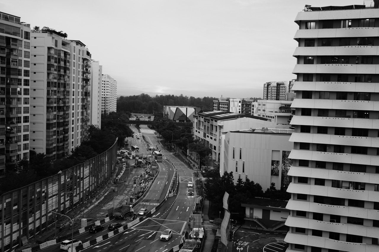
If you want to know why Punggol has particular HDB neighbourhoods, waterways, transport stations, parks, schools and technology offices, begin with Singapore’s land-use planning system rather than a property advertisement. The Urban Redevelopment Authority (URA) Master Plan is the statutory land-use plan that guides physical development over about 10–15 years, showing intended land use and permissible development density. Master Plan 2025 was officially gazetted on 1 December 2025. But a site marked for a future purpose is not automatically an approved construction contract, guaranteed opening date or entitlement to use a building today.
For practical Punggol research, use URA SPACE and search the exact address or site. Then identify whether the question concerns zoning, a more detailed development approval, an HDB housing project, a JTC business district, an LTA transport facility, NParks public space or PUB water infrastructure. Those institutions cooperate on the town while retaining different statutory roles. A proposed pedestrian link and a functioning lift should not be described as equivalent amenities; the latter can be used today, while the former is a planning objective until delivered.
This Understanding Punggol | Things to Know article is based on URA, HDB, JTC and relevant agency information verified through 21 October 2026. It explains how a public planning proposal becomes a built environment, how residents should evaluate maps, how land-use feedback works and which future claims require additional evidence. It is intended for students, families, prospective homebuyers, working adults and established residents. The focus is planning literacy and practical retrieval of official information, not property-price forecasting or promises about construction schedules.
Punggol planning at a glance
- Statutory land-use plan: URA’s Master Plan, gazetted as Master Plan 2025 on 1 December 2025.
- Planning horizon: medium term of approximately 10–15 years, reviewed on a roughly five-year cycle.
- Longer horizon: the separate Long-Term Plan considers strategic land needs over decades, not the same detail or date certainty.
- Official interactive map: URA SPACE provides Master Plan 2025 zoning, development-site information and other planning layers.
- HDB: plans and develops public housing estates and related neighbourhood functions within national frameworks.
- JTC: master plans and develops Punggol Digital District, a 50-hectare innovation, education and business cluster integrated with SIT.
- LTA: plans, builds and regulates relevant transport infrastructure, including the NEL, LRT and bus connections.
- NParks: manages designated parks and ecological spaces; park access rules differ from statutory zoning.
- PUB: manages water resources, reservoirs, drainage and flood-resilience assets within its jurisdiction.
- Key distinction: gazetted zoning ≠ development approval ≠ construction started ≠ construction completed ≠ actual public opening.
- Resident participation: URA’s public engagements inform planning; project-specific consultations and agency feedback channels can follow.
- Verification rule: note the publication date, mapped location, stage and responsible agency before acting on a future-development claim.
1. Planning is a system of decisions, not one master drawing
Punggol’s current landscape did not emerge from one single moment of design. Its older settlement and agricultural history was followed by HDB new-town planning, waterfront development, transport investments and newer employment and education projects. Each required decisions at different scales.
The urban system must make room for housing, jobs, schools, shops, social infrastructure, public transport, roads, drainage and nature. These uses can compete for finite land. A plan therefore expresses trade-offs rather than an unlimited wish list. Even when a proposal is popular, implementation may require funding, approvals, detailed design and construction time.
Understanding that sequence changes how a resident reads the town. Instead of asking only “When will everything be ready?”, ask “What stage is this particular facility at, and which authority has announced that stage?”
2. What the URA Master Plan legally does
URA describes the Master Plan as the statutory land-use plan guiding Singapore’s development over the next 10–15 years. It shows allowable land uses and development intensity and is accompanied by a Written Statement and relevant control plans. It is reviewed approximately every five years.
This means the Master Plan has a more formal status than a developer’s artist impression. But it should not be mistaken for a licence to commence any construction activity without further development-control and technical approvals. The actual landowner or project proponent still has to satisfy the relevant processes.
For a resident comparing possible uses of land near a block, the Master Plan is a starting record about planning permission and intentions, not a complete real-time construction schedule.
3. The 2025 plan is already adopted, not merely a draft
The development team for a school report should use precise dates. URA released Draft Master Plan 2025 for public feedback, and on 1 December 2025 URA formally gazetted Master Plan 2025. The gazette marks its status as the approved statutory plan for the relevant planning framework.
An article copied from mid-2025 may still call the plan a proposal without noting the later gazette. That is a historical description of one earlier stage, not the best statement of its current status in October 2026.
Use the official Master Plan homepage and URA gazette circular for the authoritative sequence.
4. The Long-Term Plan asks a different question
Singapore’s Long-Term Plan looks ahead over a substantially longer timeframe and sets broad directions for land, population needs, economic development, resilience and quality of life. URA’s Master Plan translates those strategic ambitions into more detailed medium-term land-use proposals.
A resident should not treat a long-horizon strategy as a specific announcement that a building will open by the next school term. Nor should a land-use allocation in the Master Plan be understood as a guarantee that every budget or contractor is already assigned.
For decision-making, distinguish strategy from land-use designation from approved construction project. The more specific the commitment, the more exact the responsible document and date should be.
5. How to inspect a Punggol site in URA SPACE
Open URA SPACE, search for the actual property address, postal code or recognised lot number, and select the relevant Master Plan 2025 layer. Then inspect the site boundary, mapped zoning and any relevant planning notes. The portal also offers other services such as planning decisions and control plans.
An HDB precinct name or marketing phrase may cover more than one land parcel. Use the official address or parcel whenever possible. A search for the whole Punggol town does not settle which side of a road the relevant site lies on.
Save the date of the map check and identify the mapping layer you used. If a serious property or legal decision depends on an official interpretation, consider the appropriate certified or formal service rather than relying only on a cropped screenshot.
6. Zoning describes permissible use, not actual ownership
A zoning colour might indicate residential, commercial, business, educational or park-related use, subject to the exact URA legend and Written Statement. It does not by itself identify the landowner, current tenant or operator of a future facility.
For example, land designated for a future institutional use is not automatically a particular named school. A residential zoning label does not mean a specific HDB block is already available for balloting. A business zoning label does not prove a particular employer has committed to occupy a completed building.
The meaningful process is to read the map, identify what the zoning permits, and then seek a separate agency or project announcement for what has actually been planned or commissioned at that site.
7. Development intensity is part of the plan
URA’s Master Plan includes development intensity and other control information for relevant land parcels. A higher permitted intensity can allow more floor space under the applicable framework, but it should not be translated directly into a prediction of population or building height without further analysis.
An office building and residential building use floor area differently. Roads, landscaping, infrastructure and planning conditions can affect actual design. It is therefore inaccurate to infer the number of residents in a neighbourhood by multiplying a map label without understanding the project.
For school work, state the planning variable and its definition before drawing conclusions. Clear terminology makes urban analysis useful instead of superficially numerical.
8. The Written Statement matters
URA explains that the Master Plan is to be read with the accompanying Written Statement, which clarifies zoning interpretations and other rules. A screenshot of the coloured map alone can omit conditions that matter for a proposed land use.
For a household, this is a reminder that the visual layer is a guide to where further authoritative information sits. For a business owner considering a location, reliance on a colour alone may create costly errors if the actual permitted use has conditions or requires change-of-use approval.
Read the appropriate official statement and consult URA’s services when a transaction has legal or financial consequences. The map is useful, but it is not a substitute for the full planning framework.
9. Special and Detailed Control Plans add specificity
URA publishes relevant Special and Detailed Control Plans and urban-design guidance. These can affect particular localities beyond broad Master Plan zoning. Building professionals may also need to consider access, setbacks, design, conserved elements, public space and technical standards.
A proposed development may fit a general land-use category yet require substantial redesign before approval. That is not necessarily evidence that the original master plan was inaccurate; it reflects the difference between strategic land use and detailed project permission.
Ordinary residents do not need to memorise every control code. They should know that a planning map has additional legally relevant documentation and that qualified professionals should examine it when needed.
10. Legal requisition is different from casual map browsing
URA provides a Legal Requisition service for obtaining information about a property’s latest planning decision and current Master Plan zoning. It is commonly used by law firms during property transactions but can also be applied for by members of the public under the service conditions.
This formal enquiry is useful when the planning status of a property matters to a purchase or professional transaction. It is more appropriate than assuming an estate agent’s screenshot constitutes an authoritative legal determination.
The URA Legal Requisition page explains what address and property identifiers may be required.
11. Punggol’s waterfront was a deliberate planning choice
HDB’s historical town account describes the Punggol 21 blueprint, the revised waterfront vision and the 2010 Eco-Town direction. The 4.2-kilometre man-made Waterway connecting the dammed Sungei Punggol and Sungei Serangoon reservoirs became a distinctive organising element.
The Waterway shapes some walking connections and leisure experiences, but it is also part of a managed freshwater landscape. Building a waterfront neighbourhood required coordinating housing, public spaces, bridges, transport and environmental features rather than simply excavating a decorative canal.
Our Waterway and drainage systems guide addresses the technical water and safety functions separately. This article explains how planning agencies make such features part of a town.
12. Why HDB developments are completed in phases
HDB new towns are delivered in precincts and projects rather than as a single simultaneous construction event. Land preparation, building design, procurement, construction, inspection and handover occur at different times. Local amenities can also open independently.
A recently occupied block may therefore have a different neighbourhood rhythm from a mature precinct. A promised shop might not be trading yet, and a public path may still be diverted while adjoining works finish. That is not proof that every announced town feature is permanently unavailable.
For a home purchase, check the actual phase, its completed amenities and the real route rather than assume all residents enjoy the entire future town plan immediately.
13. HDB flat launches are not URA zoning approvals
URA zoning may identify land appropriate for residential development. HDB then has its own flat launches, eligibility rules and project delivery process. A person cannot conclude that a zoned housing parcel guarantees a particular flat size, BTO balloting chance or key-collection date.
A property decision involves at least three layers: whether the site is planned for housing, whether HDB has announced a specific project, and whether the applicant qualifies and successfully obtains a flat. Each needs different evidence.
Our Punggol HDB housing systems guide deals with transactions and personal eligibility. Planning policy is the broader context, not a replacement for those application rules.
14. Punggol Digital District has another developer
JTC is the master planner and developer of Punggol Digital District (PDD), described in its current overview as a 50-hectare business-park and education cluster integrated with the Singapore Institute of Technology (SIT). It is intended to support sectors including cybersecurity, artificial intelligence, robotics and financial technology.
JTC describes a planned ecosystem of approximately 28,000 jobs and 12,000 students. These are district-level planning or capacity figures, not a count of occupied positions or students physically present on a particular morning. Some employers and buildings can operate while other parts of the ecosystem develop further.
This is where accurate language matters. Say “JTC describes a district with capacity or projected opportunity” rather than “28,000 jobs are guaranteed to residents today”.
15. Master planning a work district is not job allocation
A business park can bring jobs closer to a residential town, reducing commuting for some workers. But proximity does not guarantee a job offer, and a district’s tenant mix may evolve. Employment depends on employers’ actual vacancies, qualifications, labour regulations and individual applications.
Punggol residents can benefit from new education and work connections while recognising that the district serves wider Singapore. A student may take a relevant SIT programme, an employee may commute from another region, and a parent may still work in the city.
Our Punggol Digital District and SIT guide examines the employment and learning decisions. The Master Plan article focuses on how land was committed and developed.
16. SIT and JTC have distinct operational roles
SIT is an autonomous university with admissions, academic courses, student facilities and campus policies. JTC’s business park supports companies, workspaces and district-wide infrastructure. Physical integration does not merge admission criteria with commercial tenancy rules.
A student cannot infer a university programme place from the fact that the campus sits in PDD. A small business cannot assume JTC space is leased without an application and suitable fit. Campus and business spaces may also have different visitor access.
For an actual question, identify whether it concerns education or commercial premises, then contact the proper operator. A single landmark should not become the answer to unrelated service requests.
17. Punggol Coast MRT illustrates infrastructure delivery
LTA opened Punggol Coast MRT on 10 December 2024 as an extension of the North East Line serving the northern district. A station opening is a specific operational milestone supported by an official transport announcement; it does not mean every adjacent commercial or educational facility was completed at the exact same time.
This is an example of sequencing. Public transport can become available before the full district reaches its planned level of activity. Conversely, a future development may be designed around transport that must be expanded in advance.
When comparing 2022 plans with the town in 2026, distinguish the published completion of the MRT station from other separate phases. See LTA’s opening announcement.
18. Bus facilities are their own milestones
LTA’s Punggol Coast Bus Interchange opened in June 2025, following the 2024 opening of the MRT station. The transport infrastructure can be co-located or integrated without having the same launch date. Bus service numbers and routes may also change afterward.
A resident planning a commute should use present service information rather than infer bus routes from the original Master Plan. The map can show the intended transport hub, but only current LTA and operators’ schedules describe today’s service.
The lesson is that planning, commissioning and everyday operations form a sequence. A clear guide names the stage and date of each asset, avoiding vague claims that “Punggol Coast opened” as if it were one single event.
19. NParks and nature conservation are separate systems
Punggol’s parks, promenades and Coney Island Park are important to the town’s character. NParks manages parks under its remit, with visitor rules, conservation responsibilities and operational notices. A park shown on a planning map does not automatically allow camping, fishing or unrestricted vehicle access.
The wider environmental aim can involve protecting habitats while giving people opportunities to enjoy nature. More paths and visitors can create pressure, so designated access and closing times matter.
Our Punggol parks and Coney Island guide covers practical access. The planning system explains why natural and recreational land uses must be balanced.
20. PUB’s drainage responsibilities remain essential
A waterfront town needs drainage and flood-resilience infrastructure as well as attractive public spaces. PUB manages Singapore’s national water and drainage framework, including responsibilities for local systems and larger catchments. HDB, URA and other bodies coordinate with PUB where developments affect water movement.
A dry neighbourhood path on one occasion does not prove that every road is flood-proof. Intense rainfall and local levels can create temporary hazards. Engineering improvements may be undertaken after past observations or as new land is developed.
For live conditions, residents should use PUB and NEA alerts rather than infer safety from a Master Plan. Planning determines infrastructure provision, while operational weather warnings determine immediate travel decisions.
21. One project can involve several authorities
A new residential precinct may require URA planning compliance, HDB or private developer project management, BCA building oversight, LTA road and transport interfaces, PUB drainage works, NParks landscaping and utility connections. That does not mean every agency signs every document or manages every finished asset.
For a reader, the useful skill is identifying the project’s specific function. A bus-stop relocation is an LTA/transport issue, while a newly planted public park may be a different management responsibility. Construction debris on HDB common property can involve the building operator or Town Council.
Rather than sending a generic letter to all agencies, specify the asset and ask which authority has the relevant decision power.
22. Construction completion is not the same as opening
A building can look physically complete while testing, safety approval, tenant fit-out or operational commissioning remains. A sports centre might have finished visible structural works while its pools, equipment and access systems are still being tested. An office building can receive approval while individual businesses are still preparing to occupy it.
Public opening should be supported by an actual operator announcement or live facility page. A developer’s target date, an artist impression or a tenant tender is not equivalent evidence.
This distinction is especially important in rapidly evolving parts of Punggol. A family planning an activity should verify that the particular facility is operating now, not simply that it appears on a recent satellite image.
23. The five-stage evidence ladder
A useful way to classify development claims is: concept or vision → statutory land-use plan → specific approved project → construction or commissioning → opened service. Different sources document each stage. A plan can remain relevant for years without every particular project passing all subsequent milestones on the same schedule.
A new transport line discussed in strategic planning belongs early on the ladder; a completed MRT station with an official opening date belongs at the operational end. Residents should not apply the same certainty to both.
A good article states the stage next to the claim. This one editorial habit avoids many misleading headlines about “confirmed Punggol amenities”.
24. Artists’ impressions are not measured site photographs
URA and developers use visualisations to help the public understand possible designs. Some may be conceptual or computer-generated, representing planned streets, landscaping and buildings. A rendered image should not be treated as proof of an exact material, shop, species of tree or view from a particular apartment.
The correct analysis asks what the visual is trying to communicate, which parts are fixed, and what approvals or contracts support the claim. A housing buyer should never rely only on renderings when an actual site visit and official project details are available.
An artist’s impression is useful for discussion but weaker evidence about a completed building than an operator’s current photographs, as-built documentation or official opening notice.
25. Planning public engagement is a real process
URA’s Draft Master Plan 2025 involved an extended public engagement programme. URA says nearly 220,000 people took part in engagement activities since October 2023. These included exhibitions, focus groups, workshops and opportunities to share concerns about housing, neighbourhoods, resilience, heritage and economic development.
Public consultation does not mean every suggestion can be adopted. Limited land and conflicting needs force trade-offs. Feedback can nevertheless inform priorities, reveal accessibility problems and highlight uses that planners might otherwise overlook.
A resident writing a thoughtful submission should describe a specific place, current problem, affected people and a workable change rather than simply repeat a campaign slogan.
26. How to make feedback actionable
Suppose a Punggol resident wants a safer crossing near a frequently used walking route. A useful submission identifies the crossing, time of day, specific hazard, people affected and any photographs taken from a safe position. It distinguishes an existing maintenance defect from a proposed redesign.
A request for a new bus shelter should likewise name the actual stop and observed conditions rather than claim no shelter exists anywhere in town. Supporting evidence makes it easier for the right agency to investigate.
The most effective public feedback is factual, local and proportionate. It is not necessary to collect strangers’ private identities or publicly accuse officials to raise a practical concern.
27. Different issues have different feedback channels
A future land-use proposal may be appropriate for URA planning engagement. A pothole, faulty walkway light or rubbish issue may be better routed to the responsible municipal agency or OneService. HDB flat eligibility belongs to HDB, while current MRT service changes belong to transport operators or LTA.
The first task is to identify whether the issue involves future planning, existing service operation, maintenance or individual entitlement. Sending all four types to one generic political or community contact can delay resolution.
Our One Punggol services and agency guide explains where everyday issues go.
28. A Town Council does not determine national zoning
Town Councils manage relevant HDB common property, estate maintenance and related local services. They do not unilaterally change statutory URA land-use zoning because a resident dislikes a future building. Conversely, URA is not the ordinary first contact for every broken lift or missing corridor lamp.
These agencies occupy different levels of governance and operation. A local Town Council may give feedback on the experience of residents, while formal land-use decisions follow the relevant national planning processes.
Correctly identifying the role protects the resident from expecting an estate-management hotline to resolve a decision outside its authority.
29. HDB precinct names are not always planning-area boundaries
Punggol’s neighbourhood names include Matilda, Waterway, Sumang, Northshore and Punggol Point, among others. Their exact everyday use can differ from URA planning-area boundaries or administrative service limits. A property listing may emphasise a familiar precinct name, while an official map uses a site address or lot number.
For an important decision, trust the exact address and official map. Someone buying a flat near a town boundary might reasonably use shops in neighbouring Sengkang while the property remains officially within Punggol.
Names are useful for orientation. They should not replace the exact legal location when calculating eligibility, permits, delivery directions or public services.
30. Infrastructure capacity is not an individual entitlement
A district plan can include projected school capacity, expected jobs or planned transport services. These are aggregate planning concepts. They are not promises that a specific pupil will be admitted to a nearby school, a resident will obtain a specific job or a household will qualify for a BTO flat.
Admission rules and employer recruitment decisions involve separate criteria. Proximity can help with travel time but does not remove legal or practical constraints.
Readers should connect the correct systems without merging them: zoning makes a facility possible; delivery makes it real; its operator’s eligibility and access rules decide who can use it.
31. Public infrastructure has operating costs after opening
A park, community hub or transport facility does not stop requiring management after ribbon-cutting. Maintenance, staffing, electricity, security, repairs and future improvements shape service quality. Different agencies or operators may take over from the development project team at handover.
This distinction helps explain why a temporary closure is not necessarily evidence that a facility never opened or has been abandoned. It may be undergoing scheduled maintenance, operational change or repair.
For everyday use, check current operating notices. For policy analysis, recognise that ongoing maintenance budgets are part of the wider cost of providing public infrastructure.
32. A building’s existence may change neighbourhood movement
New schools, offices and amenities can alter pedestrian flows, bus demand, shop opening patterns and noise at different times of day. A residential area once quiet on weekdays may gain daytime activity when a university or office cluster opens. This can bring useful services alongside congestion at particular junctions.
A household deciding on a home should visit at meaningful times and test the recurring commute. Future amenity plans can be considered for long-term context, but the existing route is what matters for tomorrow’s school run.
An optimistic plan is reasonable; an unverified promise of zero noise or permanent empty roads is not.
33. Worked example: checking a proposed school site
A fictional Punggol family sees an online graphic showing an “education” land-use parcel near its estate. The parents should first verify the site and zoning in URA SPACE. Next, check whether MOE has separately announced an actual school, its name, education level, opening year and admissions rules.
Without the second step, it would be inaccurate to promise that a Primary 1 child can attend a new school next January. A site can be reserved for an education use while the actual project schedule remains undecided or evolving.
The family can value the long-term planning provision while making immediate childcare and school decisions using facilities already confirmed.
34. Worked example: a promised retail centre
A buyer reads that a shopping centre is “coming soon” next to a Punggol flat. The buyer checks whether the description comes from an official project announcement, a signed development contract, tenant promotion or a general future land-use plan. Then they inspect the actual construction status and whether any supermarket or essential shop has announced a trading date.
If the centre is not yet open, the buyer should assess groceries, medical care and transport using current nearby alternatives. The planned centre may become an advantage later, but should not be counted as a functioning service today.
This prevents a future promotional promise from being treated as evidence of immediate convenience.
35. Worked example: studying Punggol Digital District
A tertiary student wants to explain how innovation districts are planned. The student can begin with URA’s medium-term land-use framework, then examine JTC’s 50-hectare PDD description and SIT’s separate university role. The student notes JTC’s planned jobs figure and distinguishes it from actual employer hiring announcements.
The next step is to investigate how transport, sustainability and public spaces support the cluster. A critical report may discuss benefits such as closer work-study links and potential challenges such as congestion or demand for services, without claiming outcomes that have not been measured.
This is a more useful research method than copying a press-release headline and presenting projected capacity as a completed result.
36. Worked example: responding to a noisy construction site
A resident hears construction noise near a Punggol precinct. The first question is whether the noise is from an authorised infrastructure or building site, an HDB flat renovation or another source. Those activities have different operators, work-hour restrictions and complaint channels.
Document the exact location, time and observable impact. If safety is threatened, use the urgent response route. For an ordinary construction concern, contact the relevant developer, contractor or responsible authority rather than assume the Town Council can alter a national project’s approved schedule.
Keep regulatory and environmental concerns separate from frustration. Accurate records help professionals address the actual issue.
37. A school project can use planning evidence responsibly
An upper-primary or secondary student can choose a real Punggol site and compare an older planning statement, the current Master Plan and today’s operating facilities. Each source should be labelled by date and purpose. Changes over time can then be analysed rather than interpreted as contradictions without context.
The student might trace Waterway development, the opening of Punggol Coast MRT or the growth of PDD. Relevant disciplines include geography, mathematics, history and civics. For an analytical report, distinguish observation, policy intention and measured outcome.
This method produces stronger work than a list of attractions because it explains the mechanisms that made the town possible.
38. Common Punggol planning misconceptions
Myth: Master Plan zoning means construction begins tomorrow. Zoning and implementation are separate. Myth: an artist’s impression proves every feature will exist exactly as drawn. It illustrates a proposal. Myth: a 28,000-job district projection means 28,000 positions are currently vacant. Capacity is not real-time hiring.
Myth: a new MRT opening means every adjacent development opened too. Projects have separate milestones. Myth: a Town Council can rezone land on its own. URA planning is a separate statutory responsibility. Myth: proximity to a new school guarantees admission. MOE has independent rules.
Myth: public feedback means every suggestion is binding. Engagement informs planning within real constraints. Myth: the old Draft Master Plan is still the sole current legal document. Master Plan 2025 was gazetted on 1 December 2025.
39. Practical planning research checklist
- Begin with a complete address, block, site or property lot number.
- Open the current URA Master Plan rather than a developer’s extracted screenshot.
- Use URA SPACE and identify the exact zoning layer and date.
- Read relevant Written Statement and detailed control information where needed.
- Separate strategy, statutory zoning, project approval, construction and public opening.
- Find the right project agency: HDB, JTC, LTA, NParks, PUB or another body.
- Check project-specific announcements rather than infer names from zoning.
- Treat projected jobs or capacity as projections unless measured current data is provided.
- Verify the real operating hours and access of completed amenities.
- Use site visits to test current commuting, shopping and accessibility.
- Record publication and update dates for future-facility claims.
- Submit practical location-specific feedback through the appropriate official channel.
- Avoid presenting a planned amenity as available in an immediate household decision.
- Preserve property transaction documents when legal land-use interpretation matters.
- Revisit the evidence when a project moves to the next stage.
Frequently asked questions
What is Singapore’s current statutory Master Plan?
Master Plan 2025, officially gazetted by URA on 1 December 2025. It guides medium-term land use over approximately 10–15 years and is reviewed periodically.
Is the Master Plan the same as a list of projects already under construction?
No. It sets out permissible uses and development intensity. Individual projects require separate decisions, approvals, funding and implementation.
Where can I check zoning for an address in Punggol?
Use the official URA SPACE map, search the actual address or lot, and review the appropriate Master Plan 2025 layer.
Does a planned school site guarantee my child a place?
No. MOE must announce and operate the actual school, and admissions are governed by separate current rules. Zoning alone does not establish enrolment eligibility.
Who develops Punggol Digital District?
JTC, integrating a 50-hectare business park and innovation cluster with the Singapore Institute of Technology campus and other partners.
Are the 28,000 PDD jobs guaranteed available now?
No. JTC’s figure describes the planned district ecosystem and opportunity, not a count of current vacancies or guaranteed employment for Punggol residents.
Who manages Punggol Waterway and parks?
Different public bodies have responsibilities. HDB planned the Waterway within the town, PUB manages national water and drainage functions, and NParks manages its designated parks and connectors.
Can the public influence future planning?
URA and partner agencies hold public engagements and feedback processes. Submissions can inform decisions but do not automatically result in adoption of every proposal.
Is an opening-year target the same as a confirmed opening date?
No. A target can change during design, building, testing or commissioning. Check the actual operator announcement and live facility listing for operational access.
Why does an HDB flat handover not mean every nearby amenity is ready?
Public housing, shops, transport and civic infrastructure are delivered through separate projects and phases. Use existing facilities for immediate decisions and planned amenities for longer-term context.
Official sources and connected Punggol articles
- URA: Master Plan and statutory planning definition.
- URA: Master Plan 2025 framework and regional plans.
- URA: Gazetting of Master Plan 2025 on 1 December 2025.
- URA: Interactive URA SPACE planning maps.
- URA: Legal requisition and official zoning information.
- URA: Public engagement behind Draft Master Plan 2025.
- URA: Draft Master Plan 2025 public launch.
- URA: Smart Planning and planning-data tools.
- HDB: Punggol town history and waterfront development.
- JTC: Punggol Digital District, size and functions.
- JTC: PDD physical project and property information.
- LTA: Punggol Coast MRT official opening.
- PUB: Flood resilience and infrastructure strategy.
- Understanding Punggol: Where it is and how its neighbourhoods work.
- Understanding Punggol: Digital District, SIT and jobs.
- Understanding Punggol: HDB buying, resale and estate living.
- Understanding Punggol: Transport connections and accessible journeys.
- Understanding Punggol: Waterway infrastructure and flooding.
- Understanding Punggol: Civic services, Town Council and OneService.
Bottom line: Punggol becomes easier to understand when a resident reads its built environment through a sequence of decisions: land-use planning, detailed approval, project delivery, opening and maintenance. The best source is the responsible agency’s most specific current record, not a promise extracted from a future rendering. Use the Master Plan to understand direction and operating pages to make today’s decisions.


