
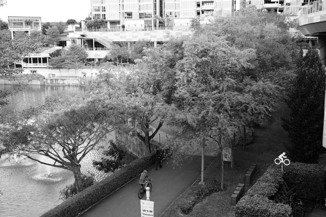
Punggol Waterway Park is where the “Crazy Rich Punggol” idea becomes deliciously upside-down. Some cities keep their best waterfronts behind private gates. Punggol gives families kilometres of water, bridges, paths, greenery and sunset space to use without buying a ticket. That is a kind of public luxury worth noticing.
Did you know? NParks lists Punggol Waterway Park at 25.79 hectares and open 24 hours, while the Punggol Waterway Park Connector follows an approximately 8.4 km track along both sides of Singapore’s largest man-made waterway. The park is organised into four areas—Nature Cove, Recreation Zone, Heritage Zone and Green Gallery—so the same outing can feel like exercise, nature study, local history and family leisure all at once.
The Crazy-Rich Idea: Waterfront as Everyday Infrastructure
The obvious thing to do at a waterway is admire the water. The more interesting thing is to ask why it is there and what it does for the town. Punggol Waterway is not merely decorative scenery. It shapes routes, views, recreation, drainage, habitat, housing frontage and the identity of Punggol itself.
That is why a walk here can teach a surprisingly modern lesson: good infrastructure can perform several jobs at once. A path can be transport and exercise. A planted edge can be beautiful and ecological. A bridge can connect neighbourhoods and become a landmark. A public space can support family life while also increasing the attractiveness of the surrounding town.
For the bigger town picture, the eduKatePunggol Atlas helps connect the waterway to homes, schools, MRT/LRT, retail and the newer Punggol Coast side of town.
Four Zones, Four Ways to Read the Park
Nature Cove
Nature Cove is a good place to slow down. The richer experience is not racing from attraction to attraction but noticing textures, shade, bird calls, reflections and the changing light on the water. Children who are usually told to “look carefully” in Science suddenly have something worth looking at.
Recreation Zone
This is the energetic layer: movement, play, walking, cycling and family activity. It reminds us that a park is not successful because it looks good from a drone photograph. It succeeds when people can actually use it comfortably.
Heritage Zone
Punggol is a very modern-looking town, but the area has a history long before the newest flats, malls and digital district. Heritage elements—including reminders of old Punggol Road and earlier transport—help residents understand that a town is a sequence of layers, not a blank sheet that appeared with the latest BTO launch.
Green Gallery
The green sections make the waterway feel less like a canal and more like a continuous landscape. This is where urban design becomes ecological thinking: shade, planting, habitat and visual relief all help dense neighbourhoods feel more liveable.
Cycling Punggol: The Waterway as a Movement Spine
Cycling is one of the most satisfying ways to understand Punggol because it reveals distances differently. A place that feels “far” by walking can become an easy ride; a route that seems simple on a map can reveal bridges, crossings, slopes, shared paths and weather exposure once you are actually moving.
The Punggol Waterway Park Connector follows both sides of the waterway, creating a strong recreational spine for running and cycling. Families can use the route as a simple systems exercise: choose a start, identify crossing points, decide where to turn back, and always build in a weather and fatigue margin.
- For younger children, choose a short out-and-back route rather than chasing a distance target.
- For older students, compare estimated travel time with actual travel time and explain the difference.
- Notice where pedestrians and cyclists share space; speed is not the only variable that matters.
- Use bridges as decision points so the route can be shortened without drama.
- Carry water and plan around Singapore’s heat, rain and lightning conditions.
The practical side matters. Our Punggol weather guide for families treats weather as a planning variable rather than an annoyance that appears after everybody has left home.
Why Bridges Make the Waterway Memorable
Bridges are functional, but they also make excellent mental anchors. A child who cannot remember street names may still remember “the bridge after the playground” or “the one where we crossed to the other side”. That is how wayfinding often works in real life: landmarks first, formal names later.
This is why our Punggol wayfinding framework uses landmarks, MRT/LRT, waterways and major destinations to build a mental map. The waterway is especially useful because it gives the town a visible line to organise around.
Biodiversity: A Park Is Never Just “Green”
Look long enough and “greenery” stops being one category. You begin to see different plants, insects, birds, water edges, open lawns, shaded areas and human-managed habitats. NParks highlights biodiversity around Punggol Waterway Park and the use of vegetation in the waterway landscape. That creates an easy invitation to practise scientific observation.
Try a 10-minute biodiversity audit
- Count how many different bird types you can distinguish without needing to name them.
- Compare plant forms: trees, shrubs, grasses, climbers and aquatic-edge vegetation.
- Notice which areas are sunny, shaded, wet or dry.
- Ask where insects are most active and propose a reason.
- Record one observation, one possible explanation and one question you still cannot answer.
That final step is important. Science is not “seeing something and instantly knowing why”. Good science separates observation from explanation and keeps uncertainty visible.
The Mathematics Hiding in a Waterfront Walk
Punggol Waterway Park is full of mathematics that feels less artificial than a worksheet. Distance, speed, time, scale, area, ratio and estimation all appear naturally.
- If a family cycles 8 km at an average moving speed of 12 km/h, how long is the moving time before stops?
- If you walk 4.2 km in 70 minutes, what is your average speed?
- If a bridge cuts a route by 1.3 km, how many minutes might that save at your walking pace?
- How does a map scale turn centimetres on a screen or page into actual distance?
- Why can “average speed” be misleading when a trip includes long rest stops?
The mathematics becomes more meaningful because the quantities belong to a real family decision: Can we finish before lunch? Is the child likely to tire? Which bridge gives us an easy exit?
The English Hiding in a Waterfront Walk
A place also improves language when children are encouraged to describe it precisely. “Nice view” is a starting point, not a finished sentence. What made it nice? Was the water glassy, rippled, brown, silver, wind-ruffled? Was the path crowded, quiet, exposed, shaded, winding or straight?
This is vocabulary learning with evidence. A student cannot casually call a path “secluded” if twenty cyclists are passing every minute. The word has to fit the observation. That is exactly the discipline strong writing needs.
Punggol Waterway as a Family Reset
Not every outing needs an achievement. Some of the richest family time comes from a route with no ticket, no reservation and no pressure to “maximise” the experience. Walk until the conversation gets interesting. Stop when somebody is hungry. Cross a bridge because the light looks beautiful on the other side.
That flexibility matters in a high-schedule city. Punggol families often juggle school, tuition, CCA, work and errands. A waterfront park can provide a low-friction reset between structured blocks of the week.
From Waterway Point to Punggol Coast: Watch the Town Change
The waterway also offers a long-term lesson in urban change. Punggol’s established town-centre side and the newer Punggol Coast/Punggol Digital District side tell different chapters of the same story. One is familiar and mature; the other is still accumulating institutions, workplaces, retail and public spaces.
Compare them with Punggol Town Centre vs Punggol Coast. Children who repeatedly walk the town over several years can literally watch planning decisions become buildings, routes and habits.
A Simple 90-Minute Waterway Learning Walk
- First 15 minutes: walk without teaching. Let everyone settle into the place.
- Next 20 minutes: pick one system to notice—bridges, planting, cycling flow, signs or water.
- Next 20 minutes: stop somewhere comfortable and ask one “why do you think…” question.
- Next 20 minutes: continue the route and look for evidence that changes your first idea.
- Final 15 minutes: get a drink, take one photograph or write one sentence that captures what you learned.
That is enough. The aim is not to turn leisure into tuition. It is to show a child that thinking travels with them.
Ten Vocabulary Words for Punggol Waterway Park
- riparian — relating to the edge or bank of a river or waterway.
- waterfront — land beside a body of water.
- promenade — a paved public place for walking, especially beside water.
- biodiversity — the variety of living organisms in an area.
- habitat — the natural environment where an organism lives.
- corridor — a connected route that allows movement through an area.
- landmark — a recognisable feature used to identify or navigate a place.
- gradient — the steepness or rate of slope.
- permeable — allowing water or another substance to pass through.
- respite — a short period of rest or relief.
FAQ: Punggol Waterway Park
Is Punggol Waterway Park open all day?
NParks lists the park as open 24 hours. Families should still plan around weather, lighting, personal comfort and the needs of children.
How big is Punggol Waterway Park?
NParks lists the park at 25.79 hectares.
Can you cycle at Punggol Waterway?
Yes. The Punggol Waterway Park Connector is a popular route for cycling and jogging. Riders should use appropriate speeds and share paths carefully.
How long is the Punggol Waterway route?
NParks’ Park Connector Network describes an approximately 8.4 km track running along both sides of the waterway.
Is the park useful for children beyond exercise?
Very much so. It is a natural setting for observation, route planning, biodiversity, local history, descriptive writing and real-world mathematics.
References and useful links
- NParks — Punggol Waterway Park
- NParks Park Connector Network — Punggol Waterway
- NParks — Activities at Punggol Waterway Park
- eduKatePunggol Atlas
- eduKatePunggol — Turn Punggol into a Living Classroom
- eduKate — Crazy Rich World
The crazy-rich Punggol move? Own less of the waterfront and enjoy more of it. Bring water, wear comfortable shoes, leave room in the schedule—and let one of Singapore’s most distinctive town landscapes do the rest.


