
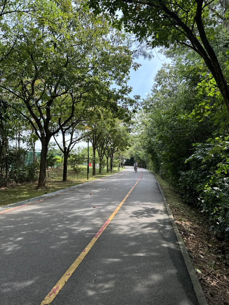
A direction sign along a Punggol park connector may tell walkers and cyclists which way leads to a park, bridge, rest area or the next stretch of the route. If an arrow has broken off, a distance plate is unreadable or a signpost is lying across the path, it can become more than a navigation inconvenience. A person may turn onto the wrong trail, walk much farther than intended or miss a safe route around works. The immediate response is to keep clear of sharp or unstable sign parts, use current official route information and report the exact junction or path segment to the responsible operator.
NParks manages Singapore’s Park Connector Network (PCN) and maintains official information about the Punggol Waterway, Punggol Park Connector, Punggol Promenade and North Eastern Riverine Loop. In September 2026, NParks also explained its trial of a colour-banding system for direction signs and lampposts on the Eastern Corridor, demonstrating that wayfinding formats are being improved over time. The pilot does not mean every Punggol sign already has colour bands or that a blank-looking pole is automatically missing a required marker.
- Slow down at an unclear junction and do not rely on a guessed arrow.
- Check the exact route name: Punggol Waterway Park Connector and Punggol Park Connector are different routes.
- Look for another authentic directional sign, park map or posted closure notice without entering a restricted area.
- Use the official NParks PCN route pages and notices to verify your intended path.
- Do not twist, move, repaint or attach homemade arrows to a public sign.
- If the sign is physically broken or blocks the path, give the precise location and report promptly.
- Contact NParks through its park and PCN feedback channel, or OneService for suitable municipal routing.
- If you are lost or unwell, move to a safe public place and seek appropriate assistance instead of taking an uncertain shortcut.
1. What a park connector direction sign does
A direction sign helps users make decisions at the points where routes divide or connect. It may identify a park, another PCN, a transport connection or a nearby facility. Arrows, place names and sometimes distances guide a person who does not already know the area. A missing arrow can therefore create uncertainty just when a walker or cyclist needs to choose a branch.
Not every sign has the same function. Some display behavioural rules such as giving way to pedestrians; others show route identification or facility locations. A distance marker may help users judge progress, while a trail map gives a broader overview. These distinctions matter when reporting a defect because the response team needs to know which kind of information is unavailable.
2. Why Punggol has several similar route names
Punggol contains an extensive set of parks, promenades and connectors. The Punggol Waterway park connector is an 8.4 km route along the Waterway. Punggol Park Connector is a separate 6.1 km route linking the promenade towards Gerald Drive. People sometimes shorten both names to ‘Punggol PCN’, creating understandable confusion.
A report should distinguish them using the name on an existing sign and nearby street or waterbody. Do not assume that a marker referring to Punggol Park Connector is supposed to have the same kilometre number as a Punggol Waterway sign. Route lengths, branches and distances are defined by the actual official mapping.
3. The North Eastern Riverine Loop connects more than one town
NParks describes the North Eastern Riverine Loop as a 26 km route linking parks through Punggol, Sengkang and Buangkok. It includes waterfront sections, green corridors and connections to other park paths. A user who follows a sign for the broader loop may travel much farther than a short local walk.
This is why route context matters. A destination arrow may be correct within a 26 km loop even if it looks unusual to someone who planned a 2 km walk. Check the route name and direction rather than treating every long-distance sign as misplaced. Only report a missing or conflicting marker based on a clear observed problem.
4. A distance number is not always a countdown
A sign reading a distance can indicate metres to the next named location, a segment length or a route’s progress marker depending on its design. It may not count down uniformly every hundred metres. A runner who expects all numbers to increase in a single sequence can become confused where routes join.
Check what the plate is intended to identify before reporting an alleged error. If the sign is physically missing or its digits have peeled away, that is a clearer maintenance issue. If the distance seems inconsistent, provide photos of neighbouring signs and the route junction without inventing a corrected figure.
5. What the official 2026 colour-banding trial means
NParks’ Island-wide Routes page, updated 10 September 2026, explains that NParks has been introducing a colour-banding system on PCN direction signs and lampposts to improve wayfinding. Its November 2025 to February 2026 pilot was on the Eastern Corridor, with potential expansion after evaluation.
This does not establish that every Punggol marker already uses the new colours. A resident should not report a sign as broken merely because it lacks a colour band seen in another town. Actual damage, missing information or conflict with an authorised route is a different issue from variation between signage generations.
6. Broken arrows are different from faded paint
A snapped arrow can leave a sharp protruding plate or remove the direction needed at a junction. Faded paint may make a sign difficult to read in sunlight or at dusk without creating a physical hazard. Both can be reported, but their urgency and maintenance work may differ.
Describe whether the sign is bent, broken, detached, sun-faded, turned around or hidden behind vegetation. A technician can determine whether cleaning, straightening, repainting or replacement is suitable. The resident should not grab the arrow or use a stone to turn it back into position.
7. A loose signpost can be a hazard
A post that visibly leans, has loosened at its base or appears ready to fall may injure pedestrians or cyclists. Keep away from its potential falling area and contact the operator directly. Do not hang a bag on it, shake it to see how loose it is or ask someone to stand beneath it for a photograph.
The cause could involve impact, foundation movement or another condition requiring inspection. A public guide cannot diagnose the support or quantify whether it will fall. A precise, urgent report gives the location and visible instability, allowing the responsible team to isolate the area if necessary.
8. A sign lying across a cycling route
A fallen post, broken arrow or large panel lying across a path can catch bicycle wheels and create a trip hazard. Riders should slow early, dismount if necessary and avoid swerving into pedestrians or traffic. Do not attempt to lift a heavy or sharp sign on your own.
If an appropriate safe alternative route exists, use it while informing NParks or the relevant manager. An abandoned damaged sign may involve more than the missing information: its physical presence can obstruct wheelchair access or cause injury. Include both concerns in the report.
9. Why an arrow can look wrong but still be correct
A sign may direct users along a safe planned route rather than the shortest straight line to a destination. It might avoid a steep section, a restricted path or another road crossing. A visitor who knows a shortcut should not automatically treat the official arrow as a mistake.
Before reporting a wrong direction, check current NParks route information and onsite closure notices. A correctly installed sign can reflect the approved route even when a commercial map suggests a more direct route. A report is stronger when it names the conflicting signs and the exact junction.
10. Temporary diversions change the picture
Park connectors may close sections during construction, maintenance or environmental works. NParks publishes a PCN Notices page with affected routes, closure dates and alternative instructions. During a closure, a temporary arrow or barricade may supersede the usual permanent direction plate.
Do not remove a temporary arrow because it differs from the permanent map. If both are visible and genuinely contradictory, ask NParks or the site operator to clarify and correct the information. Do not ride through a cordon to check which route is actually open.
11. The current PCN notice is more important than a saved screenshot
A person might save a map months earlier and later assume a closed section is open. Construction schedules can change, and an old map may omit temporary works. NParks expressly says its route maps are subject to change.
Before an unfamiliar long walk or ride, check recent PCN notices and official route details. If a closure is active, follow the approved alternative. A photograph of a previous sign or a GPS track from last year is not proof that the same route remains legally accessible today.
12. Signs can be hidden by plants
Growing foliage can obscure directional plates, kilometre markers and safety warnings without any damage to the metal sign itself. The problem may require appropriate vegetation maintenance rather than a new sign. Describe the plant obstruction and where the reader must stand to see the information.
Do not prune public greenery or pull branches away while standing beside a busy cycling route. NParks and the appropriate land manager have processes for greenery and signage upkeep. A report that includes the sign location and the visual obstruction helps direct the right team.
13. Do not confuse lamp post identifiers with route distances
A lamp post may have a number or label used for maintenance and location identification. A PCN marker may have a distance, route name or directional band. These codes do not always mean the same thing, and a resident should not treat a lamp-post asset number as a kilometre marker.
If giving emergency responders or maintenance staff a location, copy visible codes accurately and explain what kind of label they came from. A wrong assumption can send teams to another point. When a sign is missing, a nearby lamp-post ID may still be useful as a landmark.
14. How to find an accurate local landmark
Use a bridge, park entrance, path crossing, named facility, nearby street, HDB block or official map feature. Punggol has several bridges and waterfront sections with similar-looking views. A location described only as ‘near the river’ may be difficult to identify.
Include which side of the waterway you are on, whether you are heading towards the coast or town centre, and which branch of the PCN is involved. A safe overview photo may reveal the relevant fixed landmark even when the damaged sign no longer carries its name.
15. A junction may have several signs
A multi-path junction can carry directional arrows, speed or courtesy notices and route identity signs. One damaged panel may not invalidate the others. Identify the exact sign with the missing arrow or text rather than claiming that all information at the junction is defective.
If different arrows appear to give conflicting directions, photograph both safely and explain the intended destination. The operator can verify whether one is outdated or whether the directions refer to different route options. Avoid twisting one of them to make the junction ‘less confusing’.
16. Navigating safely while a sign is missing
Slow down and choose a safe place to stop, especially if cycling. Check an official PCN route page, the next readable sign or a trusted map without standing in the flow of other users. A rider should not operate a phone while cycling or make a sudden turn because a map appears to recalculate.
If uncertain, return to a verified junction or seek help from park staff rather than exploring a closed path. The correct destination is more important than recovering the exact planned distance. A family with a stroller or senior may prefer the shortest safe return route instead of pressing onwards.
17. What NParks’ Punggol Waterway page provides
The official Punggol Waterway connector page gives the 8.4 km route, general location along Sentul Crescent, accessibility information and nearby park connectors. It is a useful source for confirming which named route is meant and what other connections exist.
It does not give a real-time guarantee that every marker is standing or that every segment is open under all conditions. A site-specific damaged sign still needs a field report. General route descriptions and live maintenance conditions are different categories of information.
18. What the Punggol Park Connector page provides
NParks describes Punggol Park Connector as a 6.1 km route joining Punggol Promenade and Gerald Drive via the reservoir and surrounding areas. A user should not confuse it with Punggol Waterway or another nearby path because the names share the word Punggol.
This distinction is especially important when reporting missing kilometre markers. A distance measured from the start of one connector cannot be assumed to match the same distance along a different connector. Record the route name from the nearest official sign.
19. When the North Eastern Riverine Loop becomes the relevant route
A walker may be following the broader 26 km loop across Punggol, Sengkang and Buangkok rather than a single connector. A sign that indicates a transition between segments can look different from one that points towards a nearby HDB exit.
The North Eastern Riverine Loop page provides an overview and a downloadable brochure for planning. Do not assume the loop is one unbroken straight path. Its connections and branching decisions are exactly where clear signposting matters.
20. What if the sign points towards a closed section?
An out-of-date permanent arrow may direct someone towards a path with active repair works. The rider should follow current closure signs and approved diversions. Do not ignore a barricade because a larger directional sign points that way.
Report the conflict with the sign’s exact location, the closure notice and the intended route. The operator may need a temporary cover or corrected wayfinding during works. A missing or misleading sign and the underlying closure are related, but different maintenance and communication tasks.
21. A missing sign near a road crossing
A broken PCN direction plate at a junction with roads can cause people to hesitate or turn unexpectedly near vehicles. Riders should slow, keep within legal paths and use the proper crossing. Do not follow a map line diagonally across a carriageway.
A report should mention the street or crossing number if visible and whether the missing arrow affects people approaching from one side. A safe alternative might require returning to another crossing. The operator can determine whether a replacement sign or temporary guidance is needed.
22. Shared paths and cycling rules still apply
A lost directional sign does not remove active-mobility rules. On shared paths, cyclists should slow near pedestrians, maintain control and follow posted path designations. A motorised device cannot treat an uncertain route as permission to enter a pedestrian-only path.
LTA’s active-mobility rules and NParks’ PCN etiquette signs provide the general behaviour framework. When unsure which branch is correct, dismount or stop safely rather than make a risky manoeuvre.
23. Accessibility and confusing wayfinding
For a wheelchair user or a family with a stroller, a wrong turn can lead to stairs, uneven paths or a longer exposed walk. A sign that identifies the correct step-free branch therefore has a practical accessibility role. An unclear marker at such a junction deserves specific feedback.
Do not assume every route shown on a general map is equally accessible in every direction. Check actual ramps, crossings and temporary works. When reporting, explain which accessible branch appears unmarked and how the existing signs could mislead, without disclosing a particular user’s health details.
24. Seniors on longer walks
An older resident planning a short waterside loop may rely on distance information to judge how far they are from a rest area or transport connection. A missing plate can create uncertainty about whether continuing is sensible. It is better to choose a known safe return route than rely on an assumed kilometre count.
Family members can help plan a route using official maps and landmark names. Carrying water, keeping a phone charged and allowing time for rest are practical habits, but a public guide should not guarantee that every bench or drinking point is available. Site conditions change.
25. Running pace is not proof the marker is wrong
A runner may compare an exercise watch’s GPS distance with a printed marker and conclude the sign is inaccurate. Consumer GPS readings can vary because of sampling, route choice, turns and device reception. A difference by itself does not establish a sign error.
If there is a visibly damaged number, report that directly. If a distance appears wrong, describe the exact markers and route, with observed readings treated as evidence that needs verification rather than a definitive correction. NParks can check the authorised route measurement.
26. Why online route maps sometimes differ
A third-party map may represent the most popular pedestrian trail, a cycle route or an older path alignment. NParks’ current route information and on-site notices may reflect later closures or redesigns. Several maps can therefore show different lines without all being intended for identical purposes.
Before filing a complaint, compare the names, dates and intended transport modes. A map that takes a cyclist on a separate parallel path is not necessarily wrong for a pedestrian. If the actual sign conflicts with a current NParks notice, document the exact junction and request clarification.
27. The 2026 signage upgrade is not a promise about Punggol
NParks’ 2026 island-wide routes page discusses colour bands and QR-supported wayfinding, beginning with an Eastern Corridor pilot. Some residents may have seen news of this system and expect the same design immediately on every Punggol pole.
Do not assume a sign is missing because the new coloured band has not arrived. The documented pilot had a specific geography and period, with broader rollout subject to review. A report about broken lettering or a fallen post is stronger than a complaint based on an unverified timetable for new signs.
28. When QR codes appear on route signs
A route sign may include a QR code for map or local information, but a QR code is not itself proof the linked page is trustworthy. If it is covered by an unfamiliar sticker or looks tampered with, do not scan blindly. Verify route information through the official NParks or PCN site accessed independently.
A suspicious QR sticker is a separate cybersecurity issue from a missing arrow. See the Punggol QR notice guide for the risks of replacement codes and safer verification. In a park, tell the sign’s operator as well as checking the actual route.
29. Damaged signs after heavy rain
Wind and rain may displace a panel or leave a sign leaning into a path. If loose metal or a pole appears unstable, keep clear even when the sign still points in the correct direction. Safety is more urgent than preserving the wayfinding function for one more cyclist.
Do not remove the panel or hold it up for a photograph. NParks or the appropriate facility manager can assess whether temporary closure or repair is needed. A clear statement of the falling or trip hazard helps distinguish urgent physical maintenance from a routine request to improve lettering.
30. What about private or non-PCN signs?
A café, condominium, construction site or community event might install its own directional arrow near a park connector. It may not be part of the official NParks network. A misleading private sign can still create confusion, but the maintenance owner could be the venue or event organiser.
Note the actual logo or text and exact location. Do not accuse NParks of installing an unverified sign or detach a private board yourself. The relevant property manager can confirm whether the sign is authorised and whether it should be removed or corrected.
31. How to report a missing sign
Give the nearest route name, direction of travel, junction, bridge, landmark and the side of the path where the sign should be. Explain whether the entire post is missing or a particular arrow or distance plate has gone. Include a safe photo of the site and adjacent signs if possible.
A report saying ‘PCN signs are bad’ is unlikely to identify one repair. A useful version is ‘at the fork beside [landmark], the direction arrow towards [destination] appears missing from the signpost when approaching from [direction]’. This makes the location actionable without claiming the exact replacement design.
32. How to report a damaged distance number
If the marker has a missing digit, peeling surface, cracked plate or unreadable distance, describe the printed part that remains. Do not guess the intended number from your watch and stick a correction over the sign. The operator can verify the route’s approved measurement.
A safe photo should show the route name or neighbouring sign if possible. If the marker is on a post near traffic, do not step into the carriageway or a cycle lane to photograph its back. A precise text description can be sufficient.
33. NParks’ proper feedback channel
NParks provides a Contact Us page for parks, greenery and facility issues. For a PCN sign, describe the park connector and exact junction. The operator can decide whether the repair belongs to its signage team or another managed asset.
In a mixed-use area, a lamppost, road sign and PCN arrow may be maintained by different agencies. NParks can assess or help direct the enquiry when the sign belongs to the PCN, while a public-road traffic sign may instead involve LTA. Avoid insisting that one agency owns every pole near a park connector.
34. OneService when the owner is unclear
The OneService App and chatbot can route suitable municipal feedback to public agencies or Town Councils. Include the route name, closest street, date and a context photograph. This is useful when the sign sits at the boundary of an HDB estate and a park connector.
Do not submit a location that merely says ‘Punggol’ or place a map pin at your home because it is easier. Accurate geographical detail helps a technician identify the damaged marker and reduces unnecessary referrals. If the problem is an immediate falling-object hazard, contact the operator directly as well.
35. A family ride near Sam Kee
A family cycles along a shared route near an LRT connection and reaches a fork where an arrow is missing. The adult stops with the children at a safe point outside the riding line, checks the official PCN route and chooses the appropriate branch. Later, they report the missing panel with the nearest station and path direction.
This is a hypothetical example, not a claim that any sign near Sam Kee is broken. The useful action is to prioritise navigation and safety first, and maintenance reporting second. Do not ask children to ride ahead to discover where an uncertain branch leads.
36. A walker planning Punggol Waterway
A resident sets out on the Waterway Park Connector for a manageable walk. At a junction, the remaining sign points to a park name but its distance plate has been torn away. The resident checks the official route and their own energy level, then returns by a known path rather than guessing how far it is to the next shelter.
Afterward, the resident submits a precise maintenance report. The example illustrates that distance information is valuable for planning, especially for seniors and families, but is not a substitute for a realistic personal ability to complete the journey.
37. An emergency location needs better than a guess
If someone is seriously injured or faces another emergency on a PCN, responders need a clear location. A working trail marker, bridge name or nearby road can help. If the sign is broken, copy whatever identifiers remain and provide a map location or GPS position through the emergency call as directed.
Do not waste critical time searching for a perfect trail number when immediate assistance is needed. Give the closest reliable landmark, the path side and how responders can approach. The absence of a sign is a later maintenance matter; the injured person’s safety comes first.
38. Why ordinary reports matter to park management
Direction signs are used repeatedly by people who may visit a route only once. A small missing arrow can generate many wrong turns even if it does not cause an immediate accident. Timely maintenance keeps the network legible for runners, cyclists, parents with children and people with mobility needs.
A resident who reports an exact damaged sign helps NParks focus inspection where it is needed. The report should remain specific and avoid claiming all of Punggol’s PCN is badly managed. Most effective local feedback identifies a problem that can be verified and fixed.
39. Do not repaint or improvise a new arrow
A well-meaning person might draw an arrow on a pole or attach a cardboard sign pointing towards what they believe is the correct trail. That can mislead others, obscure official signs or interfere with route management. It may also become litter when rain or wind removes it.
Notify the operator and ask whether temporary wayfinding is needed. The owner can confirm the approved path, coordinate with construction notices and install durable signage to the appropriate standards. A resident’s knowledge of a local shortcut is not an authorisation to change public navigation information.
40. A robust route-checking habit
When planning an unfamiliar Punggol route, compare the official PCN page, current notices and the intended start and destination. At the path itself, follow legitimate signs, slow at junctions and stop safely if information is unclear. A damaged marker can be reported without forcing the entire outing to continue.
The key lesson is that wayfinding is a system: accurate route data, readable physical signs, clear closures and safe path conditions all matter. Responsible park users help by reporting faults and respecting the route, rather than treating every missing sign as a challenge to find a faster unmarked shortcut.
Park connector sign reporting checklist
- Identify the actual PCN name and nearest park or junction.
- Describe the direction you were travelling and the route you intended to follow.
- Check for another current official sign or closure notice.
- Avoid sharp, loose or fallen sign parts and do not move them.
- Use NParks’ official route and notices pages to verify the path.
- Take a safe context photograph and note the date.
- Record what is missing, damaged, faded or contradictory.
- Submit a precise report to NParks or suitable OneService channel.
- Mention any access problem affecting wheelchairs, strollers or cyclists.
- Keep the case reference and avoid publishing an invented distance correction.
Frequently asked questions
Is Punggol Waterway Park Connector the same as Punggol Park Connector?
No. NParks lists Punggol Waterway as an 8.4 km connector and Punggol Park Connector as a separate 6.1 km route. Confirm which sign and path you mean.
What if a direction arrow has fallen off?
Avoid touching or trying to refit it. Record the exact junction, route and missing direction, then notify NParks or the responsible operator.
What if the signpost is leaning dangerously?
Stay clear, warn companions safely and report directly. Do not shake or straighten the post.
Can I repaint a faded sign myself?
No. Public wayfinding signs must match the authorised route information and materials. Leave repair to the owner.
Do all PCN signs have a colour-coded band in 2026?
No. NParks described an Eastern Corridor pilot from November 2025 to February 2026 and possible broader expansion. Punggol signs should not be assumed to have that design yet.
How do I check whether a PCN is temporarily closed?
Use NParks’ official PCN Notices page and follow current on-site diversion instructions rather than old map screenshots.
Why might my GPS disagree with a distance marker?
Device precision, route choice and measurement methods can differ. Report a genuine apparent discrepancy with exact markers, but do not assume the watch is authoritative.
What if a marker is covered by plants?
Report the vegetation and sign location. Do not prune public plants or climb the signpost.
What is a reliable landmark for a report?
A named bridge, nearby road, path intersection, park entrance, LRT station or fixed marker, along with the route direction.
Can I use a lamp-post number as a kilometre marker?
No. Maintenance asset labels and route-distance markers can be different. Copy the code accurately and say where it appeared.
Who handles a PCN direction sign?
NParks is the logical starting point for its Park Connector Network signage. Other adjacent road or private signs may have different owners.
Can OneService route missing-sign complaints?
Yes. Provide accurate location and context for suitable municipal reports. Use direct operator contacts for urgent physical hazards.
What if the direction sign points through construction?
Follow the current official closure or diversion, not an apparently outdated arrow. Report the conflicting instructions.
What if I get lost with a child?
Stop in a safe public place, check an official route or return to a known landmark, and contact trusted assistance rather than exploring closed paths.
What if the sign is on a private condominium boundary?
Describe the exact location and logo. The managing agent or NParks can help determine which party owns the feature.
Is a missing distance marker an emergency?
Not ordinarily. A physical hazard or real injury requires more urgent action, but a missing number should generally be reported for maintenance.
Do I need to measure the route myself?
No. Provide the sign, junction and apparent problem. The operator can verify official distances and replacement information.
Can I take a photo of the fallen sign?
Yes, from a safe position without entering traffic or moving broken material. Respect other path users’ privacy.
What if the official map and third-party app differ?
Prioritise current NParks information and notices for PCN route status, and report discrepancies with dates and actual locations.
What is the best one-line report?
‘At [PCN/junction], the sign towards [destination] is [missing/broken/unreadable] as of [date/time]; please inspect and update wayfinding.’
Official sources and related Punggol reading
- NParks — Punggol Waterway Park Connector (8.4 km)
- NParks — Punggol Park Connector (6.1 km)
- NParks — North Eastern Riverine Loop
- NParks — 2026 PCN Sign Colour-Banding Trial
- NParks — Current Park Connector Notices and Closures
- NParks — PCN Safety and Directional Signs
- NParks — Park Connector Feedback
- OneService — Municipal Report Routing
- eduKate Punggol — Broken Cycling Path Bollards
Reviewed 10 November 2026. Route lengths and 2026 colour-banding details are taken from current NParks PCN pages. No specific sign on Punggol’s PCN is claimed to be broken. Use the latest official notices and the appropriate operator for actual route conditions.
