
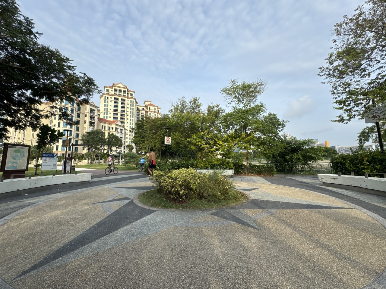
You can walk from Tanjong Rhu MRT to The Kallang by following the waterfront side towards the Tanjong Rhu suspension footbridge, crossing the Geylang River and continuing to your venue. It is a free public walk when the paths are open. The venue’s transport guide gives about 350 metres from Tanjong Rhu MRT to the precinct, so use that for orientation and allow extra time for the walk to your specific gate.
Choose Tanjong Rhu MRT on the Thomson–East Coast Line if it gives you a simpler train journey and you have time for the open-air crossing. Choose Stadium MRT on the Circle Line for the more direct approach to the precinct when the weather, your venue entrance or your group’s walking needs make that preferable. This guide treats the bridge as an outing in its own right and also shows how to use it on an event day.
- Start at Tanjong Rhu MRT, TE23, for a waterfront approach to The Kallang.
- Follow the pedestrian suspension footbridge over the Geylang River. Choose it by name and appearance in your route planner.
- Stadium MRT, CC6, serves the venue precinct directly and is a useful alternative.
- The venue’s approximate 350 m is a precinct estimate. Check your event’s entrance, gate and arrival guidance.
- Choose a turnaround point and leave room for weather, crowds and a longer walk to your door.
How to walk from Tanjong Rhu MRT to The Kallang
Start with the right station and destination
Take the Thomson–East Coast Line to Tanjong Rhu MRT, TE23. Follow signs for Exit B, the footbridge and the promenade. If you are walking for the bridge itself, put ‘Tanjong Rhu Suspension Bridge’ or ‘Tanjong Rhu Footbridge’ into your walking map. If you are going to an event, also save the name of the venue and the gate number on your ticket. The bridge is an intermediate destination. Give the group enough information to continue once you reach the far bank.
Follow the public pedestrian route towards the Tanjong Rhu waterfront. On the promenade side, look for the footbridge with tall frames and suspension cables across the Geylang River. Check the crossing on your map before following a road or a more distant park-connector route. Several ways of moving around the wider waterfront look plausible on a small screen. Choosing the named footbridge gives you a definite target.
The station’s surroundings include homes. Stay on public paths and avoid entering a private driveway or estate just because it appears to line up with the water. If a temporary barrier changes the route, follow on-site directions and recheck the path from where you are standing. The familiar route can be easier to recognise on the return when you already know which turn leads back to the station.
Cross first, then find your specific entrance
Cross the footbridge and continue towards the part of The Kallang you are visiting. Singapore Indoor Stadium, the National Stadium and Kallang Wave Mall are distinct destinations. Once you are on the venue side, use the current precinct map and event signs to work out which direction to turn and which level or entrance to use.
For a walk with no event ticket, choose a public stopping point and look back across the Geylang River. You can return across the bridge or continue to Stadium MRT, depending on your route home. Crossing once and taking the train from the other side saves retracing the same stretch if your group wants a point-to-point outing.
The precinct estimate of roughly 350 metres from Tanjong Rhu MRT provides a sense of scale. It does not include every detour for a particular event, the time spent crossing in a crowd or the path to a seat. For a person attending a show, the most useful timing runs from the station platform to the venue entrance named on the ticket.
Tanjong Rhu MRT or Stadium MRT?
Start from the line you already use
Tanjong Rhu is on the Thomson–East Coast Line. If your trip is already on that line, walking across may save you an interchange. Stadium is on the Circle Line and is a practical choice when your existing journey reaches it easily. Compare the complete trip, including the walk through any interchange and the way from your chosen station to the right gate.
A visitor coming from a hotel near a Thomson–East Coast Line station may choose Tanjong Rhu for an afternoon bridge walk. A group coming from a Circle Line station may arrive through Stadium and make the bridge a short optional detour. Both groups can be visiting the same venue. Their starting points and available time can make different routes sensible.
Let the entrance and the weather influence the choice
Pick your route after looking up the venue entrance. Someone heading to the Indoor Stadium may have a different walking path from someone attending an event at the National Stadium. If there is a queue or diversion, use the signs for your actual gate. Follow the operator’s event instructions when they direct people along a particular path.
The crossing is outdoors. If the weather makes an exposed walk unappealing, Stadium MRT is a useful alternative for direct precinct access. Continue to plan for any open-air section between the station and the door. For a companion who needs a step-free route, ask the venue about the entrance and check the route from the station, including lifts, ramps and any temporary changes. Proximity on a map is only one part of accessibility.
Use a different station on the way back if it helps
An outbound route chosen for the view can pair with a return from Stadium MRT. The reverse also works when weather and event instructions permit and when Tanjong Rhu makes the journey home easier. Keep the return choice flexible until you know where your group leaves the venue. The entrance you used at the start may be far from the exit directed by staff at the end.
What to notice on the Tanjong Rhu footbridge

Look at the frames and cables as a structure
The bridge opened in 1998. The archival speech from its opening describes a crossing 130 metres long with frames about 19 metres high. It gives a good reason to look up from the deck when you reach a place where you can pause out of the traffic. Find a tall frame, then see how the main cables span between the ends and how the smaller hangers lead down towards the deck. The parts are easier to distinguish from an oblique view.
For a child who likes building things, ask which parts would still be visible if you stood at one end and looked straight down the path. Then walk to an available spot on the bank and compare. The repeating shapes create a strong view along the crossing, while a view from the side helps show the changing angle of the main cables. The two perspectives help a visitor see why a bridge is more than the flat surface they walk on.
Give other people space to cross. A wide view from the approach can be easier to photograph than a stop in the middle. If people are moving in both directions after an event, put the phone away until you are in a public area with room to stand. A small group photo from the promenade tells a better story than several rushed attempts in a narrow flow of people.
Take a moment to see both banks
From the bridge you can relate the residential waterfront to the sports precinct. The difference is clear even on a short walk. On one side people are passing homes and using the promenade. On the other side the route opens into a venue district that can receive very large crowds. A footbridge connects the two everyday uses of the river edge. On a quiet day the connection feels like a neighbourhood walk. On an event day it becomes part of a larger trip.
URA’s guide to the Kallang River describes boatbuilding and repair in the wider area, including Tanjong Rhu’s place in that history. The modern promenade does not show all of that former activity directly. Use the guide if you want to connect the current landscape with its earlier working waterfront. A practical way to start is to look at how the route gives people access to the bank today, then read how the same waterways served boats and shipyards.
Three itineraries for different kinds of visits
A short bridge outing without a ticket
Meet at Tanjong Rhu MRT and make the suspension bridge the main attraction. Follow the public approach, cross at a comfortable pace and decide whether to return immediately or continue to Stadium MRT. Let one person choose a public place to stop for a picture or a view. A short visit can be satisfying without adding a full lap around the basin.
If the group wants to walk for a little longer, spend a few minutes on the promenade before crossing. Use the station and bridge as the two landmarks to remember. A child can point towards the frame of the bridge, then explain where the train station is in relation to it. An adult can use the same exercise to agree on the quickest route back if plans change.
A pre-event meal and an unhurried approach
Work out the gate and its opening time first. Choose a meeting place that works for people arriving on both lines. A public point on the venue side can be easier than asking everyone to find the same stretch of the residential promenade. If you have a restaurant reservation, make sure the walk from the restaurant to the right entrance is part of the plan.
People arriving early can take the bridge for the view, while others come directly from Stadium. Set an agreed time to start heading for security or the door. If the line at the restaurant takes longer than expected, keep the venue as the priority and save the bridge for a quiet day. The walk fits best when everyone has room for it in their schedule.
A late-afternoon walk that ends on the Circle Line
Start on the Tanjong Rhu side with enough light and time to enjoy the waterfront. Take a photo from one bank, cross, and take a second from a public place on the venue side. Use Stadium MRT for the onward trip if it suits your line. A route with different stations at either end is convenient when you are meeting people in one part of town and continuing to another.
If there is a major event on the same afternoon, the precinct can feel busier than expected even though you are not attending. Check the venue listings if a calm route matters to your group. An ordinary day gives more opportunity to pause, talk about the river and compare the two sides of the bridge.
Event-day details that change the walk
Use the exact venue name and gate
The National Stadium and Singapore Indoor Stadium are separate venues. Read what your ticket says before you send out a meeting point. A message that says ‘meet at Stadium’ can mean the MRT station, the stadium building or an entrance. Include the venue and a specific gate or public landmark. Send a second choice in case staff keep people moving at the first meeting spot.
Time the journey in parts. Estimate train travel, the walk to the precinct, the walk inside the precinct and any arrival process given by the organiser. If the group is unfamiliar with the location, leave time for a wrong turn or level change. A distance estimate ends when you arrive at the point being measured. Your event journey ends when you are where the organiser expects you to be.
Follow event directions at the end
At the end of an event, movement through the precinct can be slower or go along different paths from the arrival. Read the latest instructions for train access and obey on-site directions. If the bridge is open and is appropriate for your group, Tanjong Rhu can give you a route to the Thomson–East Coast Line. If signs direct people a different way, use the available route.
For a family or group of friends, choose a place to regroup before heading home. People may leave a venue through different doors. A fixed time and a clearly named location makes it easier to check who is with you. Allow someone who needs a slower pace to stay with the group instead of trying to catch up in the crowd.
Consider what the walk feels like in practice
The bridge can be a pleasant alternative to another train connection, particularly when you are already on the Thomson–East Coast Line. A person carrying event merchandise, looking after a child or helping a companion who needs rests may prefer the most direct open route after a long day. The scenic option remains available for another visit. Use the conditions you encounter when choosing between two workable stations.
How the footbridge differs from a longer waterfront walk
This guide is about crossing the Geylang River between the Tanjong Rhu Promenade side and the venue side. A longer promenade or park-connector outing is a separate plan. NParks’ Geylang Park Connector guide can help when you want to explore the wider network. Keep the bridge as your route’s named waypoint so a mapping app does not substitute a crossing intended for a different destination.
If you like short public-transport walks, the bridge gives you a route with a distinct midpoint and a choice at each end. Begin near the station, see the river, cross it and make a choice about how much more to do. That is easier to adapt for different visitors than a fixed long loop. If the weather changes, cut the time outdoors. If everyone is enjoying the view, add a public waterfront section or a meal.
A bridge visit also offers a clear way to compare the area with other waterfronts. Think about the width of the water, how the crossing changes the route between two districts and what uses you see on either bank. You can describe a public place in concrete terms after only one walk. That is a better starting point for returning with friends than a list of stops chosen without a sense of how they connect.
Make the route clear for someone who has never been
Before you send directions, include the MRT line, the footbridge and the destination in that order. For an event attendee, add the gate and point them to the organiser’s current map. For a friend joining a walk, add the turnaround point and whether you plan to finish at Stadium MRT. A useful message might say to meet near Tanjong Rhu MRT, walk across the suspension footbridge and decide on the venue side whether to return or continue to Stadium.
If a companion wants to know how long the outing takes, give the meaning of the estimate along with the number. The venue guide’s 350 metres is an approximate distance to the precinct. It is reasonable to give a wider planning window for stopping, wayfinding and continuing to a named entrance. A friend who wants photographs, a snack and a seat needs a different window from someone walking straight through.
On the way home, remember the name of the crossing and which side you started on. Next time, start on the opposite side and compare what becomes visible first. The bridge feels different when you can see the promenade approaching rather than the sports precinct. A change that small can make a familiar short walk worth repeating.
Use the bridge and lookout as separate landmarks
Read the public waterfront before stepping onto the crossing
Look for the bridge approach and the lookout structure as separate elements. The 1998 opening material describes the footbridge and a jetty with a lookout tower as parts of the same waterfront project. One gives people a way across the river. The other reaches out from the promenade and creates a different way to see the water. You can see the relationship from the public path even when access to individual sections differs.
If you see the tower on a map, use it as a reference point for the bridge approach. Follow on-site signs for anything you want to visit. The basic station-to-venue walk works without adding a climb, an extra turn or time at a lookout. Save that extra stop for a day when your purpose is the waterfront itself.
The footbridge was described at its opening as four metres wide. That is enough to feel generous on a quiet walk and can feel very different when many people are moving together. A parent walking with two children can use the approach to set the plan. Keep together, leave room for people passing, and pause after crossing if anyone wants a longer look. The same arrangement helps a group travelling at different speeds.
Try a waterfront photograph from each bank
On the Tanjong Rhu side, include a stretch of promenade so the viewer can see how people arrive at the crossing. Put the nearest frame towards one side of the photograph if you want space for the river. On the venue side, look back and try to capture the span between the two banks. The second picture can explain the crossing even if the first gives the more attractive view.
Choose a place where you can stand without moving into the path. On a busy event day, a clear picture of the bridge from the bank will generally be easier to take than one from the middle. If you are walking with young children, make the photo spot a single agreed stop. They can help identify the same structure in both photographs once you are home.
The river can look very different when the buildings behind it are bright and the foreground is dark. A wide phone photograph often keeps the story clear. If you zoom in on the tower or cable details, take one wider photograph afterwards to show where the detail belongs. The walk gives you both a picture of a structure and a picture of how it serves the surrounding area.
Compare the two sides if you are planning a return visit
Coming back for a concert or match
Save a route to the gate rather than just to a pin for the sports precinct. Check when the gate opens and read the organiser’s information about queues, bags and arrival routes. A practice walk on a quiet day can help you recognise the bridge and venue side, but the crowd on the event date may move differently. Allow time to respond to the directions you actually receive.
Consider which station you need at the end of the night. If your fastest route home uses the Thomson–East Coast Line, check the train schedule and whether the bridge route is open. If the return via Stadium serves more of the group, agree whether you are travelling together until an interchange or separating at the venue. A clear departure plan can be more useful than a shared assumption that everyone will follow the same crowd.
Coming back for the river
Start at Stadium if you want to see the bridge approach from the venue side first. Look back after crossing and find the same landmarks from Tanjong Rhu. Someone who has only seen the bridge on an event night may be surprised by how clearly the structure reads at a quieter time. Extend the outing along an open part of the promenade if the weather and the group’s pace suit it.
If your group is interested in local history, read the archival speech and URA material before or after the visit. Notice which details the walk confirms easily, such as the shape of the frames, and which details belong to a former landscape, such as the boatbuilding uses along the broader river. That distinction gives you a way to talk about how the area changed without treating every present landmark as a surviving piece of the old waterfront.
Take a shorter outing with a companion who needs rests
Choose a starting side close to the public place you most want to see. Walk as far as the approach before deciding whether to cross. A companion can enjoy the bridge from a bank and return without committing to the whole route. If crossing matters to both of you, check for open routes and rest points before setting out. Leave the rest of the day flexible enough that the bridge can be the main stop.
Frequently asked questions
Can I walk from Tanjong Rhu MRT to the National Stadium?
Yes. Use public paths towards the Tanjong Rhu suspension footbridge and cross to The Kallang. Continue to the gate shown on your event information.
How far is The Kallang from Tanjong Rhu MRT?
The venue transport guide gives about 350 metres on foot to the precinct. The distance to your specific venue entrance or gate varies.
Which MRT is best for Singapore Indoor Stadium?
Stadium MRT on the Circle Line is the direct precinct station. Tanjong Rhu on the Thomson–East Coast Line is a useful alternative when your journey is simpler on that line and the public crossing is open.
Is the bridge free to cross?
It is a public pedestrian crossing. Follow temporary closure or event signs if they affect your route.
Is the route sheltered the whole way?
The suspension crossing is outdoors. If you want to minimise exposure, consider Stadium MRT and check the route from the station to your actual door.
What river does the footbridge cross?
The footbridge crosses the Geylang River at Tanjong Rhu, linking the promenade side and the sports precinct.
Can I cross the bridge without going to a sports event?
Yes. Cross as part of a public waterfront walk and either return the same way or continue to Stadium MRT.
What name should I use in a map app?
Search for Tanjong Rhu Suspension Bridge or Tanjong Rhu Footbridge and verify the crossing on the map. Add your exact event venue as the final destination if you have a ticket.
Sources and next reading
- The Kallang official getting-here guide, including MRT walking estimates
- National Archives of Singapore opening speech with footbridge details
- The bridge builder’s Tanjong Rhu footbridge project record
- NParks Geylang Park Connector route information
- URA’s Kallang River guide and the area’s boatbuilding history
- NParks Tanjong Rhu Promenade Park Connector route


