
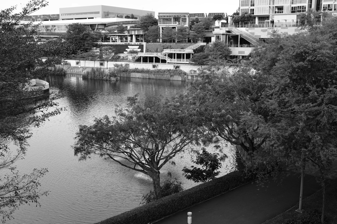
PG3 is Posting Group 3 for Secondary 1 admission, while G3 Geography is the subject level under Full Subject-Based Banding. Punggol Waterway Park offers local families a concrete way to understand geographical inquiry: students can frame a question about public space, study official maps, observe how a park is used, record evidence, compare patterns and evaluate what their information can actually support. NParks describes the park as a 25.79-hectare public space along Sentul Crescent, with four themed areas—Nature Cove, Recreation Zone, Heritage Zone and Green Gallery—and a connected network of walking and cycling facilities. Any field observation must follow park rules and appropriate adult or school supervision.
The point is not to promise that Edgefield, Greendale, Punggol Secondary or Yusof Ishak Secondary will assign every student a Waterway Park field trip. MOE’s lower-secondary G2/G3 Geography curriculum emphasises geographical concepts and investigation, and the actual school decides which topics, assessment tasks and supervised visits it uses. Parents can teach these skills through official maps, carefully sourced information and a brief safe observation from public paths. This article explains how to avoid biased sampling, misleading graphs, unsupported environmental claims and unsafe data collection, so the child learns genuine geographical thinking rather than simply taking photographs.
- PG3 identifies the initial secondary posting group; G3 describes the level of the Geography subject.
- MOE Geography uses space, place, environment and scale to study physical and human patterns.
- Geographical investigation begins with a focused question, an appropriate evidence plan and consideration of ethics and safety.
- NParks lists Punggol Waterway Park along Sentul Crescent with Nature Cove, Recreation Zone, Heritage Zone and Green Gallery.
- NParks records the park as 25.79 hectares and part of the North Eastern Riverine Loop.
- An NParks Waterway park connector route is 8.4 km; do not confuse the connector’s length with a short school activity route.
- Use publicly available maps and notices; do not invent distances, usage counts or weather observations.
- Plan observation sites from safe public areas and follow park regulations, including its no-fishing rule.
- Distinguish primary observations made by the student from secondary data published by NParks or other agencies.
- Use fair sampling across suitable times or locations; one observation cannot represent every visitor.
- Protect privacy: do not photograph or interview identifiable strangers without appropriate consent and school authorisation.
- Tables, annotated maps, field notes and graphs should show dates, definitions, units and limitations.
- Make recommendations proportionate to evidence and acknowledge alternatives and trade-offs.
- A family fieldwork exercise is optional practice, not an official school assignment, scientific test or water-quality certification.

From PG3 Geography theory to a responsible local investigation
1. Definition lock: admission group, subject level and geographic fieldwork
Posting Group 3 is the administrative pathway through which a child enters mainstream Secondary 1. G3 describes the level at which a particular subject is offered. Geography is a discipline that explores the relationships between people, environments and places. Fieldwork is one way students gather evidence to investigate those relationships. These are separate terms, and a child’s posting group does not prove that they already know how to conduct an inquiry.
Full Subject-Based Banding creates opportunities for mixed form-class experiences while pupils learn subjects at their applicable levels. A student may have strong factual knowledge about Punggol yet still need to learn how to frame a fair comparison. Another may be good at map reading but uncertain about interpreting survey results. The most useful parent support addresses the specific skill rather than making assumptions from a school label.
MOE’s Geography framework uses the concepts of space, place, environment and scale. These concepts direct attention to different aspects of an issue: where something occurs, what it means to people, how environmental and human systems interact, and which level or representation is relevant. A local waterway can illustrate all four without becoming the entire syllabus.
Ask the child to write one sentence describing the question they want to investigate. Then check whether the words in that question can be connected to observable or reliable published evidence. Clear purpose comes before visiting a park or making a chart.
2. The park is a real place, not a dataset invented by a guide
NParks describes Punggol Waterway Park as a public park along Sentul Crescent that runs through Punggol Town. It identifies four themed areas: Nature Cove, Recreation Zone, Heritage Zone and Green Gallery. The park’s official page reports a size of 25.79 hectares and provides visitor information, accessibility guidance and park regulations. These are verified contextual facts, not data collected by the student.
NParks also describes the connected Punggol Waterway Park Connector as an 8.4-kilometre route along the waterway. This is a network-level figure. It does not mean a student’s walk from a chosen entrance to a specific bridge will take that distance, nor that a family must complete the whole route. Do not use one published number to answer a different geographic question.
Nearby access and transport depend on the actual starting point, chosen section and conditions. For fieldwork learning, the family can use official NParks information and a current public map to identify a suitable safe viewing area. The article does not invent a meeting point or claim that a particular school has permission to use a given site.
Students should begin a research notebook with a source table. Which facts come from NParks? Which observations will be gathered if an approved visit occurs? Which claims are merely hypotheses? Keeping those categories separate protects the integrity of the inquiry from the start.
3. Frame a question that a student can actually answer
A question such as ‘Is Punggol a good place to live?’ is too broad for a short field exercise. It combines personal values, transport, housing, schools, costs and many other matters. A focused question might examine which types of activities are observed at two safe public locations during a defined observation period, or how published information describes accessibility at different sections of the park.
The narrower question needs operational definitions. Does ‘activity’ mean walking, cycling, resting or something else? How will the learner classify an adult pushing a stroller or someone stopping briefly? Categories should be clear enough that two observers would usually classify the same situation similarly. Otherwise, disagreement in the data may reflect the method rather than the park.
Students also need to consider feasibility. A question that requires sampling water chemistry, entering restricted areas or photographing identifiable people is not appropriate for casual home practice. Choose observations that are legal, non-intrusive and manageable from public paths, or use official secondary information instead.
Before anything is recorded, ask what an acceptable answer might look like and what evidence would challenge it. A well-framed question helps the pupil recognise when a result is inconclusive rather than forcing a confident conclusion merely because the assignment needs a final paragraph.
4. A geographical question should reveal the spatial dimension
Geography is more than describing that people walk in a park. The spatial question asks where different activities occur and whether their distribution may be related to features of the place. A shaded rest area may be used differently from a wide movement corridor, but the pupil must observe or verify the relationship instead of treating it as automatically true.
On a current map, identify relevant physical or built features, access paths and safe observation points. The student should note what the map represents and when it was published. A schematic illustration may be useful for orientation without providing accurate measured distances, while a geospatial map may be more suitable for locating features.
Ask the learner to describe spatial patterns precisely. ‘At this observation point during the chosen time, more walkers than cyclists were recorded’ is more defensible than ‘Punggol residents prefer walking.’ The second statement implies a population-wide preference that the small observation did not measure.
The distinction between pattern and explanation is essential. Observed activity differences may have several possible influences, including design, time, weather and nearby amenities. A good fieldwork response can suggest questions about these factors while acknowledging the evidence needed to test them.
5. The concept of place includes human meaning
Place is not merely a coordinate. People experience parks as destinations for exercise, rest, social contact, nature appreciation or memories. NParks identifies heritage features at Punggol Waterway Park, including the preserved Old Punggol Road bus stop and Kelong Bridge. These features can help a teenager see how a designed landscape carries traces of local history.
A child might write that a preserved bus stop is a reminder of the past, consistent with the park’s published heritage description. It would be unreasonable to claim that every visitor experiences nostalgia or that all residents share the same memory. A place can hold different meanings for different people and generations.
Ask students to separate official interpretation from personal response. NParks may describe a bridge’s heritage inspiration; the child’s own response to its appearance is a perception. Both can appear in a thoughtful discussion, provided they are labelled correctly. The skill is to avoid turning a personal impression into a universal fact.
This aspect of Geography connects with Humanities source evaluation. Where does a claim about local heritage come from? Which historical information supports it? What is still uncertain? The student learns that understanding place requires both physical observation and reliable contextual sources.
6. Environment: examine relationships instead of decorative greenery
A waterway park contains managed vegetation, built facilities and human activity. Students should avoid assuming that every green landscape is entirely natural or that all human modifications have the same effect. Geography investigates how environments are shaped and used and what trade-offs arise when societies manage shared resources.
NParks’ nature-walk description identifies aquatic plants such as Red Thalia, Bulrush and Swamp Cabbage along the waterway and discusses their pollutant-removal roles. This is useful published information, but a family should not claim to have identified a particular plant without reliable evidence or appropriate expertise. Species names can be recorded as sourced context rather than invented field observations.
Ask the student what additional evidence would be needed to evaluate environmental performance. A photograph of a clean-looking water surface does not establish water chemistry or ecological health. Proper environmental monitoring requires methods, instruments and authority far beyond a casual public-path observation.
The educational task can be to describe visible vegetation and built features, then compare the observations with the official park description. The learner practises distinguishing appearance, explanation and evidence without disrupting habitats.
7. Scale changes the answer to a geographic question
Scale refers to how an area is represented or the spatial level at which an issue is considered. A single seating area is not the same scale as the whole Waterway Park, the Punggol estate or Singapore. A conclusion that fits one short section may not hold elsewhere. Students should state the relevant extent of their observation.
The official park connector route extends well beyond the immediate area beside Waterway Point. A family observing one public path must not assume the findings characterise the entire 8.4-kilometre connector. The chosen section is a sample of a larger network with potentially different design, access and use.
Map scale also affects how distances are interpreted. A schematic transit diagram may distort geographical spacing to make connections easier to follow. A student should check whether a map is intended for measuring or for showing relationships. Using the wrong representation can create false certainty.
Ask the learner to rewrite a statement at two scales. A claim about one observed bench area may be precise; the same claim about all Punggol parks becomes unsupported. This short exercise teaches why scope belongs in every geographical explanation.
8. Primary and secondary data must be labelled
Primary data are observations the learner gathers for the investigation, while secondary data are collected and published by another source. A child’s field note about the number of pedestrians at a defined time is primary data if genuinely observed. NParks’ reported park size and area descriptions are secondary information. Both can be useful, but their origins must be clear.
Students sometimes copy a published number into a field notebook and imply that they measured it. This is misleading. A proper entry cites the source, publication or access date where appropriate and explains what the figure represents. The same applies when using a map, photograph or publicly released dataset.
A family can complete meaningful geographic learning using only secondary sources. It might compare an official park webpage with a map and identify how the features relate to access. If a supervised visit is impractical, no one needs to invent an observation session to make the report look more authentic.
Teach the pupil to distinguish observation date from publication date. A photograph taken last year may document a feature at that time but not prove its current condition. Geographic information changes, and responsible work acknowledges the time to which evidence applies.

9. Safe observation points and non-intrusive conduct
Any outdoor learning must be appropriate to the child’s age, school instructions and the site. Public paths are not permission to enter planting beds, approach water edges unsafely or move into restricted areas. NParks publishes rules for visitors, including that fishing is not allowed at Punggol Waterway Park. Students should follow the current notices displayed on site.
A parent or teacher should choose a safe location that does not obstruct pedestrians or cyclists. Observers must remain aware of other park users and avoid becoming so focused on a worksheet that they ignore their surroundings. If weather, crowding or poor visibility makes the activity unsuitable, postpone it or use secondary data instead.
Privacy is also part of safety and ethics. Recording anonymous counts of broad activity categories is different from photographing individual visitors or collecting identifiable personal information. Do not interview strangers or record faces without the necessary consent and school approval. A home exercise should avoid collecting personal data altogether.
Students can still learn a great deal by observing designed paths, seating, signage and general patterns from a suitable public space. The objective is to understand a place respectfully, not to generate the largest possible dataset.
10. Choose a sampling method deliberately
Observing everyone in a large park for an entire day is unrealistic for a school exercise. Students therefore need a sampling plan. That might mean clearly defined observation intervals at one safe location or comparing observations from two preselected points, under appropriate supervision. The method should correspond to the question rather than be chosen because it produces a convenient result.
Sampling creates limitations. A period on a weekday morning may not represent a weekend evening. A location near a café may attract different activities from a quiet path. If the student observes only one area at one time, the conclusion must be restricted to those conditions.
Convenience sampling is easy but may be unrepresentative. A more systematic schedule can improve comparability, although it still cannot guarantee that all wider patterns are captured. The learner should explain why the chosen intervals were used and what type of bias may remain.
Parents can teach these ideas with a fully fictional observation table rather than conducting an actual census. Ask what changes if a different time is chosen. The student learns to evaluate the method and respect uncertainty instead of treating every small set of counts as a population fact.
11. Field notes are more than a collection of adjectives
Useful field notes record context, observation and uncertainty. A note such as ‘very busy and beautiful’ tells us little about the question. A more informative entry identifies the place, time period, type of activity observed and the conditions under which it was recorded. Subjective impressions can be included separately rather than mixed with objective counts.
If a pupil notices a path used by cyclists and walkers, they should describe what was directly observed without making unsupported claims about who the visitors are or why they chose the route. A single observed interaction may suggest an interesting question, but should not be inflated into a statement that the area is always unsafe.
Field sketches can be useful because they encourage careful attention to relevant features. The student should label elements accurately, indicate orientation where appropriate and explain that the sketch is an interpretation rather than a measured engineering plan. A clear sketch often reveals the relationship between features better than many photographs.
After the activity, ask what the pupil would need to clarify before someone else could interpret the notes. Missing units, vague location labels or uncertain category definitions may become apparent. Revision is part of building a usable geographic record.
12. Maps and photographs require source discipline
Maps and photographs can provide evidence about land use, connectivity and design. They also reflect the choices of their creators. A map may omit small paths or simplify distances, while a photograph captures one viewpoint at one moment. Students should examine scale, legend, orientation, date and the purpose of the representation before drawing conclusions.
NParks’ official Waterway Park page provides visitor information and locations. That is a useful starting point for understanding the park’s layout and rules. A student might annotate a current official map to show the subject of an inquiry, but should not present the annotation as an exact surveyed position unless measured and verified appropriately.
Photographs should be used ethically. Avoid identifiable people when consent has not been obtained and never imply that an old image was taken during a new school investigation. A caption should tell the reader what feature is shown and when or where the image came from, to the extent known.
Parents can compare two publicly published images of the same setting and ask what each makes easy to see. Does camera angle affect the apparent width of a path? Does the image show a wider context or only one feature? The child learns that visual evidence must be interpreted rather than accepted uncritically.
13. Turn observations into a well-labelled table
Once data exist, the student should organise them without altering their meaning. A table of fictional counts can list observation period, number of walkers and number of cyclists at a stated location. Headings must make the quantities clear. The total should match the sum of the recorded categories if the categories are mutually exclusive.
Suppose a hypothetical ten-minute observation lists eight walkers and three cyclists. That shows counts for the invented interval only. It does not establish that the path is mostly used by pedestrians throughout the day, and it provides no information about why people chose their activity. The limited statement is still a valid exercise in accuracy.
Students can add an explicit note that the data are simulated for learning. Do not dress them up as measurements from a school field trip. An honest synthetic dataset can be analysed rigorously and is much better than a fabricated real-world claim.
Ask the child to reconstruct what the table means in one sentence. If they cannot explain the categories, location and period without guessing, the recording system needs clarification. Good tables make evidence understandable to someone who was not present.
14. Choose a graph that matches the question
A bar chart may suit counts of activity categories, while a line graph may suit observations over ordered time periods. The choice depends on what the variables mean. A student who connects unrelated categories with a continuous line may accidentally suggest a relationship that is not present in the data.
Every chart needs labels and an appropriate scale. A vertical axis that starts close to the data values can exaggerate small differences, especially in a bar chart. Encourage the learner to check how the choice of scale changes the visual impression. This is a mathematical and geographical literacy skill.
After drawing the chart, require a description of the pattern before any explanation. ‘More walkers than cyclists were recorded in this fictional interval’ is supported by the example, while ‘residents prefer walking because cycling is unsafe’ is not. The latter would require evidence about preferences and safety conditions.
Ask the teenager to identify one thing the graph cannot show. Perhaps it lacks weather conditions, user demographics or observations from other times. Recognising missing evidence demonstrates stronger reasoning than adding an unjustified causal paragraph.
15. Weather, time and activity categories affect comparisons
Outdoor observations can be influenced by weather, lighting, day of the week, holidays and the timing of nearby activities. A visitor count taken on a sunny weekend cannot be assumed comparable to a count taken during heavy rain. Students need to record relevant conditions or acknowledge that they were not measured.
Activity categories also need clear boundaries. Is someone pausing beside a bicycle counted as cycling, resting or walking? What about a person jogging while pushing a stroller? A vague classification system makes results hard to reproduce. The student should define categories before counting and apply them consistently.
Parents can teach comparability using fictional observations from two different days. If both time and location changed, it may be difficult to identify the cause of any difference. A stronger design would keep more factors consistent where practical. The pupil should explain the trade-off between a manageable study and a broad claim.
The point is not to turn a family outing into a complicated research project. It is to help the child see why a comparison must be fair before the resulting numbers are given interpretive weight.

16. Environmental claims need more than an attractive photograph
The waterway’s vegetation, paths and features can inspire discussion of sustainability, but the visible appearance of a landscape does not prove its ecological or water-quality condition. NParks provides information about aquatic plants and park management; the family should treat that as sourced material rather than independent scientific measurement.
A student may notice litter at one location. A careful description can record what was observed at that place and time. It would not be defensible to conclude that the whole park has a permanent litter problem from one instance, or to guess who caused it. The claim should match the scale and reliability of the evidence.
Likewise, seeing birds or plants does not justify a complete biodiversity assessment. Species identification and ecological monitoring may require expertise, repeated sampling and approved methods. The learner can appreciate nature while being honest about what a short visit cannot establish.
This distinction is a useful lesson in environmental citizenship. Responsible recommendations are stronger when they acknowledge uncertainty, use trustworthy data and recognise the roles of park management and other users.
17. Make recommendations that follow from the findings
Geographical investigation often asks students to suggest an improvement or action. A strong recommendation identifies the problem supported by evidence, proposes a plausible response and considers possible benefits and drawbacks. A vague sentence such as ‘Build more facilities to improve everything’ does not show the reasoning needed to justify the decision.
Suppose a fictional student observes that a particular rest area becomes crowded during a short interval. A cautious recommendation might be to investigate use at other times before deciding whether additional seating is needed. The student should not demand construction as though the small observation settled the question.
Trade-offs matter. Adding a facility may improve convenience while affecting greenery, maintenance or space for others. A good student can consider alternative solutions and identify what evidence would help choose between them. The aim is thoughtful planning rather than an absolute claim that one interest must override every other consideration.
Parents should ask the teenager to state the evidence in one sentence, the proposal in another and the limitation in a third. If the proposal relies on a fact not in the data, mark that fact as a question for further research. This makes the final answer proportionate and credible.
18. A four-week Geography inquiry practice plan
Week one is question framing. Read the MOE school topic and a current NParks source, then develop one manageable inquiry question. Identify whether it concerns space, place, environment or scale, and choose a safe, lawful evidence method. The family can complete the entire exercise using public information if visiting is not appropriate.
Week two is evidence design. Write a table with clear variables, source fields and a date. If working with a fictional dataset, label it simulated. If the school has approved a visit, follow the teacher’s safety and privacy instructions and use only the approved observation method. The objective is honest and comparable data.
Week three is analysis. Present the information in a suitable table, map annotation or graph, describe what it shows and identify one reasonable limitation. Ask the child to distinguish observation from possible explanation. Avoid inventing counts to fill missing rows or borrowing an old photo as though it documents a new visit.
Week four is evaluation and communication. Write a concise conclusion that answers the question, followed by a recommendation justified by available evidence. Compare the outcome with the child’s initial assumption. Geography learning succeeds when the student can revise an idea responsibly, not when the final paragraph simply sounds confident.
Frequently asked questions about Geography fieldwork
Is Punggol Waterway Park an official fieldwork site for every PG3 student?
No. This is an optional local learning context. Individual schools determine their current Geography lessons, supervised visits and assignments. Parents should never claim an unofficial family exercise counts as a school field trip.
What are the four themes of Punggol Waterway Park?
NParks identifies Nature Cove, Recreation Zone, Heritage Zone and Green Gallery. These names describe park areas, not four compulsory school fieldwork stops.
How large is Punggol Waterway Park?
NParks lists 25.79 hectares. The connected Punggol Waterway Park Connector is separately described as an 8.4-kilometre route; those figures measure different things.
Is fishing permitted during fieldwork?
No. The current NParks Punggol Waterway Park visitor information explicitly says fishing is not allowed. All posted rules, safety and site restrictions must be followed.
Can a pupil interview or photograph strangers?
Not without appropriate consent, privacy safeguards and school authorisation. A family exercise should avoid identifiable personal data and can instead use secondary sources or anonymous non-intrusive observation.
Can one short observation prove how the whole park is used?
No. Activity patterns depend on place, time, weather and sampling method. Conclusions must be limited to the evidence actually collected.
What does a strong fieldwork conclusion include?
An answer to the focused question, the evidence supporting it, relevant limitations and a proportionate recommendation or next question.
What if our family cannot conduct an outdoor visit?
Use official NParks maps, publicly available information and explicitly fictional data to practise framing questions, representing patterns and evaluating evidence. Learning geographical reasoning does not require fabricating field observations.
Your next step
Ask your child to choose one limited geographical question about a public-space feature. Check the current NParks information, distinguish official secondary data from anything genuinely observed, design a safe and privacy-respecting recording method, and write a conclusion that does not exceed the evidence. Follow the school’s actual assessment and fieldwork directions. A good geographic investigation is one the learner can explain, verify and improve.
Official references and connected Punggol learning
NParks Punggol Waterway Park official information · NParks Waterway Park Connector length and network · NParks nature walk and vegetation features · MOE lower-secondary G2/G3 Geography syllabus · MOE Full SBB and posting groups · G3 lower-secondary History and Geography foundations · Applied learning across Punggol secondary schools. Always follow the current park rules and the child’s school guidance.
Independent educational fieldwork guide for Punggol parents, reviewed against NParks and MOE materials available on 1 November 2026. Fictional datasets are labelled as examples and must not be passed off as observations; field visits are neither required nor automatically school-approved.


