
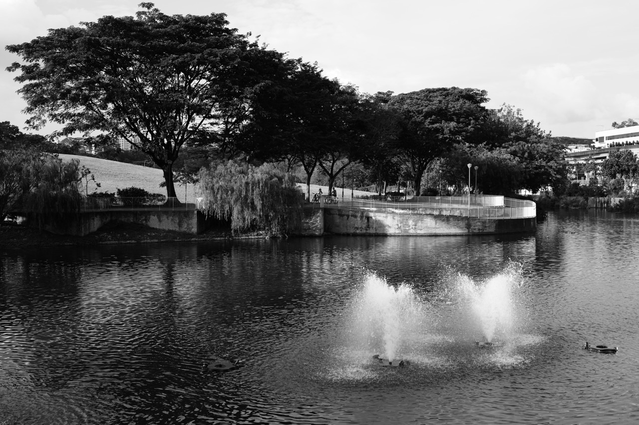
The quick answer: Some of Punggol’s attractive planted depressions and shallow grassy channels are working stormwater infrastructure, not just ornamental gardens. Rain gardens, known technically as bioretention basins, and vegetated swales can slow, temporarily store and filter rainfall runoff before water reaches larger drains and waterways. PUB documents Waterway Ridges in Punggol East as an important local example. This does not mean every planted bed in Punggol is a rain garden or that these features can prevent every flood.

If you walk around Punggol just after a tropical downpour, you may see three different scenes within a short distance. A paved path sheds water into a grated inlet. A gently lowered patch of planting holds shallow water before becoming dry again. A large channel continues carrying water away. These are not three versions of the same device. They are parts of a wider stormwater system, each designed for different conditions and each needing an appropriate level of care.
This guide focuses on how to read Punggol’s landscaped drainage features as a resident. It distinguishes rain gardens from ordinary decorative planting, vegetated swales from drains, expected temporary ponding from potentially dangerous flooding, and official engineering claims from what a family can observe during a walk. For separate explanations of Punggol Waterway, reservoirs and broader flood safety, follow the related site guides at the end. The purpose here is the everyday, near-home system.
Find the right explanation first
| If you notice | Likely question to ask | What you should do |
|---|---|---|
| A shallow planted depression after rain | Is this a designed bioretention feature? | Check site signs; observe from the path |
| A grassy channel alongside a walk | Is it a vegetated swale or an ordinary low point? | Do not block or modify the flow path |
| Standing water across a walking route | Is the path temporarily unsafe? | Avoid entering; use a safe alternative |
| Debris inside an obvious drain inlet | Could drainage be obstructed? | Report the exact location without reaching inside |
| Water rising in a canal or reservoir edge | Is there an active warning? | Follow PUB alerts and keep away from floodwater |
| Rain stops but ground remains saturated | How is the surface draining? | Note time and location; do not assume a defect immediately |
1. Why rain must be managed where it lands
Rain becomes runoff when it cannot soak into the ground or when rainfall arrives faster than the surface can absorb it. Roofs, pavements, roads and paved plazas often route water quickly toward gutters, inlets and drains. Punggol has many such surfaces because it is a built residential town. Without sensible management, water arriving from different roofs and roads at the same time can produce a sharp flow peak downstream. The issue is not merely how much rain falls during a day, but how quickly that water reaches vulnerable points.
PUB explains Singapore’s flood-resilience approach in terms of source, pathway and receptor measures. Source measures manage runoff near where rainfall lands, such as detention tanks or bioretention basins. Pathway measures improve the ability of drains to convey water. Receptor measures protect the buildings and infrastructure that could be damaged. These categories are useful because residents otherwise expect a single visible drain to solve an entire rainfall event. In practice, the system needs several different functions acting together.
A rain garden cannot make intense rainfall disappear. Its value is more specific: it can slow some surface runoff, let selected pollutants settle or filter through appropriate media, and release water at a managed rate. When many elements work together, they can help reduce peak flows. Whether a given garden delivers a measurable benefit depends on its location, design, soil media, catchment, maintenance and storm conditions, not merely on how green its plants look.
Punggol example
After watching rain strike a Punggol block’s roof, ask where it goes next. Does it enter a downpipe, run across paving or reach a planted basin? Follow only routes that are publicly and safely accessible. You are tracing a sequence of functional elements, not seeking one magical drain.
2. A rain garden is an engineered planted basin
In Singapore’s ABC Waters terminology, a bioretention basin is commonly called a rain garden. It usually combines a shaped surface, vegetation and deliberately selected soil or filter media; some designs also include subsurface gravel, drainage components or controlled overflow routes. The visible plants are only one part of the treatment process. Their roots, the underlying media and the way water enters and leaves determine how the feature behaves in a rainfall event.
A normal ornamental garden bed may have flowers, shrubs or trees but no designed inflow from a nearby paved area. A rain garden has a hydraulic job. It receives runoff from a defined contributing area and slows or treats it before discharge or infiltration where the design allows. That does not mean every rain garden must look like a deep pond. Many are shallow and relatively inconspicuous, especially when dry. Identifying one correctly requires signage or reliable engineering information.
PUB publishes ABC Waters design guidelines and technical templates for features including bioretention basins, bioretention swales and vegetated swales. The fact that professional design templates exist matters to residents: the basin’s width, depth, slope, material and overflow must be calculated. Do not scoop out soil, change its grade, fill a depression or redirect a pipe because you think it would look more attractive. Such changes can alter the designed flow and treatment path.
Punggol example
A patch of grass beside a playground has a low centre. Instead of declaring it a ‘rain garden’ based on its shape, look for an ABC Waters sign or a published precinct plan. You can describe it as a low planted area until the design is verified. Accurate naming keeps a useful observation from turning into an unsupported engineering claim.
3. Vegetated swales are not simply decorative ditches
A vegetated swale is a shallow landscape channel designed to convey water along a route while helping reduce flow speed. The vegetation and gentle form can also encourage some settling or treatment. It is different from a pipe hidden below ground and from a steep concrete drain, even though all three are connected by the common need to move stormwater. A swale may be almost dry during ordinary weather and become active during a shower.
Engineers consider the shape, slope, ground cover and expected flow through a swale. Too much sediment, litter, uncontrolled growth or an obstruction can change its performance. The feature may need mowing, sediment removal and inspection at appropriate intervals. It is therefore managed landscaping rather than an area where residents should dump soil, install stepping stones or build a shortcut. A neat appearance is good, but hydraulic function comes first.
Swales can appear in a train of stormwater features. Rainwater may first enter one treatment area, overflow or flow into another and then discharge through a drain. Because the components are connected, a change at one point may affect another part of the network. This is why a resident seeing a shallow channel should not infer that all the water is supposed to soak away at that location. Some water is intentionally conveyed onward.
Punggol example
During a supervised family walk, a child notices that one planted channel slopes toward another. Discuss gravity and drainage without putting anything into the channel. A leaf in your hand can illustrate flow direction conceptually; you do not need to release objects into a functioning water system.
4. Waterway Ridges is a documented local case study
Waterway Ridges in Punggol East provides an unusually concrete example. PUB’s stormwater management technical publication describes the development as a 3.98-hectare public housing precinct where bioretention basins and vegetated swales are integrated with residential landscaping. The published case study is specific about the catchment and treatment arrangement. This makes it a better reference than a generic photograph of a green Punggol estate labelled ‘sponge city’.
PUB reports that about 70 per cent of the precinct’s runoff was to be directed through a train of rain gardens and vegetated swales before discharge. The intention was to manage runoff rates and improve water quality while maintaining pre-development peak-runoff performance for storms up to a specified design return period. Do not confuse that 70 per cent with a claim that 70 per cent of Punggol’s rainwater is recycled, that flooding is impossible or that rain gardens occupy 70 per cent of the land.
The same case explains that under normal conditions the gardens and swales can appear dry, while during rain they act as temporary detention and treatment features. This reversible use is one reason the integration is interesting: an attractive residential landscape can also manage a specific engineering problem. The published data describe that development and its design assumptions. They should not be copied as universal specifications for other blocks.
Punggol example
A student writing about Punggol can state, ‘PUB documented a rain garden and swale system at Waterway Ridges.’ That is supportable. The broader statement ‘all Punggol estates use the same 70 per cent runoff design’ would be false or unsupported. The lesson is to retain the scale and conditions of a source.
5. The order of water movement matters
Visualise a raindrop landing on a roof. It may pass to a downpipe, then into a surface drainage inlet, across a landscaped filter or into a drain. Another drop landing on a paved path may enter a nearby swale. The paths converge or diverge according to the precinct’s construction. What matters is the series of designed stages, not the idea that every drop must follow one neat route from roof to reservoir.
In the Waterway Ridges case, PUB’s drawings depict runoff moving through bioretention basins and vegetated swales, with discharges toward drains and the wider Punggol Waterway system. This shows how landscape design and conventional drainage can be combined instead of treated as enemies. The drainage system handles conveyance; the planted features can slow and improve water quality for the flows they are designed to receive.
The complete pathway includes points that a passer-by cannot see: inlets, filter layers, underdrains and overflow provisions where fitted. It is not necessary to inspect them to understand the system. In fact, opening a grate or reaching into a concealed outlet would be unsafe. Residents should use public plans or official facility information for hidden mechanisms and limit on-site observation to accessible surfaces.
Punggol example
Draw a simple diagram with boxes for ‘roof’, ‘paved area’, ‘garden or drain’, ‘public drain’ and ‘waterway’. Add arrows marked ‘possible path’ until a verified plan establishes the actual connections. The uncertainty label is part of sound science, not a weakness.
6. Temporary ponding is not automatically an equipment failure
A rain garden may be designed to hold water temporarily following rain. Water standing inside its intended basin immediately after a storm is therefore different from water covering a footpath, lift landing or road. The former may be normal operation; the latter may pose an access or safety problem. A resident needs to know where the water is located and whether that location is designed for occasional detention.
Conversely, not every pool of water in a landscaped area is a rain garden working correctly. Persistent standing water could reflect blocked outlets, unsuitable soil conditions, debris, design limitations or other causes requiring inspection. The public should avoid making a diagnosis based on a single photograph. Record the approximate duration and location, then raise a concern if the condition appears abnormal or creates a hazard. Avoid digging, draining or treating the feature yourself.
The most misleading habit is interpreting every temporary puddle as proof of a townwide flood crisis. Rain intensity, terrain, a nearby blockage and construction conditions can create very different local outcomes. A safe, precise observation might be that water covered the entrance path for an hour after a heavy storm. It should not become a claim that the entire Punggol drainage system has failed.
Punggol example
If a planted basin contains shallow water after a shower while the adjacent walkway is clear, observe it from the path. If the walkway itself becomes slippery or submerged, choose an alternative. The same rain event can produce both intended water storage and a separate safety concern.
7. Filtering water is different from making it drinkable
Plants and engineered soil media can help remove selected sediment and other impurities from stormwater. PUB explains the role of bioretention features in improving the quality of runoff before it is conveyed into downstream water bodies. However, this is environmental treatment, not a guarantee that the ponded water is sterile, suitable for drinking or safe for children to splash in. The word ‘clean’ can be misleading when detached from the particular water-quality objective.
Stormwater can pick up fine particles, residues from roads, litter and materials washed off roofs and hard surfaces. The treatment features address some of these loads according to their design. They are not public water-play facilities. Residents should avoid collecting water from basins for home use or allowing pets to drink from pooled runoff. Use properly designated recreational facilities and potable-water sources instead.
Singapore’s drinking water undergoes a separate and much more comprehensive treatment and supply process managed by PUB. Confusing a rain garden with a drinking-water treatment facility erases vital stages of that system. Punggol can be used to teach the distinction among collection, detention, filtration, reservoir storage, treatment and household supply. Each step needs its own evidence and standards.
Punggol example
A primary-school student observes that muddy runoff appears clearer after a filter demonstration. That is not enough to declare the water safe to drink. Parents can explain that clarity is not the same as water safety and that actual rain gardens are public infrastructure, not an experimental tap.
8. The waterway is part of a larger catchment
Punggol Waterway is prominent because residents walk, cycle and gather near it. Less visible are the many smaller routes through which rainfall from nearby sites reaches drains and water bodies. PUB publishes catchment maps for Singapore, including a Punggol drainage catchment. These maps remind us that a catchment is defined by where water flows rather than by the name printed on an HDB block.
A development’s internal drains may connect to public drains, while green stormwater features manage runoff before it leaves the site. In the Waterway Ridges example, PUB describes discharge pathways that ultimately contribute to the Punggol Waterway and reservoir environment. Residents should not assume that every road puddle or roof downpipe sends water directly into the most visible canal. The exact route depends on levels and infrastructure.
The catchment perspective also explains why work upstream can matter downstream. Litter dropped in a drain may be carried toward larger waterways, while a blockage can alter local flow. Maintaining inlets and avoiding pollution contributes to the system as a whole. Residents cannot inspect or redesign the network, but they can avoid introducing debris and report visible defects with accurate locations.
Punggol example
On a map, trace a walking route beside the waterway and then identify surrounding roofs, roads and planted areas. Discuss where water might begin its journey. Mark the answer as a hypothesis until you consult an official drainage or development plan.
9. PUB’s source–pathway–receptor approach helps explain resilience
PUB describes flood resilience through three complementary groups of measures. Source solutions manage runoff where it first accumulates. Pathway solutions provide capacity for water to travel through public drainage infrastructure. Receptor solutions protect vulnerable sites and buildings, including through elevation and other design requirements. Residents can use this vocabulary to ask much clearer questions than ‘Why don’t they just build a bigger drain?’
A larger drain may help convey water in one location but does not by itself control how rapidly runoff leaves hundreds of roofs or paved surfaces. A detention basin may slow incoming water but cannot substitute for a safe route through the remainder of the catchment. Protection at a building entrance matters because a rare intense event can exceed a design assumption. The three approaches distribute responsibility across different scales and engineering functions.
This is also a reason to resist exaggerated promotional claims. A landscaped project can be a meaningful stormwater improvement without being ‘flood-proof’. Every system is designed against particular storm conditions, with uncertainty about future rainfall and local changes. PUB explicitly recognises more intense rainfall risks in its flood-monitoring and management work. The reliable claim is about improving resilience, not eliminating risk.
Punggol example
If a family asks why Punggol has both planted drainage and concrete drains, explain that they do different jobs. One may slow and filter runoff; the other may need to move large flows reliably. Neither should be dismissed simply because the other is more visually appealing.
10. Why more planting does not always equal more drainage capacity
It is tempting to think that adding any plant to any roadside area will increase flood protection. Some vegetation can improve soil structure, interception and shade, but engineered bioretention has precise design conditions. In a heavily compacted or poorly draining space, adding a few shrubs may do little for runoff. A decorative planter with a sealed base may retain irrigation water without taking meaningful stormwater from adjacent paving.
The performance of a rain garden depends on its incoming catchment, hydraulic connection, volume, soil media, overflow and maintenance. If rainfall bypasses the feature entirely, even an elegant planted depression may perform no relevant treatment during a storm. If a small basin receives too much water for its design conditions, it can overflow. These are questions for qualified designers, not conclusions that can be settled by counting the number of trees.
Greening has other valid benefits—habitat, visual appeal, respite, and potential microclimate effects—but these should be evaluated separately. An estate can have rich landscaping without having the same source-control design as Waterway Ridges. Keeping each claim specific gives the reader a more useful picture of what the town’s greenery actually does.
Punggol example
A student compares two planted spaces, one on a flat courtyard and the other below a downpipe. The correct question is not ‘Which has more leaves?’ It is whether runoff is deliberately guided into a filter feature and what evidence shows that it was designed to manage that flow.
11. Rainfall intensity and duration change what you see
A light shower and a short intense thunderstorm may leave very different traces on the same path. With a mild rain, water can arrive slowly enough for the designed treatment or conveyance routes to keep up. During a heavy downpour, the arrival rate may be much faster. The total daily rainfall figure is therefore not sufficient to explain the maximum water depth at one location.
The timing also matters. If one storm arrives after the ground has been wet for hours, conditions may differ from the first rain after several dry days. Some rain gardens are intended to fill and drain after rainfall, and a saturated feature may respond differently from a dry one. Without measurements and a verified design, residents should avoid claiming that a visible water level proves a fixed performance rate.
PUB operates rainfall, drain-level and flood-monitoring systems across Singapore and shares public alerts. Residents can use official heavy-rain and flood information when conditions deteriorate, while recognising that not every shallow planted basin is itself a monitored site. A warning for one drainage location should not be recast as a precise forecast for every walkway in Punggol.
Punggol example
A child records rainfall start and stop times in a weather journal. With adult supervision, the family notes when a safe, observable puddle disappears. The record can reveal a pattern over several storms, but it does not independently establish the system’s engineered drainage capacity.
12. Maintenance is part of green infrastructure
A visible landscaped drain may look self-sustaining because the plants continue growing. In reality, performance often depends on inspection and maintenance. Litter may block an inlet. Silt can build up where water enters, affecting flow. Vegetation may need management to prevent obstructions while keeping enough cover for the intended ecological function. Overflow provisions need to remain accessible. These are reasons why a rain garden is an operational asset, not merely a landscaping photograph.
Maintenance responsibilities vary according to the asset and location. Some features are within an HDB precinct, others along public roads or park environments, and others inside private development boundaries. Residents should check local operator signs and the official service channels before deciding who is responsible. OneService may route municipal feedback where ownership is uncertain, while urgent flood hazards should follow appropriate emergency instructions rather than an ordinary cosmetic-work request.
Good reports identify the likely issue without pretending to diagnose hidden components. ‘Leaves blocking the visible grated inlet beside Block X’ is concrete. ‘The biofiltration media has lost its permeability’ is a technical claim that a passer-by typically cannot substantiate. A wide photograph and an exact location are often more useful than an elaborate theory.
Punggol example
You notice litter gathered against a swale inlet after a storm. Do not step into deep or slippery water to clear it. Photograph it safely, record the block or path marker, and report the obstruction. Let authorised personnel determine the right remedy.
13. Nature-based drainage has limits during unusually intense storms
No local rain garden should be advertised as protection against every imaginable storm. PUB’s case studies specify design storm conditions, while its current flood-resilience programme recognises the changing risks associated with intense rainfall. Performance depends on the size and duration of a storm, the catchment and the condition of supporting infrastructure. Overflows or water temporarily reaching a higher route can occur during events outside a feature’s ordinary operating range.
This does not mean the approach has failed whenever water is visible. Detention features are designed to fill. A water level can be evidence that a basin is doing its job up to a point. The right question is whether water remains within the designed area, whether overflow is safely conveyed and whether adjacent access routes are protected. Those questions require site-specific engineering information that should not be guessed from roadside observation.
For families, the safety decision remains straightforward: do not wade into floodwater, cross a submerged path, move barricades or encourage children to play in fast-moving runoff. A stormwater feature is never a substitute for paying attention to weather and access warnings. Stay indoors or choose a safe sheltered route when heavy rain makes outdoor movement uncertain.
Punggol example
After a severe downpour, the water in a drainage channel may look like a stream. Enjoying the sight from a safe vantage point is different from entering the channel. Children should be taught that attractive moving water can conceal uneven surfaces, debris or strong flow.
14. Puddles on pavements are a separate user problem
A landscaped detention basin can hold water by design; a pedestrian path usually needs to remain usable. Even a modest puddle may cause problems if it covers a ramp landing, hides a pothole or makes a surface slippery. The issue should be evaluated as an accessibility and safety concern, not only as a rainfall statistic. A small obstacle can make a route effectively unavailable to someone using a wheelchair or pushing a pram.
Sometimes an ordinary low point sheds water after the rain stops, while other puddles recur because of damaged surfacing, settlement, blocked drains or inadequate local slope. Residents can observe the recurrence and report the effect without choosing the engineering diagnosis. Repeated flooding at one entrance is useful evidence even if nearby green spaces function correctly. Different assets may need different maintenance responses.
For non-urgent local faults, record the location, direction of travel and safer alternative if one exists. Distinguish what you saw during rainfall from what remained afterward. A phrase such as ‘Water covering the only step-free approach for 45 minutes after rain’ communicates more about the impact than ‘bad drainage everywhere’.
Punggol example
A family using a stroller finds a ramp landing submerged after rain. Rather than lifting the stroller over a risky kerb next to traffic, they should choose a safe alternative and report the location. Access to a continuous path matters as much as the drainage hardware.
15. Do not confuse runoff drains with sanitary sewers
Rainwater drainage and used-water sewerage are different public utility systems, even though both are associated with water and may have covered structures below ground. Stormwater infrastructure handles rainfall runoff from the surface. Sanitary sewerage conveys used water from homes and businesses toward treatment. Their design objectives, operating conditions and public-health concerns are distinct.
A rain garden is part of surface runoff treatment, not a place where households should dispose of wastewater or grease. Pouring paint, chemicals or waste liquids into a street inlet because ‘it goes to water anyway’ can pollute receiving waterways or create safety risks. Used cooking oil also should not be poured into household drains, because it can contribute to blockages. The practical message is to follow proper disposal routes for each substance.
Do not open any roadside cover, drain grating or manhole to investigate connections. Identification of buried services belongs to the relevant owner or qualified professional. Public maps and signs can help residents understand the broad network, but the physical infrastructure is not a teaching apparatus for unsupervised inspection.
Punggol example
During a Primary Science lesson, compare a rain cloud to a running kitchen tap. Both involve water, but they enter different collection systems. The difference helps children understand why littering into a road drain and disposing of grease into a sink are both harmful yet need different responses.
16. Water quality improvements depend on what enters upstream
Rain gardens and swales are designed to help improve stormwater quality, but they do not justify careless behaviour in the catchment. Litter, sediments from unauthorised works and unsuitable liquids can overload or interfere with drainage features. If households and contractors reduce pollution near its source, downstream treatment features have an easier job. This is the environmental equivalent of sorting recyclables before they enter a collection system.
Some water-quality benefits come from sediment being slowed and deposited, while other treatment happens through suitable filter media and biological processes. The exact mechanisms and efficiency vary with materials, design and conditions. Claims that a particular basin removes ‘all pollution’ or produces ‘crystal-clear pure water’ are not supported by the mere presence of vegetation. PUB’s ABC Waters programme is framed around improving runoff quality and public environments, not guaranteeing drinking-water purity.
Residents can contribute through ordinary habits. Keep litter out of roadside channels. Do not wash construction residues into drains. Avoid dumping garden waste where it can block an inlet. Report obvious pollution through the correct channel with photos taken from a safe location. These steps have more value than trying to clean a public bioretention feature without approval.
Punggol example
A class identifies wrappers near a drainage inlet. Instead of entering the inlet to collect them, students can organise a properly supervised, approved cleanup in safe public areas and discuss where loose rubbish might travel when rain arrives.
17. Why safe observation is better than an amateur intervention
Green infrastructure makes engineering visible in an inviting way. That creates an educational opportunity, but also the temptation to interfere. A family might want to place sticks to measure water depth, pour dye to trace the flow or test filtration by dumping soil into a basin. These actions are unnecessary and can create contamination, obstruction or personal danger. Published diagrams and small at-home models provide safer ways to study the underlying principles.
Parents can instead teach three methods: observation from public paths, comparison with official plans and careful description of uncertainty. Ask children to note the weather, whether a basin is dry or holding water and what signage is present. Do not enter restricted or unstable terrain. If photographing infrastructure, avoid disrupting pedestrians or revealing private residential details. Good fieldwork leaves the environment unchanged.
At the classroom level, concepts such as infiltration, detention and runoff can be modelled using clean trays, pebbles, soil and measured water under teacher supervision. The model should be labelled a demonstration, because it does not reproduce the full hydraulic behaviour of a real PUB or HDB installation. That intellectual honesty is part of science education.
Punggol example
A parent plans a ‘Punggol rain detective’ walk. Instead of placing a bottle in a drain, the family uses a printed PUB illustration and records safe observations at a public path. Back home, they create a tray model. The real drainage feature is left intact for residents and maintenance staff.
18. How to report a local drainage problem intelligently
First decide whether there is immediate danger. Floodwater covering a road or access route, a fallen grate, fast-moving water near children or another serious hazard needs a prompt safety response. Do not wait to produce an ideal photograph if doing so would require entering danger. Follow public warnings and emergency directions. For ordinary maintenance concerns, the preferred approach is to identify the exact location and describe the visible condition.
Specify whether the issue is a roadside drain, estate inlet, planted swale, waterway path or private development. Add a block number, nearby sign, street name or path marker. Note the dates of recurrence, approximate weather and what movement is affected. Two photographs—one of the detail and one of the surrounding context—can help. Avoid uploading unnecessary faces or identifying people; report the asset, not the neighbours.
Use a posted facility-management contact or OneService for municipal feedback where responsibility is unclear. PUB provides flood-related information and monitoring for public safety. The final assignment depends on which authority owns the asset. Residents should not confuse an acknowledgement receipt with a completed repair. Save the report reference, then follow up only with meaningful new observations.
Punggol example
A drain beside a Punggol footpath appears covered by leaves and water is spreading toward a nearby ramp. A precise report describes the inlet, location, rainfall timing and accessibility effect. It does not need to declare the drain ‘undersized’ or blame the nearest construction site without evidence.
19. Use Punggol’s rain gardens as an everyday science lesson
Punggol gives families a way to connect Primary Science and secondary geography to actual infrastructure. The core concepts include the water cycle, surface runoff, gravity, infiltration, sediment, filtration and land-use decisions. A useful learning sequence is to begin with a direct observation, ask a testable question, consult an authoritative source and propose a cautious explanation. The observed landscape is the prompt, while the published design information supplies necessary context.
For younger children, focus on where rain goes when it hits different surfaces. An older student can map potential pathways and distinguish source-control from downstream drainage. At secondary level, students can compare permeable and impermeable areas, explain a hydrograph conceptually and discuss why engineered drainage and green treatment must work together. University students can examine technical design assumptions and monitoring limitations without pretending that casual field notes replace engineering data.
The strongest product is a short, transparent evidence table: what was observed, what is known from PUB, what is still uncertain and what further documentation would be required. This is the same standard that improves resident reports, local journalism and community discussions. Rain gardens are not merely things to look at. They can teach how evidence is used to make claims about a complex system.
Punggol example
A Secondary student writes, ‘At this visited location a shallow planted area held water for part of the afternoon. PUB’s published Waterway Ridges case shows how designed rain gardens can temporarily detain runoff. I cannot identify the visited area’s exact design without its plan.’ That is careful reasoning, not an incomplete answer.
20. The resident’s three-step weather decision
Before a walk, check for official weather warnings and choose a route appropriate to the expected conditions. During rain, keep clear of drains, canal edges, flooded paths and closed areas. Afterwards, use safe, accessible routes and avoid standing on soft garden edges. These choices are independent of whether the estate’s rain gardens are sophisticated: good infrastructure does not remove a person’s responsibility to assess immediate conditions.
If the question concerns maintenance, separate an observed fault from a design feature. A wet bioretention basin may be ordinary; a blocked grate on a pedestrian ramp may need attention. Where technical responsibility is uncertain, report the location and impact instead of guessing. This helps the right authority decide what to inspect. Your contribution is a reliable description, not an unofficial hydraulic diagnosis.
The lasting point is that Punggol’s landscaped drainage deserves to be understood as infrastructure. A shallow garden can have a role in slowing and treating runoff. A conventional drain can carry flows that a garden cannot. A raised entrance can protect a vulnerable building. Together they illustrate how an urban town manages rain while remaining a place where people live, walk and learn.
Punggol example
At the end of a rainy-day walk, ask three questions: ‘Was our route safe?’, ‘Which feature was designed to manage water?’, and ‘What can we verify rather than assume?’ These prompts turn a common weather inconvenience into a grounded picture of how the neighbourhood works.
Four practical mini-case studies
A walk after a short shower
A resident sees a low planted space holding a little water while an adjacent drain remains open. The correct response is to distinguish an apparently functioning detention space from a pedestrian hazard. The resident can use an official precinct plan to determine whether the area is a bioretention feature, record the observation without touching it and keep children from entering the planted basin. No complaint is needed merely because water is visible in an area intended to detain it. If the water later obstructs access or remains abnormally long, that is a different question requiring local follow-up.
A blocked inlet beside a step-free route
A stroller user notices water gathering at the only accessible approach to a community facility. Nearby greenery looks healthy, but that does not settle the drainage problem. The useful evidence is the affected route, the visible inlet condition, the depth or area as safely observed, the time after rain and an alternative path if one exists. Rather than attempting to clear a grating with a tool, the resident reports it. This preserves personal safety and gives the asset owner an actionable description.
A school comparison of two rain events
A class compares two safe observations from a public walkway on different days. It records the approximate rain period from official data, whether the planted depression was wet, and when it appeared dry again. Students avoid asserting a causal mechanism from two data points: soil saturation, storm intensity and hidden outflow may differ. They can create a conceptual model of detention versus direct runoff and list what engineering data would be needed for a real performance assessment. Evidence quality matters more than a dramatic conclusion.
A neighbourhood argument about flooding
One person posts a photograph of a Punggol rain garden full of water and announces that the system failed. Another insists any planted basin proves the town is flood-proof. Neither conclusion follows automatically. A productive discussion asks whether the ponding is designed, whether adjacent assets were affected, how exceptional the rainfall was, and what PUB or the site manager reports. The lesson is to avoid both unfair alarm and false reassurance. Technical claims need location-specific evidence and appropriate design context.
Frequently asked questions
1. Is a Punggol rain garden a decorative flowerbed?
Not necessarily. A designed bioretention basin handles specified stormwater flows through planting and engineered media. Its function should be verified from local documentation or signage.
2. Are all rain gardens connected to the Punggol Waterway?
No universal connection can be assumed. Drainage routes vary by development; use verified site plans for a particular feature.
3. Why is there water in a rain garden after a storm?
Temporary ponding may be part of its design. Water on a walking path or unusually persistent pooling should be assessed separately.
4. Can children play in a wet rain garden?
Treat it as stormwater infrastructure, not a water-play area. Use designated play facilities.
5. Do vegetated swales replace ordinary drains?
They generally complement a wider drainage system; they do not eliminate the need for safe conveyance and other flood-resilience measures.
6. Does a rain garden make runoff drinking-water safe?
No. Environmental runoff treatment is not equivalent to potable-water treatment.
7. What is special about Waterway Ridges?
PUB documents it as a Punggol East housing case where extensive bioretention basins and swales were integrated to manage runoff from much of the precinct.
8. Does the cited 70 per cent apply to all Punggol?
No. The figure describes the Waterway Ridges case study, not the town as a whole.
9. Who should clear a blocked planted inlet?
The responsible asset manager or authorised maintenance personnel. Do not reach into drain structures or enter deep water.
10. Where do I check current heavy-rain and flood alerts?
Use PUB’s official flood-monitoring and alert resources and the relevant current advisories.
11. Can I use a photo to prove that a drainage design is faulty?
A photo can document an observed condition but usually cannot establish the underlying design adequacy without relevant technical information.
12. How can a child study rain gardens safely?
Observe from public paths and use small classroom models rather than interacting with public drainage equipment.
Primary sources and further reading
PUB: Stormwater Management and source–pathway–receptor measures
PUB: ABC Waters Design Guidelines
PUB: Waterway Ridges source-control case study, Source Solutions to Manage Stormwater On-Site (PDF)
PUB: Flood Forecasting and Monitoring
PUB: Subscribe to Heavy Rain and Water-Level SMS Alerts
OneService: Municipal feedback and reporting
Related Punggol guides
Understanding Punggol | Waterway, Reservoirs, Rainwater, Floods and Water Safety
Crazy Rich Punggol | Rain Gardens, Bioswales and the Luxury of Nature as Infrastructure
Science Tuition in Punggol | Rain Gardens and Bioswales
Things to Know About Punggol | Void Decks and Shared HDB Spaces
Punggol’s rain gardens are interesting precisely because they combine ordinary human surroundings with a technical purpose. The next time a shallow planted basin fills in a storm, the useful questions are where its water comes from, what it is designed to do and what evidence you have. That is how a resident turns a patch of landscaping into a better understanding of the town.


