
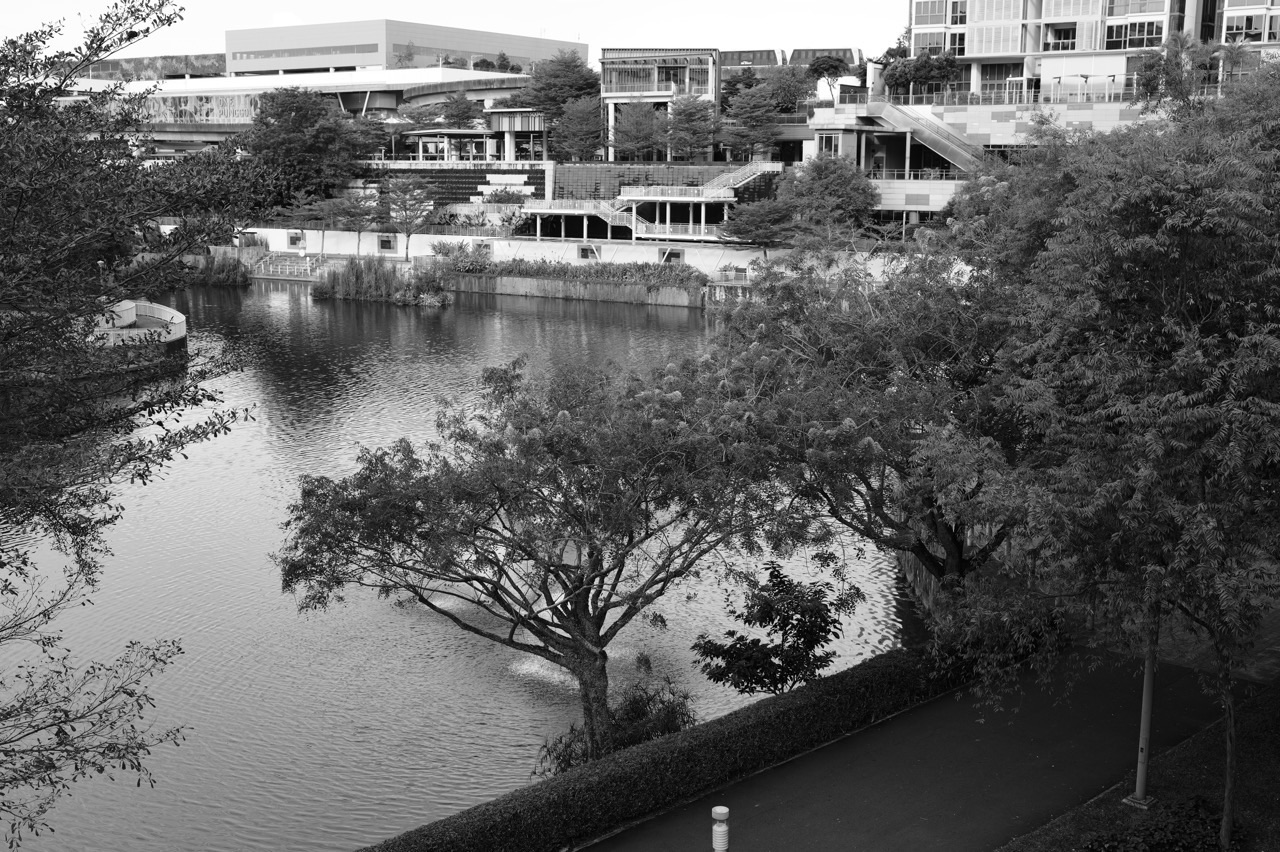
How can a Punggol child learn Marine Science from coastal observations to university research? Begin by noticing tides, plants, crabs, birds, mud and shore habitats without disturbing them. Then ask what each organism needs, how water and sediments move and which observations could reveal a change. Later, Secondary and JC Science supply ecosystems, Chemistry, Physics and data interpretation. University courses use marine ecology, oceanography, geospatial analysis and supervised research. Punggol’s local reference is Coney Island Park, whose mangroves, estuary and coastal habitats are documented by NParks; its public paths are places for learning, not permission to remove animals or collect unapproved specimens.
Three institutionally accurate routes: NUS Biological Sciences lists LSM4261 Marine Biology, with LSM3254 stated as prerequisite and course content including oceanography, coral reefs, seagrass and mangroves. NUS Tropical Marine Science Institute (TMSI) conducts research across integrated marine and environmental sciences, including biodiversity and coastal dynamics. NTU Asian School of the Environment offers Environmental Earth Systems Science programmes relevant to coastal hazards, ecology and environmental analysis. These are different kinds of academic opportunity; not every student at NTU is enrolled in a standalone Marine Biology degree.
Important local fact check: NParks’ January 2026 Coney Island Park page lists an 81-hectare park beside Punggol Promenade Nature Walk, open 7 am to 7 pm, with a West entrance near Punggol Point and an East entrance near Lorong Halus. The park describes mangrove wildlife and five themed beaches. Its official walking page describes a 3.6 km self-guided route. These details support safe observation plans but do not establish the exact tide, species count or marine water quality on any future visit. Park access rules and on-site notices govern.
Where Marine Science enters the education system
| Stage | Scientific idea | A trustworthy activity |
|---|---|---|
| Primary Science | Living things, habitats, adaptation and classification | Describe visible features from a permitted public path |
| Secondary Science | Food webs, photosynthesis, salinity, matter and variables | Differentiate observation from inference |
| JC H2 Biology, Chemistry or Physics | Data, energy, transport, chemistry and controlled investigations | Explain a graph and its limitations |
| NUS Life Sciences | LSM4261 Marine Biology and related eligible ecology study | Check LSM3254 prerequisites and actual module availability |
| NUS TMSI | Marine biodiversity, coastal processes, sensing and environmental research | Work only through authorised projects and supervision |
| NTU EESS and research | Environmental Earth systems, coastal geomorphology and ecology | Use course- and research-specific official requirements |
What NParks actually identifies at Coney Island
| Feature | Documented example | What cannot be inferred |
|---|---|---|
| Estuary and mangroves | Mudskippers and tree-climbing crabs are among highlighted wildlife | Any individual animal will appear on demand |
| Beach habitats | Five themed beach areas with distinct planted coastal species | Every beach has coral reefs or identical wildlife |
| Coastal forest and grasslands | Different habitat types can be observed on approved walks | One species sighting describes all island biodiversity |
| Bird hides | NParks describes permitted wildlife observation opportunities | One sighting measures the complete population |
| Public access | Two entrances; scheduled park hours and visitor rules | All shore sections are open for unrestricted research |
Thirty-eight concepts: from safe observation to marine research evidence
1. Marine and freshwater environments are not interchangeable
Seawater, estuarine water and freshwater differ in salinity and ecological conditions. A reservoir, coastal inlet and open sea should not be treated as chemically identical merely because all contain water.
Independent learning check. Ask whether the described habitat is marine, freshwater or influenced by mixing, and what measurement would help establish the distinction.
2. An estuary has changing conditions
Estuaries connect river-related and marine influences. Salinity, sediment, currents and organism distributions may change with tides and runoff. A single photograph cannot determine exact water chemistry.
Independent learning check. A learner observing Punggol’s coast should distinguish the visible estuary from measured salinity or flow data they do not possess.
3. Tides are predictable in principle but not visible from one image
Tidal sea-level variation results from interacting gravitational and orbital effects as well as local coastal conditions. A high- or low-water photograph cannot alone provide the day’s whole tidal range.
Independent learning check. Use officially published tide information when needed and never infer safe shore access from a classroom calculation.
4. Intertidal zones are demanding habitats
Organisms in the intertidal zone may alternate between immersion and air exposure. Temperature, moisture, salinity and wave action create ecological pressures that differ among microhabitats.
Independent learning check. A crab seen near an exposed shore is not proof the whole habitat stays dry. Ask which conditions change over time.
5. Mangroves are adaptations and ecosystems
Mangrove plants can tolerate particular coastal conditions, including saline or oxygen-poor soils through species-specific traits. A root drawing does not by itself explain an entire ecosystem.
Independent learning check. Ask which observed root feature, soil condition and biological function the explanation connects. Avoid claiming every mangrove species has identical structures.
6. Coastal forests differ from mangrove forests
Coastal vegetation may include beach shrubs, Casuarina woodlands and other communities with different soils, salinity exposure and ecological roles. A park can contain several habitats in close proximity.
Independent learning check. Coney Island’s published trail describes coastal forests, grasslands, mangroves and Casuarina woodlands. Classify a habitat using stated features rather than one familiar tree.
7. Mudskipper behaviour is not a universal fish rule
Mudskippers have adaptations linked to life in intertidal environments, but these should not be generalised to every fish. Describing a creature’s unusual appearance is not the same as explaining its function.
Independent learning check. NParks highlights mudskippers at Coney Island’s estuary. Observe from approved paths without touching, feeding or removing wildlife.
8. Crabs and sediment influence each other
Burrowing organisms can affect sediment structure and organic matter distribution, while sediment conditions affect their habitat. One burrow does not establish the full ecological function of a site.
Independent learning check. If a learner observes an opening in mud, it might be linked to burrowing activity, but identifying the occupant requires appropriate evidence.
9. Seagrasses are flowering plants, not seaweeds
Seagrasses are marine angiosperms with biological structures that differ from algae. They can create habitats and contribute to coastal carbon processes, but must not be assumed present at every shoreline.
Independent learning check. NUS marine research includes seagrass ecology across Singapore. A Punggol park photo alone cannot verify a seagrass meadow at that location.
10. Coral reefs are not guaranteed at every beach
Reef organisms and coral communities require particular habitat conditions. Singapore has coral reefs, but the existence of a beach does not imply reef-building coral is present there.
Independent learning check. The NUS Marine Biology course covers reefs as part of a broader discipline. It is inaccurate to present Coney Island’s five themed beaches as five confirmed coral-reef sites.
11. Plankton includes different ecological groups
Phytoplankton and zooplankton have differing biological roles and diversity. The words do not describe one species, and plankton classification concerns ecological drifting context as well as size.
Independent learning check. An illustrated microscopic organism may be phytoplankton, but a photograph alone cannot establish its complete life cycle or productivity.
12. Food webs represent feeding relationships
Food webs show energy and material connections among organisms, but a simplified diagram cannot list every species or guarantee a population response when one link changes.
Independent learning check. A predator might have alternate prey. Ask for conditional consequences rather than saying one declining prey species forces immediate predator extinction.
13. Photosynthesis supports marine primary production
Light-driven biological processes can support food webs through marine plants, algae and some microorganisms. Availability of light, nutrients and other conditions can shape productivity.
Independent learning check. A clearer-looking water column might transmit more light, yet that observation does not alone establish higher primary productivity.
14. Dissolved oxygen needs a measured quantity
Aquatic organisms depend on suitable oxygen availability, which varies with temperature, biological activity and water conditions. Bubbles at a surface do not quantify dissolved oxygen concentration.
Independent learning check. A student should request a suitable calibrated measurement before comparing two sites’ oxygen conditions.
15. Salinity is not inferred from water colour
Salinity concerns dissolved salts under a defined measure. Water can look clear while containing significant dissolved substances; colour is not a salinity test.
Independent learning check. Given a valid measured salinity dataset, compare its units and sampling conditions. Do not taste unknown coastal water.
16. Turbidity differs from chemical pollution
Turbidity describes light scattering by suspended material under an instrumental method. It is not a complete chemical or biological safety measure.
Independent learning check. A fictional cloudy sample may have suspended sediment; naming a toxin from appearance alone would be unsupported.
17. pH does not identify every substance
pH describes acidity-related conditions under the relevant scale and calibration. A measured pH cannot establish all nutrient, metal or microbial properties of water.
Independent learning check. The student should identify what a pH meter can and cannot detect and avoid using a single pH value as a safety certificate.
18. Temperature profiles are time and depth dependent
Water temperature can change with depth, sunlight, tides and weather. One shoreline reading cannot represent the whole coastal system over a season.
Independent learning check. Ask which depth and time were sampled, and how a repeated plan might improve comparison under authorised conditions.
19. Water sampling requires permissions and supervision
Environmental sampling involves safety, contamination avoidance, representative locations and institutional or site permission. A school student’s curiosity does not authorise entering tidal areas or removing organisms.
Independent learning check. Use teacher-supplied or public datasets for an experiment when field collection is unsafe or restricted.
20. Sediment can move without a visible storm
Coastal transport depends on waves, currents, sediment properties and human modifications. One image of a sandy shoreline cannot determine an annual erosion rate.
Independent learning check. Compare dated, consistently referenced measurements rather than photographs taken at different tide levels without context.
21. Coastal protection requires multiple forms of evidence
Mangroves and engineered structures may both influence coastal processes, but the benefits depend on site geometry, storms, ecology and maintenance. No single tree planting guarantees flood prevention.
Independent learning check. NUS research covers nature-based coastal resilience; students should read actual study boundaries before claiming universal protection.
22. Blue carbon has a defined scientific scope
Coastal ecosystems such as mangroves and seagrass meadows can store organic carbon under certain processes. Measured carbon stock and sequestration rate are different quantities and cannot be conflated.
Independent learning check. An imaginary carbon stock of 50 tonnes per hectare does not itself establish an annual sequestration rate of 50 tonnes per hectare per year.
23. Habitat restoration is not just planting something
Restoration considers suitable species, hydrology, environmental processes and long-term monitoring. Planting a coastal tree in an unsuitable area can fail even when the intention is good.
Independent learning check. NParks’ Coney Island restoration is an institutional programme; families should not plant or remove coastal species without permission.
24. Biodiversity richness is not a population count
Species richness counts distinct species identified under a method; abundance counts individuals. A site with more sightings may have fewer species, or vice versa.
Independent learning check. A pupil should label whether a count represents sightings, individuals, species or repeated observations.
25. Sampling effort affects wildlife sightings
A longer or quieter survey may detect more organisms than a brief visit. Standardising effort helps make comparisons fair, while detectability can still differ.
Independent learning check. Eight bird sightings in twenty minutes and six in ten minutes give 0.4 and 0.6 sightings per minute; neither equals a population census.
26. Quadrat and transect methods have limitations
Ecologists may use quadrats and transects in approved settings to estimate abundance or distribution. Placement, size and sampling design affect conclusions; methods should not disturb sensitive shore habitats.
Independent learning check. Teach the geometry with a drawing and simulated data instead of directing children to enter protected vegetation.
27. Remote sensing offers broad but indirect observations
Satellite or aerial imagery can map features over larger areas, but classifications require calibration, ground references and clear spatial resolution. A map’s coloured pixels are model outputs.
Independent learning check. Ask what ground truth or independent observations support an estimated seagrass or mangrove classification.
28. Acoustic monitoring observes selected signals
Passive acoustic methods can study sounds associated with marine life or habitats when appropriate recording conditions exist. A microphone does not count every organism or establish species identity by itself.
Independent learning check. NUS TMSI lists marine megafauna acoustic monitoring and coral-reef soundscape research themes; participation requires authorised projects.
29. Citizen science and research have different permissions
Citizen observations can contribute useful records, but professional field research may require more controlled sampling or formal approvals. An ordinary park visitor must follow NParks rules.
Independent learning check. A family can record a visible bird from a hide without approaching nests or disclosing sensitive locations.
30. Field notebooks need provenance
A useful record names site, observation time, weather, measured quantity, method and uncertainty. The fact that a learner took a photograph does not establish species identification or water quality.
Independent learning check. Teach an observation–inference–limitation format and keep the original notes separate from a later conclusion.
31. A single hot day is weather, not a climate trend
Climate research relies on suitable long-term datasets and methods. One intertidal observation during an unusually warm afternoon cannot establish a permanent ecological change.
Independent learning check. Ask for time series and suitable references before describing a species distribution shift as climate-caused.
32. Coral bleaching and coral death are not identical
Bleaching refers to changes in coral-symbiont relationships under stress; recovery or mortality depend on subsequent conditions. A photograph requires context before definitive classification.
Independent learning check. Do not declare a coral colony dead solely because its colour is pale in one image.
33. Water quality and public-health safety differ
A measurement of one aquatic variable does not certify water for drinking, swimming or food production. Relevant public health conclusions require official standards and comprehensive evidence.
Independent learning check. A student’s imaginary pH table cannot be used to declare coastal water safe for children.
34. University Marine Biology is a formal module
NUS lists LSM4261 Marine Biology with LSM3254 as prerequisite, covering oceanography, environments and human impacts. The module is not automatically a separate four-year Marine Biology degree.
Independent learning check. Check the student’s actual major, timetable and prerequisite rather than describing the course as universal admission.
35. TMSI is an advanced research institute
NUS TMSI undertakes multidisciplinary work across marine ecology, coastal dynamics, monitoring and sensing. A school visit or public webpage is not automatic permission for a research internship.
Independent learning check. Potential students need formal supervision, availability and institutional eligibility for research activities.
36. NTU ASE provides a complementary route
NTU’s Environmental Earth Systems Science covers coastal hazards, geology, environmental data and ecology through its programmes and faculty research. This is broader than marine organism biology.
Independent learning check. Compare degree structure and project methods rather than calling NTU ASE an identical substitute for a named NUS Marine Biology course.
37. Locality should inspire safe questions
Coney Island Park connects Punggol learners to mangroves, estuary wildlife and coastal vegetation. Its ecological value depends on protecting habitats, not turning every visit into unsupervised sample collection.
Independent learning check. A family can ask why an organism occupies a particular habitat without touching it or entering restricted shore areas.
38. The best explanation states what evidence is missing
A student who cannot identify the missing measurement should not fill the gap with an invented fact. Precise scientific uncertainty is better than a confident unsupported conclusion.
Independent learning check. After a habitat observation, ask what the learner knows, what they infer and which authorised measurements would help test the inference.
Five original worked coastal-data problems
Sighting rate and effort
An imaginary approved observation session records ten bird sightings over twenty minutes, while another records six over ten minutes. Rates are 0.50 and 0.60 sightings per minute. The second observation rate is higher, but neither describes total bird abundance without controlling detectability and possible repeated sightings.
Salinity comparison without tasting
Two fictional samples have reported salinities of 25 and 15 parts per thousand under the same defined measure. Their difference is 10 parts per thousand. This comparison alone does not identify the origin, microorganisms or potability of either sample. Actual sampling requires approved methods and permissions.
Carbon stock versus annual sequestration
A hypothetical wetland plot stores 60 tonnes of carbon per hectare at a measured point in time. If a separate properly designed annual monitoring study estimates an additional 2 tonnes per hectare during one year, the 2 tonnes per hectare per year is a change-rate measure and is not equal to the 60-tonne stock. Neither number is actual Coney Island data.
Species richness is not abundance
An imaginary site contains ten individuals each of two species, while a second site has four individuals each of five species. The first has twenty recorded individuals and species richness two; the second has twenty individuals and richness five. Greater richness does not imply greater total abundance in this example.
Sampling a coastal temperature trend
An invented site records 28°C, 29°C and 30°C during three measurements taken at different times. The arithmetic mean is 29°C. The three points cannot establish long-term warming or its cause without consistent methods, coverage and suitable long-term data.
Four-week marine Science learning plan
| Week | Action | Learning evidence |
|---|---|---|
| 1 | Review NParks Coney Island and coastal ecology information | Accurate habitat distinctions and park rules |
| 2 | Practise organism classification, food webs and observation limits | Student explains a changed ecological example |
| 3 | Analyse fictional salinity, temperature and survey datasets | Correct units and fair comparisons |
| 4 | Read NUS/NTU courses and authorised research pathways | Sourced university route and realistic next step |
Frequently asked questions
Is Coney Island Park a real location for coastal Science observation?
Yes. NParks documents mangroves, estuary features, beaches and coastal habitats there.
What hours does NParks list for Coney Island Park?
Its 2026 park information lists 7 am–7 pm; always obey current on-site notices.
Does Coney Island Park have five themed beach areas?
Yes, according to NParks. That does not mean five coral reef sites.
Can families remove crabs or collect water specimens for home experiments?
Do not assume collection is permitted. Follow NParks and other relevant permissions; use safe observations or provided data.
Does NUS teach Marine Biology?
Yes, as LSM4261, with LSM3254 listed as a prerequisite on its course page.
Does NTU have an Environmental Earth Systems Science route?
Yes. The ASE degree and research programmes include relevant coastal and environmental disciplines.
Is NUS TMSI the same as an undergraduate degree?
No. TMSI is a multidisciplinary research institute with separately governed opportunities.
Does a clear-looking shoreline prove safe water quality?
No. Calibrated measurements and relevant official criteria are needed.
Does seagrass mean the same thing as seaweed?
No. Seagrasses are flowering marine plants; seaweeds are algae.
Can one bird sighting establish a climate trend?
No. Trends require appropriate long-term and well-designed evidence.
What is the best school fieldwork result?
A truthful observation with site, method, time and a clearly bounded conclusion.
What a coastal Science field notebook should record
A scientifically useful observation includes the site, time, conditions, effort and the thing actually observed. A child seeing a crab from the mangrove boardwalk should record an approximate location permitted by park rules, visible characteristics and uncertainty in identification rather than announce a rare species with no evidence. A photograph may help later comparison, but should not justify approaching, capturing or disturbing wildlife. Exact sensitive locations may need protection, and a park’s access arrangements always take priority over an educational plan.
A parent can use a simple record: What did we see? What feature supports the description? What did we infer? What would require another visit or expert identification? Then provide an unfamiliar photograph from an official source and ask the pupil to apply the same distinction. This builds classification and evidence literacy without treating a recreational walk as a formal biodiversity survey. A university fieldwork project would add defined sampling, calibration, approvals and statistical analysis, not discard those earlier habits.
Marine organisms cannot be classified from one behaviour
Some organisms live in very different conditions across their life cycles. Others can be found in both tidal and less saline environments. The appearance of an animal on exposed mud does not mean it is a land species, and the presence of a bird near the sea does not make it a marine species in every ecological classification. Naming a crab or fish requires observing appropriate distinguishing features and sometimes specialist references.
NParks describes mudskippers, tree-climbing crabs and other organisms in the Coney Island estuary habitat. A learning exercise can compare the functions of their physical traits while admitting that a distant sighting may not allow certain identification. Ask whether the observed body feature is an adaptation hypothesis or a verified explanation for that species. A strong answer identifies what the feature might enable, which habitat condition matters and what further evidence would test the relationship. This is better than a list of labels with no causal connections.
Tides change both the view and the sampling problem
A shoreline observed at low tide is not the same physical setting seen at high tide. Water level affects accessible areas, which animals are visible and how water and sediment move. Comparing species counts or apparent beach area from photographs taken under different tidal conditions can therefore be misleading. Ordinary visitors should not use a school exercise as justification for walking into unsafe intertidal areas or entering habitats that the park protects.
Give a pupil two fictional photographs with documented tide times, but no consistent observation effort. Ask what can be compared and what cannot. The learner might describe which features were exposed at each time but should not claim that a species disappeared permanently between photographs. This is a practical example of why controlling or recording environmental conditions matters. At university, tidal models, survey timing and approved sampling plans become part of a formal coastal investigation.
Salinity, conductivity and dissolved substances are related but different
Salinity concerns dissolved salt content under an appropriate definition, while conductivity describes how electrical current passes through the measured water under a specified method. Conductivity may relate to dissolved ions, but converting it into a salinity estimate requires calibration and assumptions. The presence of invisible solutes also means a clear-looking sample cannot be identified as freshwater. Salinity, pH and turbidity measure different aspects of the same sample.
An imaginary exercise reports conductivity values for two containers but does not supply a calibration curve. The student may compare the recorded readings in their stated units, but cannot calculate an exact salt mass from them alone. The proper next question is what reference method, temperature correction and chemical composition assumptions would be needed. The exercise is explicitly hypothetical; no child should taste unknown water, take a coastal sample without permission or treat the numbers as real Coney Island readings.
Why a water-quality claim needs more than one test
Water safety depends on the actual intended use and relevant microbiological, chemical and physical conditions. A pH reading does not establish absence of pathogens, and an attractive photograph cannot establish potability or safe swimming conditions. Even a professional monitoring programme reports a defined set of variables for a defined purpose. It is therefore misleading to call water completely clean simply because it appears transparent or because one instrument gives a favourable number.
A classroom question can give a fictional pH value and measured temperature. Ask what those data describe, then identify the missing evidence for a claim about microbial safety. A scientifically responsible student does not fill the gap with confidence. They state that suitable authorised testing and current official guidance are needed. This approach reinforces both scientific literacy and the boundary between an educational exercise and a public-health decision.
Understanding food webs without assuming fixed outcomes
A mangrove or intertidal food web can include primary producers, detritus, invertebrates, fish and birds. These are relationships rather than a precise list of every organism in one site. A species can have multiple food sources, and interactions may change through seasons or life stages. When one population changes, effects on others may be complex, delayed or affected by alternative pathways. An arrow on a textbook drawing cannot prove the exact outcome of a local ecosystem disturbance.
Give the learner a fictional web with two prey types and one predator. Reduce one prey type in the scenario and ask for a reasoned, conditional prediction. A pupil who states the predator must immediately disappear has overlooked alternatives and timing. Ask what population measurements would support a stronger conclusion. This teaches transfer from a familiar Primary Science food-chain diagram into the more cautious systems reasoning needed for university marine ecology.
Blue carbon must separate stock, flux and permanent storage
Coastal vegetation can contribute to carbon processes, but the quantity already stored at a site and the rate of change over a period are different measurements. A plot holding a large carbon stock does not automatically gain the same amount each year. Reliable blue-carbon analysis may consider sediment depth, organic content, area, sampling design, turnover and long-term fate of stored carbon. NUS researchers study these issues, including spatial variability in seagrass meadows.
A mathematical exercise can give a fictional carbon density of 40 tonnes per hectare across a carefully defined two-hectare area, resulting in an ideal total stock of 80 tonnes. That multiplication does not determine an annual sequestration rate or claim anything about Coney Island. If a second estimate involves yearly change, it needs its own repeated measurements and units. This distinction is important when students read environmental headlines promising immediate carbon benefits from restoration.
What restoration success actually needs to demonstrate
Planting native coastal vegetation can be part of restoration, but the number of seedlings planted is an output of the project, not proof that ecological functions have returned. Restoration monitoring may assess survival, recruitment, species composition, sediment processes, wildlife use and other goals. Outcomes depend on site suitability, hydrology, species choice and long-term care. A public visitor should not remove existing plants or introduce seedlings independently as a school project.
Ask a student to design a hypothetical evaluation table comparing planting count with survival after a stated period. Then ask what additional indicators would support a conclusion about biodiversity or coastal protection. The second question introduces the difference between an action and an ecological outcome. NParks’ conservation work offers a useful real-world context, while the specific measures and permissions remain under its authority. A school learner can reason using supplied figures without interfering with an active restoration site.
Counting wildlife requires attention to detectability
Wildlife observations depend on time, position, weather, visibility, behaviour and observer experience. More sightings may reflect higher effort rather than greater population size. A bird could be recorded more than once during a walk, and a shy species may go undetected even when present. Standardised observation methods help with comparisons, yet still require careful interpretation.
Suppose one fictional group records twelve sightings in thirty minutes and another eight in ten minutes. Their rates are 0.4 and 0.8 sightings per minute. Those rates do not identify the number of distinct animals without individual recognition or a suitable study design. A child should learn to report observations precisely, then ask what a professional survey would need to estimate population. This exercise is also a bridge into statistics and scientific uncertainty.
Remote sensing is not automatically a field census
Satellite images and aerial data can help researchers map habitat boundaries, sediment movement and environmental conditions across large spaces. However, classifying an image into mangrove, grassland, sea or seagrass requires validated methods and appropriate spatial or spectral resolution. Shadows, tides and seasonal effects can confuse classifications. A map may be informative while still having measurable error and incomplete coverage.
Give a student a hypothetical habitat map with a stated classification accuracy assessed against independent samples. Ask what the result means and which kinds of errors may remain. Avoid treating a green-coloured pixel as proof of a particular plant species. NTU and NUS environmental research uses data-analysis methods for real questions, but school learners should work with trustworthy public materials rather than claim a simulated map is an official ecological survey.
Coastal geomorphology links Physics with ecology
Waves, currents, sediment transport, coastal slope and shoreline modification affect where organisms can live. This is one reason marine Science is not only Biology. Coastal geomorphology asks how the shape and materials of the shore change; marine ecology investigates interactions among organisms and habitats. The disciplines inform one another, but the methods and quantities are different.
An imaginary coastal profile shows a change in sediment level between two authorised surveys. To determine whether it indicates sustained erosion, the student needs comparable spatial reference points, tidal context, uncertainty and enough temporal coverage. A single photograph showing less beach on a high-tide day would be weak evidence. NTU’s Asian School of the Environment publishes faculty research in coastal geomorphology and hazards, showing a legitimate pathway for students whose interest begins with the physical coastline.
Marine acoustic monitoring and what sound can reveal
Underwater or coastal sound can provide information about environmental processes and selected animal activity when interpreted through suitable equipment and methods. A sound recorder does not automatically identify every species or count each organism. Background noise, propagation, equipment sensitivity and the training or validation of any classification model matter.
NUS TMSI includes acoustic research themes related to marine megafauna and coral-reef soundscapes. A student can study the concept through supplied audio graphs without making unauthorised recordings of protected or private areas. Ask what frequency range and signal feature the analysis measures, what comparison reference is available and which species claims remain uncertain. This gives an accessible link between Secondary waves and university marine research while preserving the need for appropriate field permissions.
Marine Biology at NUS and environmental studies at NTU are not identical
NUS’s LSM4261 Marine Biology is a specified course within a degree framework, with LSM3254 identified as a prerequisite on its current course page. TMSI is a separate multidisciplinary research institute. NTU’s Environmental Earth Systems Science degree is a broader programme with coastal, ecological, geological and environmental components. Students cannot simply enroll in any of these by expressing interest, and the existence of a laboratory webpage does not confer permission for research access.
Compare the modules and routes according to the learner’s actual goal. A pupil fascinated by coral physiology may be drawn to biological marine ecology; another interested in flood hazards and sediment may prefer coastal geomorphology; one who enjoys spatial mapping may explore environmental data science. The most reliable plan starts with the degree’s current admission requirements, mathematics or science prerequisites, available electives and permitted supervised research options. Home residence in Punggol does not alter those academic gates.
Protecting wildlife makes a field lesson scientifically stronger
Scientific enthusiasm sometimes leads children to collect shells, plants, crabs or sediment to bring home. That is not necessary for most observation-based lessons and can harm habitats or breach site rules. A meaningful lesson can use careful visual observation, authorised guides, photographs taken without disturbance and official species information. Sensitive locations and wildlife should not be exposed merely to create a more impressive school portfolio.
A family can discuss food webs from a boardwalk, classify visible plant forms and note environmental conditions without entering a restricted shoreline. Ask the child what was seen and what remains unknown. If they want to test water chemistry, use a fictional data set or an approved school laboratory activity rather than taking unpermitted samples. This turns restraint into a scientific learning outcome: the ability to choose a method that answers a question while respecting living systems and legitimate conservation controls.
A real local walk should not be represented as a laboratory experiment
NParks describes a self-guided route of around 3.6 km at Coney Island and highlights its habitat diversity. A walk can teach observation and classification, but it usually lacks the controls and permissions of a formal marine survey. Families should follow the park’s actual opening hours, weather conditions, signs and safety guidance. Shore conditions can change; a published route is not an instruction to enter tidal mud or swim.
After a visit, the learner can write a one-page report distinguishing personal observations from information read on NParks signs. If they saw an organism but could not identify it, that uncertainty should be retained. If official information describes a species as present in the park but the family did not see it, the student should not claim it was personally observed. That small source distinction is one of the strongest habits to carry into future Science reports.
Marine science is a system of interacting disciplines
A coastal question may need Ecology to explain organism interactions, Chemistry for dissolved substances, Physics for waves and tides, Geology for sediments and Statistics for sampling. The researcher’s first choice is not which subject sounds impressive, but which quantities will answer the question. Interdisciplinary Science is productive when each discipline’s contribution remains clear.
A proposed investigation into an apparent decline in birds near a shore would require reliable species identification and repeated survey effort. It might also need habitat or human-activity information. It would be scientifically weak to infer an exact cause from one sighting count or a single weather event. Students should learn to formulate one appropriately narrow question, identify a safe approved method and state what further evidence would be necessary. This is a useful preparation for environmental careers without promising specific jobs or university admission.
The school-to-university learning standard is independent transfer
A learner who memorises that mangroves tolerate saline environments may still fail when asked how seagrass differs from coastal algae. The first correction should address the exact biological misunderstanding, not simply provide a longer vocabulary list. Another pupil may understand habitats but divide sightings by the wrong observation period. That student needs quantitative and unit practice rather than another organism diagram.
Effective teaching identifies the wrong mental move, explains the proper model, guides one example and then checks a new situation without prompts. Apply that sequence to a different habitat or dataset several days later. Evidence that a child can reason independently matters more than the number of questions completed or the attractiveness of a final report. The same progression works from Primary Science through university research, provided the content and practical responsibilities remain appropriate to the learner’s age and formal curriculum.
Official Singapore habitats and university research sources
- NParks — Coney Island Park 2026 details
- NParks — safe self-guided Coney Island nature route
- NParks — Coney Island beach habitat features
- NParks — coastal and marine ecosystem types
- NParks — Coney Island birdwatching guidance
- NUS Tropical Marine Science Institute
- NUS TMSI research themes including coastal dynamics
- NUS Biological Sciences LSM4261 Marine Biology
- NUS Nature-based Climate Solutions research
- NTU Asian School of the Environment undergraduate programmes
- NTU ASE coastal geomorphology and ecology faculty
- NTU ASE microbial ecology and water-quality research
- eduKatePunggol — NUS and NTU Science pathways
- eduKatePunggol — Environmental and Earth Science
- eduKatePunggol — University Biology and Ecology
- eduKatePunggol — Biostatistics and field data
- eduKatePunggol — research ethics and laboratory safety
- eduKatePunggol — STEM enrichment and fieldwork
Fact-check: 21 October 2026. NParks is the authority for Coney Island site details and visitor rules, while universities control courses and supervised research. Numerical examples are fictional and not local measured water, carbon or wildlife records. No sampling, clinical or conservation permission is implied.


